


Get to know Wuzhong District
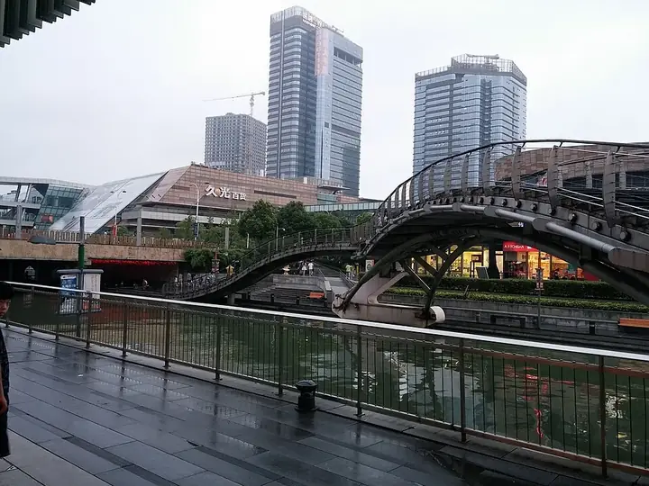
Photo adjustments
Full frame retained; resized proportionally to a maximum dimension of 960 pixels and converted to WebP quality 88. No crop, retouch, generated elements, or subject alteration. Final website rendition: full frame retained, proportionally resized to at most 720 pixels and converted to WebP. No additional retouching or subject alteration. Card displays may crop the view.
- Administrative area
- District · 市辖区
- Part of
- Suzhou
- Chinese name
- 吴中区
- Local areas
- District guide
Area & population
- Area in the source
- 745.00 km²
- Population · 2020 census
- 1,388,972
Source: cited geographic source, as of the dates shown.
History
The district government traces people on Sanshan Island (三山岛) in Lake Tai back ten thousand years and places the capital of the ancient state of Wu (吴国) here. It sets the wars between Wu and Yue along this lakeshore, the source of stories such as Fan Li (范蠡) sailing away on the lake and Xi Shi (西施) washing silk, and says Sun Wu (孙武) wrote The Art of War here. Kuai Xiang (蒯祥), a builder of the Xiangshan (香山帮) school from Wuzhong, directed the construction of the Forbidden City in Beijing.
What to see
Mudu (木渎), west of the city a few kilometres from Lake Tai, was named for the timber that Yue sent to Wu to build the Gusu Terrace, which blocked the river for three years. It became a town under the Northern Song, takes up half of Xu Yang's (徐扬) Qing scroll Prosperous Suzhou (姑苏繁华图), and has a landing where the Qianlong emperor came ashore on his southern tours. It was named a national historic and cultural town in 2005.
Luzhi (甪直) has an old-town area of about four square kilometres that is a national 4A scenic site. Luxiang village (陆巷村) in Dongshan (东山), between Lake Tai and Moli Peak (莫厘峰), keeps more than thirty Ming and Qing buildings, a Ming stone-paved street, three memorial archways and Huihe Hall (惠和堂), the home of the Ming grand secretary Wang Ao (王鏊). It is a national historic and cultural village and grows red tangerines, bayberries, loquats and Biluochun tea (碧螺春). Linwu Cave (林屋洞) on Xishan (西山), an island in the lake, was a Taoist retreat counted as the ninth of the ten great grotto-heavens (洞天).
Highlights
- Mudu 木渎古镇: Northern Song town named after timber for the Gusu Terrace; a national historic and cultural town since 2005.
- Luzhi 甪直古镇: Old-town area of about four square kilometres, a national 4A site.
- Luxiang village 东山陆巷古村: More than thirty Ming and Qing buildings and the home of Wang Ao.
- Linwu Cave 林屋洞: Taoist cave on Xishan, counted as the ninth grotto-heaven.
Sources for this guide
吴中概况 - 苏州市吴中区人民政府 · Wuzhong District People's Government, Suzhou
吴中区 - 维基百科,自由的百科全书 · Chinese Wikipedia · CC BY-SA 4.0
甪直镇 - 维基百科,自由的百科全书 · Chinese Wikipedia · CC BY-SA 4.0
林屋山洞 - 维基百科,自由的百科全书 · Chinese Wikipedia · CC BY-SA 4.0
陆巷村 - 维基百科,自由的百科全书 · Chinese Wikipedia · CC BY-SA 4.0
木渎镇 - 维基百科,自由的百科全书 · Chinese Wikipedia · CC BY-SA 4.0
Original English written from the listed sources and checked sentence by sentence against quoted extracts by a separate reviewer. Updated 2026-09-25.
Explore Wuzhong District
Core places to explore, with English and Chinese names.
Places to explore around Wuzhong District
 Wuzhong Taihu Tourism Area · 吴中太湖旅游区
Wuzhong Taihu Tourism Area吴中太湖旅游区
Wuzhong Taihu Tourism Area groups Dongshan, Qionglong Mountain and Wangshan on the Suzhou side of Lake Tai.
Read the place guide → Dongshan Luxiang Old Village · 东山陆巷古村
Dongshan Luxiang Old Village东山陆巷古村
Luxiang Ancient Village (陆巷古村) in Dongshan preserves Ming and Qing residential architecture associated with scholarly families and the Dongting trading community.
Read the place guide → A canal, stone bridge and traditional houses in the old town of Luzhi, Wuzhong District, Suzhou · 苏州市吴中区甪直古镇的河道、石桥与老宅 Source-recorded photograph date: Autumn 2004date QS:P,+2004-00-00T00:00:00Z/9,P4241,Q40720568 ;2004 年秋.
Luzhi Ancient Town甪直古镇
Canal town in Wuzhong, Suzhou, with about 40 old stone bridges, Tang-attributed clay arhats at Baosheng Temple and memorials to Wang Tao and Ye Shengtao.
Read the place guide → Visitors climbing through the 'One Line of Sky' rock crevice on Tianping Mountain, Suzhou · 苏州天平山“一线天”景观,游客穿行于狭窄岩缝之间 Source-recorded photograph date: 2021-11-21 14:21:31.
Tianping Mountain天平山
Tianping Mountain southwest of Suzhou combines an old sweetgum grove with springs and monuments associated with the family of the Song statesman Fan Zhongyan.
Read the place guide → The memorial archway marking the entrance to Mudu ancient town, Wuzhong District, Suzhou · 苏州市吴中区木渎古镇牌坊 Source-recorded photograph date: 2007-11.
Mudu Ancient Town木渎古镇
Old town west of Suzhou tied to the Qianlong Emperor's tours, with the Yan Family Garden, Old Pine Garden and Qing houses on its own Shantang Street.
Read the place guide → The rock entrance of Linwu Cave, inscribed '天下第九洞天' ('Ninth Grotto-Heaven under Heaven'), Wuzhong District · 苏州市吴中区林屋洞进口处,崖壁刻"天下第九洞天" Source-recorded photograph date: 2024-09-07 13:32:51.
Linwu Cave林屋洞
Linwu Cave on Taihu's Xishan Island is a limestone cavern revered in Daoist tradition as the ninth of the ten major grotto-heavens.
Read the place guide →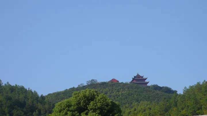 Temple pavilion atop the forested peak of Qionglong Shan, Wuzhong District · 吴中区穹窿山山顶寺庙建筑 Source-recorded photograph date: Taken on 9 September 2010.
Qionglong Mountain穹窿山
A 341.7 m ridge in Wuzhong, Suzhou, with a rebuilt Taoist temple Qianlong stayed at, a Sun Wu garden, forest reserve and cliff carvings.
Read the place guide → Xishan Mingyuewan Old Village · 西山明月湾古村
Xishan Mingyuewan Old Village西山明月湾古村
Mingyuewan is a village on the southern shore of Taihu's Xishan Island, with hills behind it and a granite quay reaching toward the lake.
Read the place guide →Plan your visit
Getting there
Wuzhong District is about 25 km in a straight line from central Suzhou. Search for 吴中区 in a map app to find stations and your accommodation.
Where to stay →Build your route
Wuzhong Taihu Tourism Area and Dongshan Luxiang Old Village are both listed here. The linked place guides have entrance and visit details.
Continue with Suzhou →More in Suzhou
Sources & geographic information
Administrative names and parent areas: Official geographic directory · Reference date 2026-09-06.
Some facts checked against 吴中区 — Wikipedia contributors, CC BY-SA 4.0.
Some facts checked against 甪直镇 — Wikipedia contributors, CC BY-SA 4.0.
Some facts checked against 林屋山洞 — Wikipedia contributors, CC BY-SA 4.0.
Some facts checked against 陆巷村 — Wikipedia contributors, CC BY-SA 4.0.
Some facts checked against 木渎镇 — Wikipedia contributors, CC BY-SA 4.0.
Photo: Wuzhong Taihu Tourism Area · Source photographer · License not provided. EXIF orientation normalized; resized without changing aspect ratio; converted to WebP. No subject edits.
Photo: Dongshan Luxiang Old Village · Source photographer · License not provided. EXIF orientation normalized; resized without changing aspect ratio; converted to WebP. No subject edits.
Photo: Luzhi Ancient Town · Gisling · CC BY 2.5. Full frame retained; proportionally resized and converted to WebP. No retouching or changes to the photographed subject. Card displays may crop the view.

Photo: Tianping Mountain · 云在动 · CC BY-SA 4.0. Full frame retained; proportionally resized and converted to WebP. No retouching or changes to the photographed subject. Card displays may crop the view.

Photo: Mudu Ancient Town · Gisling唐戈 · CC BY-SA 4.0. Full frame retained; proportionally resized and converted to WebP. No retouching or changes to the photographed subject. Card displays may crop the view.

Photo: Linwu Cave · Lt2818 · CC BY-SA 4.0. Full frame retained; proportionally resized and converted to WebP. No retouching or changes to the photographed subject. Card displays may crop the view.

Photo: Qionglong Mountain · helkonig · CC BY 3.0. Full frame retained; proportionally resized and converted to WebP. No retouching or changes to the photographed subject. Card displays may crop the view.

Photo: Xishan Mingyuewan Old Village · Source photographer · License not provided. EXIF orientation normalized; resized without changing aspect ratio; converted to WebP. No subject edits.
Map data © OpenStreetMap contributors. Pins mark approximate centres, not entrances or boundaries.