


Get to know Jiawang District
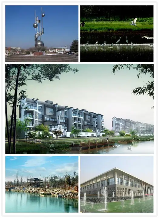
Photo adjustments
EXIF orientation normalized; resized without changing aspect ratio; converted to WebP. No subject edits.
- Administrative area
- District · 市辖区
- Part of
- Xuzhou
- Chinese name
- 贾汪区
- Local areas
- District guide
Area & population
- Area in the source
- 690.00 km²
- Population · 2020 census
- 453,555
Source: cited geographic source, as of the dates shown.
History
The district government traces settlement at Biantang (汴塘), Daquan (大泉) and Jiangzhuang (江庄) back before the Shang and Zhou. Coal showed at the surface after a flood in the summer of 1880, and in 1882 Hu Enxie (胡恩燮) sank the first shaft; the town grew with the mine and became a district of Xuzhou in 1965. On 8 November 1948, during the Huaihai campaign, two Kuomintang deputy commanders who were secret Communist Party members, Zhang Kexia (张克侠) and a fellow general, led more than 23,000 troops over to the Communists in the Jiawang mining area. In early 1949, when the East China Field Army was reorganised as the Third Field Army, its forward headquarters was also in Jiawang; the Third Field Army founding site survives in the grounds of Tuanjie Primary School (团结小学) and has been a municipal heritage site since 1991. In 2011 Jiawang was listed among China's resource-exhausted cities.
What to see
Pan'an Lake Wetland (潘安湖湿地) was created from Jiawang's largest coal-mining subsidence area and served as the model for Crescent Lake (月牙湖) in Zhou Meisen's (周梅森) In the Name of the People (人民的名义). The district also lists Dadongshan (大洞山), Matoushan (马头山), Dugong Lake (督公湖), Zhuyu Temple (茱萸寺) and Chaiwo Reservoir (柴窝水库) among its scenic spots, and ancient sites such as the Daquan kiln site (大泉窑址). Mazhuang village (马庄村) makes herbal-medicine sachets, which villagers sew for the Spring Festival, Duanwu and Mid-Autumn; the village has built a sachet guesthouse and square around the craft.
Setting and landscape
Jiawang sits in the transition between the northern subtropical and warm-temperate zones, with a monsoon climate: July averages 26.8°C and January −0.4°C, and summer brings 58 per cent of the 869 millimetres of average yearly rainfall. The Grand Canal and the Bulao River (不牢河) cross the district from west to east, the canal for 36 kilometres.
Highlights
- Pan'an Lake Wetland 潘安湖湿地: Lake made from the district's largest coal-mining subsidence area.
- Third Field Army founding site 第三野战军成立旧址: Building in Tuanjie Primary School; municipal heritage site since 1991.
- Zhang Kexia Uprising site 张克侠起义旧址: In the Xiaqiao shaft of the former Hanqiao mine, where the 1948 uprising was launched.
- Mazhuang sachets 马庄香包: Herbal-medicine sachets made in Mazhuang village for festivals.
Sources for this guide
概况区划 · Jiawang District People's Government, Xuzhou
区位交通 · Jiawang District People's Government, Xuzhou
人文历史 · Jiawang District People's Government, Xuzhou
生态环境 · Jiawang District People's Government, Xuzhou
贾汪区 · Chinese Wikipedia · CC BY-SA 4.0
Original English written from the listed sources and checked sentence by sentence against quoted extracts by a separate reviewer. Updated 2026-09-25.
Explore Jiawang District
Core places to explore, with English and Chinese names.
Places to explore around Jiawang District
 AI illustration · AI
 Plan your visit
Getting there
Jiawang District is about 35 km in a straight line from central Xuzhou. Search for 贾汪区 in a map app to find stations and your accommodation.
Where to stay →Build your route
Start with Pan'an Lake Wetland. The linked place guides have entrance and visit details.
Continue with Xuzhou →More in Xuzhou
Sources & geographic information
Administrative names and parent areas: Official geographic directory · Reference date 2026-09-06.
Some facts checked against 贾汪区 — Wikipedia contributors, CC BY-SA 4.0.
Map data © OpenStreetMap contributors. Pins mark approximate centres, not entrances or boundaries.