


Get to know Nujiang Lisu Autonomous Prefecture
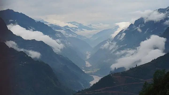
Photo adjustments
Full frame retained; proportionally resized and converted to WebP. No retouching or changes to the photographed subject. Card displays may crop the view.
- Administrative area
- Autonomous prefecture · 自治州
- Part of
- Yunnan
- Chinese name
- 怒江傈僳族自治州
- Local areas
- 4 local areas
Area & population
- Area in the source
- 14,588.92 km²
- Population · 2010
- 534,337
Source: cited geographic source, as of the dates shown.
The capital of the prefecture is located in Liuku Town, Lushui City. Nujiang Prefecture is the only Lisu Autonomous Prefecture in China, with the Lisu ethnic group accounting for about 51% of the population, and a number of other ethnic minorities, including the Bai, Nu, Pumi and Dulong, living in the prefecture.
Explore Nujiang Lisu Autonomous Prefecture
Core places to explore, with English and Chinese names.
Luoguqing Scenic Area 罗古箐
Denggeng Hot Spring Baths 登埂澡塘
Nujiang Grand Canyon Liuku to Laomudeng Route 怒江大峡谷六库至老姆登沿线
Zhiziluo Old Town 知子罗
Laomudeng Village 老姆登村
Bingzhongluo 丙中洛
Dulong River Valley Official Route 独龙江谷正规开放线路
Lushui 泸水市
Fugong County 福贡县
Gongshan Derung and Nu Autonomous County 贡山独龙族怒族自治县
Lanping Bai and Pumi Autonomous County 兰坪白族普米族自治县
Places to explore around Nujiang Lisu Autonomous Prefecture
 Luoguqing Scenic Area · 罗古箐
Luoguqing Scenic Area罗古箐
Luoguqing (罗古箐) is a Danxia-landform gorge and Pumi village below the main peak of Laojun Mountain in Lanping Bai and Pumi Autonomous County, Nujiang Lisu Autonomous Prefecture, Yunnan.
Read the place guide → AI illustration · AI 示意图(仅供参考,非该地点实拍)
Denggeng Hot Spring Baths登埂澡塘
Denggeng (登埂) is a Lisu village on the west bank of the Nujiang in Luzhang town, Lushui, Nujiang Lisu Autonomous Prefecture, Yunnan, known for a cluster of natural hot springs that have hosted a traditional Lisu bathhouse gathering.
Read the place guide → Nujiang Grand Canyon Liuku to Laomudeng Route · 怒江大峡谷六库至老姆登沿线
Nujiang Grand Canyon Liuku to Laomudeng Route怒江大峡谷六库至老姆登沿线
The Liuku-to-Laomudeng stretch (六库至老姆登沿线) is the southern section of the Nujiang 'Beautiful Highway', a 288.3-kilometre route through the Nujiang Grand Canyon in Nujiang Lisu Autonomous Prefecture, Yunnan, running from Liuku in Lushui north toward Fugong County.
Read the place guide →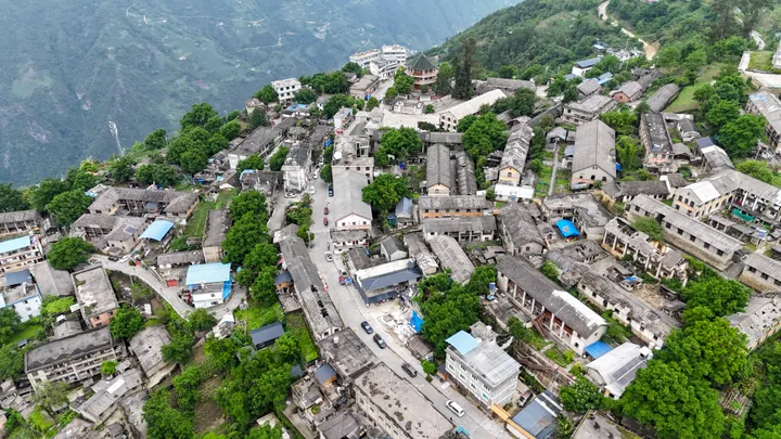 Aerial view of Zhiziluo, the former county seat perched on a mountain ridge in Fugong County · 福贡县知子罗,山脊上的旧县城航拍 Source-recorded photograph date: 2024-06-01 12:35:44.
Zhiziluo Old Town知子罗
Abandoned hillside seat of Bijiang County and once of Nujiang Prefecture, above the Nu River in Fugong, with 80 old buildings left.
Read the place guide →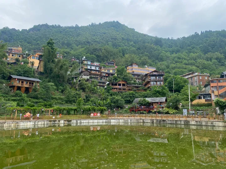 Laomudeng Village on a wooded hillside above a pond, Pihe Township, Fugong County · 福贡县匹河乡老姆登村,依山傍水的村落景观 Source-recorded photograph date: 2024-06-01 14:10:57.
Laomudeng Village老姆登村
Laomudeng (老姆登村) is a Nu ethnic village in Pihe Nu Ethnic Township, Fugong County, Nujiang Lisu Autonomous Prefecture, Yunnan, the only Nu-designated township in China, set on a hillside facing the Nu people's sacred Huangguan (Crown) Mountain above the Nujiang canyon.
Read the place guide → Zhongding Church roof and a snow-capped peak above Bingzhongluo, Gongshan County, Nujiang Prefecture · 云南怒江州贡山县丙中洛重丁教堂屋顶与雪山 Source-recorded photograph date: 2011-05-18 12:13:35.
Bingzhongluo丙中洛
Bingzhongluo occupies an unusually open part of the Nujiang valley, where cultivated land and villages sit between steep mountains. South of town, the Nujiang First Bend turns around a projecting hillside; to the north, Shimen…
Read the place guide → Dulong River Valley Official Route · 独龙江谷正规开放线路
Dulong River Valley Official Route独龙江谷正规开放线路
Dulong River Valley Official Route names the officially designated visitor route through the Dulongjiang (Derung River) valley in Gongshan Derung and Nu Autonomous County, Yunnan -- the sole settlement area of the Derung ethnic minority, reached by a road tunnel under the Gaoligong mountains completed in 2014.
Read the place guide →Local life & food
Nujiang Lisu Autonomous Prefecture local specialties
怒江傈僳族自治州特色美食 · 10 specialties to discover
 Lacquer Seed Oil Chicken 漆油鸡AI illustration · AI 示意图(仅供参考,非实拍)
Lacquer Seed Oil Chicken (漆油鸡) is a traditional dish of Lisu (傈僳族) and Nu (怒族) communities in Nujiang (怒江).
Read the dish guide →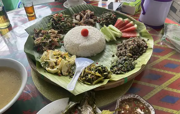 Hand-Eaten Rice Feast 手抓饭
Hand-Eaten Rice Feast (手抓饭) is served on a winnowing tray in the Lisu (傈僳族) tradition of Nujiang (怒江).
Read the dish guide →
 Stone Slab Flatbread 石板粑粑AI illustration · AI 示意图(仅供参考,非实拍)
Stone Slab Flatbread (石板粑粑) is a flatbread baked on a stone griddle, an old traditional food of the Derung (独龙族) and Nu (怒族) peoples of Nujiang (怒江) in Yunnan.
Read the dish guide →Chicken Simmered in Pounded Rice Wine 杵酒煮鸡AI illustration · AI 示意图(仅供参考,非实拍)
Chicken Simmered in Pounded Rice Wine (杵酒煮鸡) is listed among the local specialties of Nujiang Lisu Autonomous Prefecture, Yunnan. The name includes 鸡 (chicken). The term 酒 points to an alcoholic or fermented drink.
Read the dish guide → Pipa Cured Pork 琵琶肉AI illustration · AI 示意图(仅供参考,非实拍)
Pipa Cured Pork (琵琶肉) is a meat dish of Nu (怒族) households in Nujiang (怒江). Its appearance resembles cured pork, and it has a fragrant, full flavour.
Read the dish guide →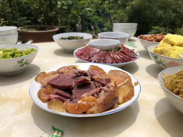 Laowo Cured Ham 老窝火腿
Laowo Cured Ham (老窝火腿) is the cured ham of Laowo (老窝), a Bai ethnic township in Lushui (泸水) city, Nujiang Lisu Autonomous Prefecture (怒江傈僳族自治州), Yunnan. It takes its name from the township where it is produced.
Read the dish guide →Photo adjustments
EXIF orientation normalized; resized without changing aspect ratio; converted to WebP. No subject edits.
 Corn Grits Porridge 包谷砂稀饭AI illustration · AI 示意图(仅供参考,非实拍)
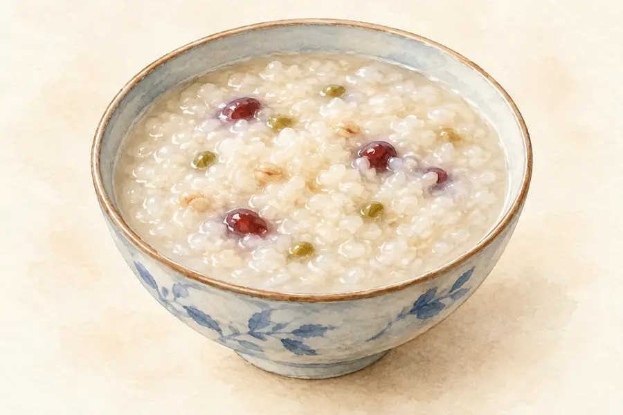
Corn Grits Porridge (包谷砂稀饭) is listed among the local specialties of Nujiang Lisu Autonomous Prefecture, Yunnan. It is grouped here with rice & congee; retain the complete Chinese name when comparing local menus.
Read the dish guide → Lisu Grilled Meat 傈僳族烤肉
Lisu Grilled Meat (傈僳族烤肉) is listed among the local specialties of Nujiang Lisu Autonomous Prefecture, Yunnan. 烤 describes roasting or grilling.
Read the dish guide →Photo adjustments
EXIF orientation normalized; resized without changing aspect ratio; converted to WebP. No subject edits.
All dish names · 全部菜名 (10)
More dishes from across Yunnan are in the Yunnan food guide.
Counties & districts in Nujiang Lisu Autonomous Prefecture
4 areas belong directly to Nujiang Lisu Autonomous Prefecture.
4 areas
Lushui 泸水市
Lushui (simplified Chinese: 泸水; traditional Chinese: 瀘水; pinyin: Lúshuǐ, Lisu: ꓡꓴꓽ-ꓢꓴꓲ) is a county-level city in and the seat of Nujiang Prefecture, western Yunnan Province, China.
Explore the area →CountyFugong County 福贡县
Fugong County (simplified Chinese: 福贡县; traditional Chinese: 福貢縣; pinyin: Fúgòng Xiàn, Lisu: ꓩꓴꓽ-ꓗꓳꓹ ꓫꓯꓹ) is a county located in Nujiang Lisu Autonomous Prefecture, in the west of Yunnan province, China…
Explore the area →Autonomous countyGongshan Derung and Nu Autonomous County 贡山独龙族怒族自治县
Gongshan Derung and Nu Autonomous County (simplified Chinese: 贡山独龙族怒族自治县; traditional Chinese: 貢山獨龍族怒族自治縣; pinyin: Gòngshān Dúlóngzú Nùzú Zìzhìxiàn; Lisu: ꓗꓳꓹ-ꓢ ꓔꓴꓽ-ꓡꓳꓽ ꓫꓵꓽ ꓠꓳꓸ ꓫꓵꓽ ꓚꓲꓸ ꓛꓬꓽ ꓗꓪꓼ ꓫꓵꓽ ꓫꓯꓹ…
Explore the area →Autonomous countyLanping Bai and Pumi Autonomous County 兰坪白族普米族自治县
Lanping Bai and Pumi Autonomous County (simplified Chinese: 兰坪白族普米族自治县; traditional Chinese: 蘭坪白族普米族自治縣; pinyin: Lánpíng Báizú Pǔmǐzú Zìzhìxiàn; Bai: Ketdant Baifcuf Pupmipcuf zibzibxiand) is located in…
Explore the area →No areas match this name.
Plan your visit
Getting there
Search for 怒江傈僳族自治州 in a map app to find stations and your accommodation.
Where to stay →Build your route
Luoguqing Scenic Area and Denggeng Hot Spring Baths are both listed here. The linked place guides have entrance and visit details.
Continue with Yunnan →More in Yunnan
Sources & geographic information
Administrative names and parent areas: Official geographic directory · Reference date 2026-09-06.
Background text adapted from Nujiang Lisu Autonomous Prefecture — Wikipedia contributors, under CC BY-SA 4.0. Text has been shortened and reorganized; source revision 1354643561.
Photo: Luoguqing Scenic Area · Source photographer · License not provided. EXIF orientation normalized; resized without changing aspect ratio; converted to WebP. No subject edits.
Photo: Nujiang Grand Canyon Liuku to Laomudeng Route · Source photographer · License not provided. EXIF orientation normalized; resized without changing aspect ratio; converted to WebP. No subject edits.
Photo: Zhiziluo Old Town · 瑞丽江的河水 · CC BY-SA 4.0. Full frame retained; proportionally resized and converted to WebP. No retouching or changes to the photographed subject. Card displays may crop the view.

Photo: Laomudeng Village · 瑞丽江的河水 · CC BY-SA 4.0. Full frame retained; proportionally resized and converted to WebP. No retouching or changes to the photographed subject. Card displays may crop the view.

Photo: Bingzhongluo · 蒋亦炯 · CC BY-SA 3.0. Full frame retained; proportionally resized and converted to WebP. No retouching or changes to the photographed subject. Card displays may crop the view.

Photo: Dulong River Valley Official Route · Source photographer · License not provided. EXIF orientation normalized; resized without changing aspect ratio; converted to WebP. No subject edits.
Map data © OpenStreetMap contributors. Pins mark approximate centres, not entrances or boundaries.