


Get to know Lianjiang County
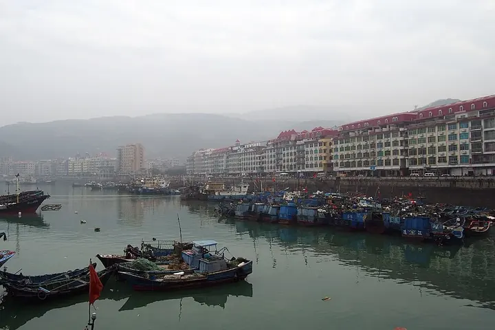
Photo adjustments
Full frame retained; proportionally resized and converted to WebP. No retouching or changes to the photographed subject. Card displays may crop the view.
- Administrative area
- County · 县
- Part of
- Fuzhou
- Chinese name
- 连江县
- Local areas
- County guide
Area & population
- Area in the source
- 1,168.00 km²
- Population · 2010
- 561,490
- Administrative seat
- Fengcheng
Source: cited geographic source, as of the dates shown.
Setting and landscape
The county sits on offshoots of the Jiufeng Mountains (鹫峰山), high in the northwest and northeast and sloping to the southeast. The Ao River (敖江), its largest river, flows 137 kilometres from Gutian (古田县) to the East China Sea at Pukou (浦口镇) and Dongdai (东岱镇). The Huangqi Peninsula, on the south side of Luoyuan Bay (罗源湾), has more than 100 gale days a year. The offshore Matsu Islands (马祖列岛) are governed from Taiwan as a separate Lienchiang County.
History
The county was founded in 282 as Wenma (温麻县). It took the name Lianjiang in 623, after its seat, which adjoins the river, and in 742 the seat moved to its present site, called Fengcheng (凤城), "phoenix town", for its shape. In 1990 China's first class of underwater archaeologists worked with Australian specialists off Dinghai (定海村), locating nine ancient wreck sites. The sea from the Min estuary to Huangqi Bay has long been a main shipping lane, and with dense reefs and no beacons in the past, ships often sank there.
What to see
Changmen Battery (长门炮台), on a hill in Guantou (琯头镇), was first built in 1632 and rebuilt under the Qing. During the Battle of Mawei (马江海战) in 1884 it damaged the French armoured cruiser La Galissonnière; in the war against Japan it was bombed repeatedly and finally destroyed. Also in Guantou, Qingzhi Mountain (青芝山), 12 kilometres from the county seat, is a provincial scenic area named after the bluish-purple lingzhi fungus once found there; its many caves earned it the name Hundred-Cave Mountain, and it carries more than 80 cliff inscriptions.
Two old pagodas mark the county town: the granite Ruiguang Pagoda (瑞光塔), built in 849, and the seven-storey Hanguang Pagoda (含光塔) of 1588, a 23.2-metre red-brick tower on Doumen Hill (斗门山) east of the town. Pukou was known for its 36 dragon kilns, and the National Museum of Australia holds celadon, white and black-glazed wares from them.
Food and local products
The county carries the titles of China's home of abalone, of fish balls and of kelp. Local food favours light, sweet and sour flavours with almost no chilli; well-known snacks include fish balls, rouyan (肉燕) and dingbianhu (鼎边糊). Lianjiang has also been named a Chinese home of hot springs.
Highlights
- Changmen Battery 长门炮台: Coastal battery of 1632 that damaged a French cruiser in the 1884 Battle of Mawei.
- Qingzhi Mountain 青芝山: Provincial scenic area with many caves and more than 80 cliff inscriptions.
- Hanguang Pagoda 含光塔: Seven-storey red-brick pagoda of 1588 on Doumen Hill.
- Pukou dragon kilns 浦口龙窑: Group of 36 kilns whose wares are held by the National Museum of Australia.
Sources for this guide
连江简介 - 连江县人民政府 · Lianjiang County People's Government
建置沿革 - 连江县人民政府 · Lianjiang County People's Government
名胜古迹 - 连江县人民政府 · Lianjiang County People's Government
连江县 - 维基百科 · Wikipedia (Chinese) · CC BY-SA 4.0
Original English written from the listed sources and checked sentence by sentence against quoted extracts by a separate reviewer. Updated 2026-09-23.
Explore Lianjiang County
Core places to explore, with English and Chinese names.
Places to explore around Lianjiang County
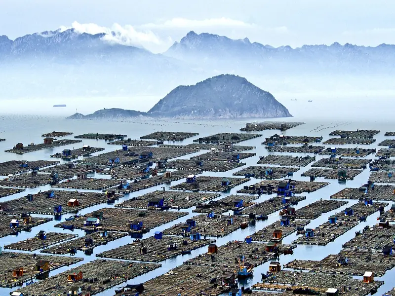 Qida Village (奇达村), Lianjiang County. Photograph: "Lianjiangqida1".
Qida Village奇达村
Qida is a fishing village in Ankai Township, Lianjiang County, where houses gather beneath Qiguanding and fish-farming structures pattern the bay.
Read the place guide → Pingliuwei Geopark · 平流尾地质公园
Pingliuwei Geopark平流尾地质公园
Villager-built coastal geopark in Lianjiang County, Fuzhou, around a flat volcanic rock, with sea caves, wave-cut platforms and cliffs.
Read the place guide →Plan your visit
Getting there
Lianjiang County is about 25 km in a straight line from central Fuzhou. Search for 连江县 in a map app to find stations and your accommodation.
Where to stay →Build your route
Qida Village and Pingliuwei Geopark are both listed here. The linked place guides have entrance and visit details.
Continue with Fuzhou →More in Fuzhou
Sources & geographic information
Administrative names and parent areas: Official geographic directory · Reference date 2026-09-06.
Some facts checked against 连江县 — Wikipedia contributors, CC BY-SA 4.0.
Photo: Qida Village · spamlian · CC BY 2.0. Full frame retained; EXIF orientation normalized, proportionally resized to at most 800 pixels and converted to WebP. No generated pixels or subject changes. Cards may crop the display.

Photo: Pingliuwei Geopark · Source photographer · License not provided. EXIF orientation normalized; resized without changing aspect ratio; converted to WebP. No subject edits.
Map data © OpenStreetMap contributors. Pins mark approximate centres, not entrances or boundaries.