


Get to know Gulou District
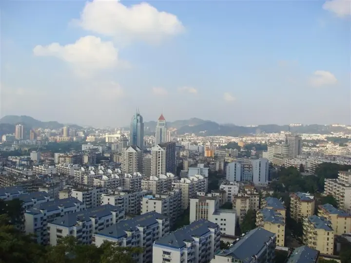
Photo adjustments
Full frame retained; proportionally resized and converted to WebP. No retouching or changes to the photographed subject. Card displays may crop the view.
- Administrative area
- District · 市辖区
- Part of
- Fuzhou
- Chinese name
- 鼓楼区
- Local areas
- District guide
Area & population
- Area in the source
- 35.43 km²
- Population · 2020
- 669,090
Source: cited geographic source, as of the dates shown.
Setting and landscape
The district sits at the centre of the Fuzhou Basin (福州盆地) on the alluvial plain of the lower Min River (闽江). Ground is higher in the north-west and lower in the south-east; the highest point is the main peak of Dafu Mountain (大腹山), at 181.2 m. The Bailong River (白龙江), a branch of the Min, forms the south-western edge facing Cangshan (仓山区). Small hills are scattered across the district: Wufeng (五凤山), Jinniu (金牛山), Wushan (乌山), Yushan (于山) and Pingshan (屏山). Twenty-one rivers run through it, and it takes in the lakes of West Lake (西湖) and Zuohai (左海).
The district government describes Gulou as the only provincial-capital core district in China with urban hot springs. A band of springs about five kilometres long runs through it; they have been called the finest baths since Huaqing, and the Song writer Li Gang (李纲) wrote a poem on them.
History
In 202 BC Wuzhu (无诸), king of Minyue (闽越), built the Ye city (冶城) between Pingshan and Yeshan (冶山), and Fuzhou's six later enlargements all took place within today's district. The Guping Road–Bayiqi North Road axis (鼓屏路—八一七北路) has remained the city's central line. The Ouye Pool (欧冶池), a smelting site of the Spring and Autumn and Warring States periods, survives, and in the Song the Kaiyuan Temple (开元寺) and the Wanshou Taoist Temple (万寿观) on Yushan printed Buddhist and Taoist canons of five to six thousand fascicles. Gulou District itself was set up in 1946, the year Fuzhou became a city.
What to see
The district holds 115 protected heritage sites, among them the main hall of Hualin Temple (华林寺), the Fuzhou Confucian Temple (福州文庙), and the old building groups of Sanfang Qixiang (三坊七巷, "three lanes and seven alleys") and Zhuzifang (朱紫坊). Sanfang Qixiang is a national 5A scenic area; over a hundred modern figures, including Lin Zexu (林则徐), Yan Fu (严复) and Shen Baozhen (沈葆桢), came from its lanes. The Wu Pagoda (乌塔) and White Pagoda (白塔) are also listed sites. West Lake Park and Zuohai Park are among the district's 13 riverside parks.
Food and local products
The district government features Fuzhou classics. Lychee pork (荔枝肉) is pork cooked to imitate a lychee in colour, shape and taste, and stands for the sweet-and-sour side of Fuzhou cooking. Taiji taro paste (太极芋泥) is a festive sweet of mashed betel-nut taro laid out in a yin-yang pattern; it looks cool but is served scalding. Juchunyuan (聚春园) makes it with Fuding (福鼎) taro, and the China Cuisine Association lists it as a famous Chinese snack.
Highlights
- Sanfang Qixiang 三坊七巷: National 5A scenic area of old lanes; home to Lin Zexu, Yan Fu, Shen Baozhen and over a hundred other modern figures.
- Hualin Temple main hall 华林寺: One of the district's 115 protected heritage sites.
- West Lake Park 西湖公园: A lake taken in by the district, and one of its 13 riverside parks.
- Taiji taro paste 太极芋泥: Scalding-hot taro sweet in a yin-yang pattern, listed as a famous Chinese snack by the China Cuisine Association.
Sources for this guide
鼓楼概况_福州市鼓楼区人民政府 · Gulou District People's Government, Fuzhou
鼓楼区自然地理信息_福州市鼓楼区人民政府 · Gulou District People's Government, Fuzhou
荔枝肉_福州市鼓楼区人民政府 · Gulou District People's Government, Fuzhou
太极芋泥_福州市鼓楼区人民政府 · Gulou District People's Government, Fuzhou
鼓楼区 (福州市) - 维基百科,自由的百科全书 · Chinese Wikipedia · CC BY-SA 4.0
Original English written from the listed sources and checked sentence by sentence against quoted extracts by a separate reviewer. Updated 2026-09-25.
Explore Gulou District
Core places to explore, with English and Chinese names.
Places to explore around Gulou District
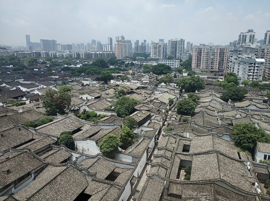 Sanfang Qixiang viewed west from the Dongbai Centre observation terrace in Fuzhou, July 2019.
Sanfang Qixiang三坊七巷
Sanfang Qixiang is organised around Nanhou Street, with residential lanes extending to either side. The contrast between the commercial spine and enclosed courtyard houses makes the old ward layout easy to read. Yijin Lane…
Read the place guide → The main exhibition-building entrance at Fujian Museum, Fuzhou; 2 May 2022.
Fujian Museum福建博物院
Fujian Museum gives the province’s history a physical focus through bronzes, ceramics, sculpture and local performance traditions. A large bronze nao from Jian’ou exemplifies the early metalwork in its collection, while the…
Read the place guide →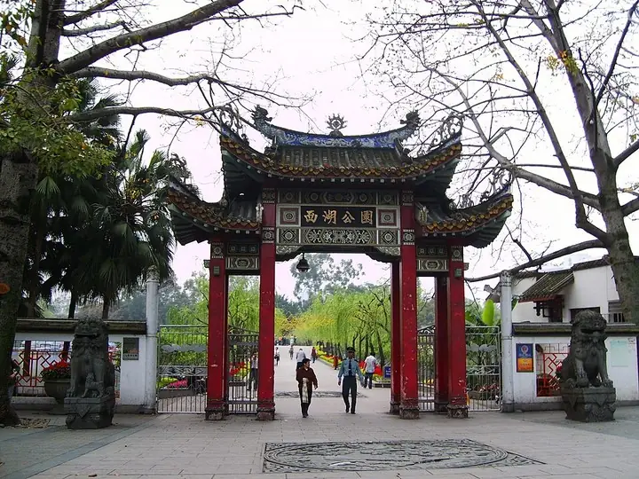 West Lake Park entrance, Fuzhou · 福州西湖公园入口 Photograph date recorded by the source: Taken on 13 April 2009.
West Lake Park (Fuzhou)西湖公园
Fuzhou’s West Lake is a garden landscape of islands, bridges and buildings associated with the city’s literary life. Kaihua Temple stands on Kaihua Islet, while Wanzai Hall beside it commemorates poets and their gatherings…
Read the place guide →Plan your visit
Getting there
Gulou District covers the centre of Fuzhou. Search for 鼓楼区 in a map app to find stations and your accommodation.
Where to stay →Build your route
Sanfang Qixiang and Fujian Museum are about 2 km apart in a straight line. The linked place guides have entrance and visit details.
Continue with Fuzhou →More in Fuzhou
Sources & geographic information
Administrative names and parent areas: Official geographic directory · Reference date 2026-09-06.
Some facts checked against 鼓楼区 (福州市) — Wikipedia contributors, CC BY-SA 4.0.
Photo: Sanfang Qixiang · 董辰兴 · CC BY-SA 4.0. Proportionally resized and converted to WebP without cropping, retouching or changing the photographed subject.

Photo: Fujian Museum · FradonStar · CC BY-SA 4.0. Proportionally resized and converted to WebP without cropping, retouching or changing the photographed subject.

Photo: West Lake Park (Fuzhou) · ting wei chun · CC BY 3.0. The exact downloaded source bytes are separately retained and hashed. Prepared JPEG is proportionally reduced to a maximum 720-pixel long edge; full frame retained, no subject alteration. Final website rendition: full frame retained, proportionally resized to at most 720 pixels and converted to WebP. No additional retouching or subject alteration. Card displays may crop the view.

Map data © OpenStreetMap contributors. Pins mark approximate centres, not entrances or boundaries.