


Get to know Yongtai County
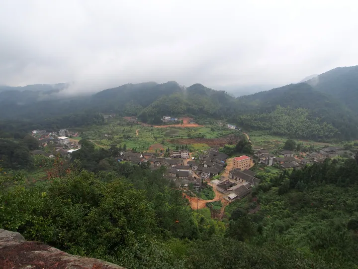
Photo adjustments
Full frame retained; proportionally resized and converted to WebP. No retouching or changes to the photographed subject. Card displays may crop the view.
- Administrative area
- County · 县
- Part of
- Fuzhou
- Chinese name
- 永泰县
- Local areas
- County guide
Setting and landscape
The Dazhang River runs 127 km inside the county. Temperature, rainfall, wind and cloud all change with altitude, which is why local people say that one mountain has four seasons and the weather differs every ten li. Forest covers 76.8% of the county according to the county government, and it describes bathing in hot springs as a traditional Yongtai health habit.
History
The county was created in 766, in the Tang Yongtai era, from parts of Houguan (侯官) and Youxi. In 1102 it was renamed Yongfu (永福) to avoid a taboo on an imperial tomb name, and in 1914 it took back the name Yongtai because Guangxi already had a Yongfu. In three successive examinations, in 1166, 1169 and 1172, Yongtai men Xiao Guoliang (萧国梁), Zheng Qiao (郑侨) and Huang Ding (黄定) each came first in the national imperial exam; the Liankui Pagoda (联奎塔) at Xishan (溪山) in the county town, built in the Daoguang reign, commemorates them.
What to see
Songkou Ancient Town (嵩口古镇) is the only town in Fuzhou prefecture listed as a Chinese Historic and Cultural Town. The county's fortified manor houses, the Yongtai zhuangzhai (永泰庄寨), number 152 well-preserved examples and are in the eighth batch of national key protected sites.
Qingyun Mountain (青云山), 13 km from the county town in Linglu (岭路乡), is a national key scenic area and 4A site of canyons, waterfalls and volcanic landforms; it is the reference locality for an Early Cretaceous volcanic sequence. Its name, "rising to the blue clouds", recalls the Southern Song scholar Xiao Guoliang, who studied here before taking first place. Yunding (云顶), at the top of Qingyun Mountain at an average altitude above 1,100 m, has upland meadows around a volcanic crater lake, terraced fields and a suspended plank walkway. Tianmen Mountain (天门山) is a national water-conservancy scenic area.
Food and local products
Plums are the main fruit crop, grown on some 130,000 mu, and Yongtai was named "China's Plum Village" by the State Forestry Administration in 2001. Dried Yongtai plums (永泰李干) carry Chinese geographical-indication protection covering the whole county.
Highlights
- Songkou Ancient Town 嵩口古镇: Fuzhou prefecture's only Chinese Historic and Cultural Town.
- Yongtai zhuangzhai 永泰庄寨: 152 well-preserved fortified manors, listed in the eighth batch of national key protected sites.
- Qingyun Mountain 青云山: 4A canyon and waterfall area set in Cretaceous volcanic rocks, 13 km from the county town.
- Yunding 永泰云顶: Top of Qingyun Mountain, averaging above 1,100 m, with meadows around a volcanic crater lake.
- Dried Yongtai plums 永泰李干: Geographical-indication product covering the whole county.
Sources for this guide
永泰县 - 维基百科,自由的百科全书 · Chinese Wikipedia · CC BY-SA 4.0
自然资源_ 自然资源_ 永泰县人民政府 · Yongtai County People's Government
风景名胜_ 永泰县人民政府 · Yongtai County People's Government
风景名胜_ 永泰县人民政府 · Yongtai County People's Government
人文历史_ 永泰县人民政府 · Yongtai County People's Government
Original English written from the listed sources and checked sentence by sentence against quoted extracts by a separate reviewer. Updated 2026-09-25.
Explore Yongtai County
Core places to explore, with English and Chinese names.
Places to explore around Yongtai County
 Songkou Ancient Town · 嵩口古镇
Songkou Ancient Town嵩口古镇
Songkou is a former trading town on the Dazhang Stream in Yongtai, with old landing steps, Ming and Qing houses, and a narrow lane shaped like a crane’s neck.
Read the place guide →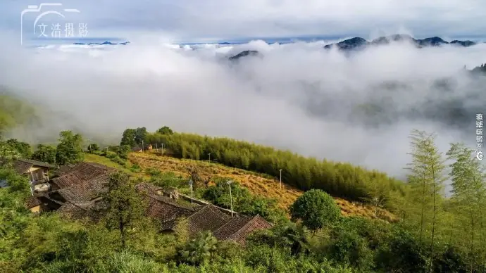 Yongtai Yunding Scenic Area · 永泰云顶
Yongtai Yunding Scenic Area永泰云顶
Yongtai Yunding is an upland scenic resort in Linglu Township, combining meadow around Tianchi lake with a separate landscape of gorges and waterfalls.
Read the place guide →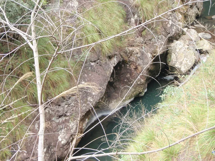 A rocky gorge and stream in the Qingyun Mountain scenic area, Yongtai County, Fuzhou · 福州市永泰县青云山风光,溪流与岩壁 Source-recorded photograph date: Taken on 12 March 2011.
Qingyun Mountain青云山
Qingyunshan is a mountain landscape centred on Linglu Township in Yongtai, where volcanic rock forms cliffs and gorges crossed by streams and waterfalls.
Read the place guide →Plan your visit
Getting there
Yongtai County is about 40 km in a straight line from central Fuzhou. Search for 永泰县 in a map app to find stations and your accommodation.
Where to stay →Build your route
Songkou Ancient Town and Yongtai Yunding Scenic Area are both listed here. The linked place guides have entrance and visit details.
Continue with Fuzhou →More in Fuzhou
Sources & geographic information
Administrative names and parent areas: Official geographic directory · Reference date 2026-09-06.
Some facts checked against 永泰县 — Wikipedia contributors, CC BY-SA 4.0.
Photo: Songkou Ancient Town · Source photographer · License not provided. EXIF orientation normalized; resized without changing aspect ratio; converted to WebP. No subject edits.
Photo: Yongtai Yunding Scenic Area · Source photographer · License not provided. EXIF orientation normalized; resized without changing aspect ratio; converted to WebP. No subject edits. Source photograph turned 90 degrees counter-clockwise to restore the upright landscape orientation.
Photo: Qingyun Mountain · 江上清风1961 · CC BY 3.0. Full frame retained; proportionally resized and converted to WebP. No retouching or changes to the photographed subject. Card displays may crop the view.
.jpg)
Map data © OpenStreetMap contributors. Pins mark approximate centres, not entrances or boundaries.