


Get to know Sanyuan District
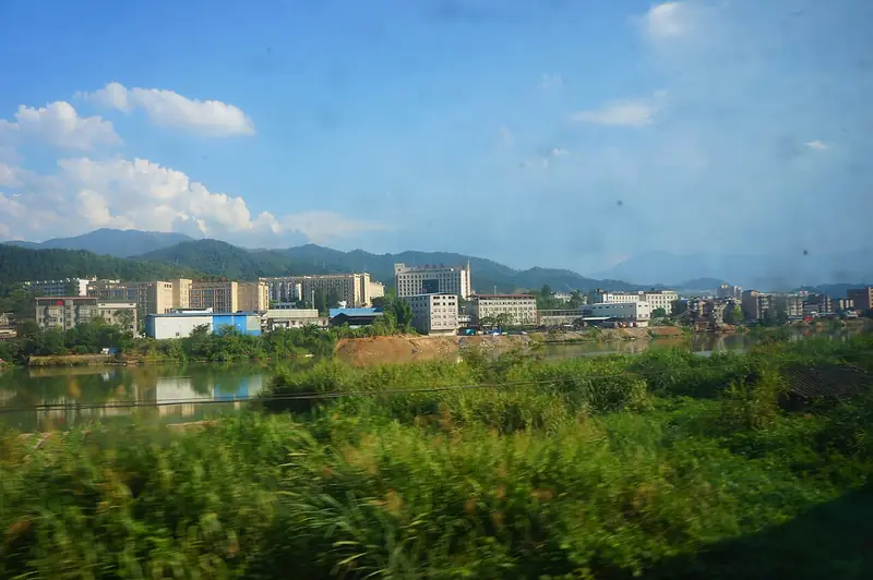
Photo adjustments
Full frame retained; EXIF orientation normalized, proportionally resized to at most 800 pixels and converted to WebP. No generated pixels or subject changes. Cards may crop the display.
- Administrative area
- District · 市辖区
- Part of
- Sanming
- Chinese name
- 三元区
- Local areas
- District guide
Area & population
- Area in the source
- 805.00 km²
- Population · 2020
- 187,936
Source: cited geographic source, as of the dates shown.
History
The area once belonged to Sha County (沙县) and was a village called Sanyuan under the Song; Sanyuan County was first created in 1940 from parts of Sha, Mingxi (明溪) and Yong'an (永安). The name is traced to a Tang-era story of a woman of the An family who bore three sons at one birth, each named with "yuan". In 1983 the old county-level city of Sanming was divided into Sanyuan and Meilie districts.
The district describes itself as a heavy-industry base for Fujian. In January 1958 Liexi (列西) was chosen as the site of the Fujian steel works and fertiliser plant, and at midnight on 2 January 1959 the first six-tonne heat of molten steel was poured, which the district says ended Fujian's lack of any steel of its own. Zhu De (朱德) wrote the poem "Sanming New City" (三明新市) after an inspection in February 1961. In 2013 Sanyuan was recognised as part of the former Central Soviet Area, and the district counts 27 revolutionary sites.
What to see
The Wanshouyan site (万寿岩遗址), found in November 1999, pushed the record of human life in Fujian back to 185,000 years ago and is described by the district as the earliest cave-type early Palaeolithic site found in East China. It became a national key cultural relics protection unit in 2001 and, in December 2017, Fujian's only national archaeological site park; the Wanshouyan cultural tourism town (万寿岩文旅小镇) is a national 4A scenic area.
The district also lists Ruiyun Mountain (瑞云山) scenic area, the Sansteel industrial tourism area (福建三钢工业旅游区), Qingfeng Valley (清枫谷), the Castanopsis kawakamii national forest park (格氏栲国家森林公园) and Zhengshun Temple (正顺庙), a national key cultural relics protection unit. The district says it has the world's largest and purest primeval stand of Castanopsis kawakamii, a chinquapin tree.
Food and local products
Sanyuan Sarcandra (三元草珊瑚) is a national geographical indication product, and the district holds the title "home of Sarcandra in China". Xiji tangerines (西际蜜桔) are listed as a nationally recognised special farm product. The local speech is the Sanming dialect (三明话) of Central Min.
Getting oriented
Yong'an lies to the west and Datian County (大田县) to the south. Sanming railway station, on the Nanping–Longyan railway (南龙铁路), is in the district, and so is Sanming University (三明学院).
Highlights
- Wanshouyan site 万寿岩遗址: Cave site dated to 185,000 years ago; national archaeological site park since 2017.
- Castanopsis kawakamii national forest park 格氏栲国家森林公园: Primeval stand described by the district as the world's largest and purest.
- Zhengshun Temple 正顺庙: National key cultural relics protection unit.
- Sanyuan Sarcandra 三元草珊瑚: National geographical indication product.
Sources for this guide
三元概况 _ 三元概况 _ 三元区人民政府门户网站 · Sanyuan District People's Government, Sanming
人文历史 _ 三元区人民政府门户网站 · Sanyuan District People's Government, Sanming
自然地理 _ 三元区人民政府门户网站 · Sanyuan District People's Government, Sanming
三元区 - 维基百科,自由的百科全书 · Wikipedia (Chinese) · CC BY-SA 4.0
Original English written from the listed sources and checked sentence by sentence against quoted extracts by a separate reviewer. Updated 2026-09-23.
Explore Sanyuan District
Core places to explore, with English and Chinese names.
Sanyuan District 三元区
Plan your visit
Getting there
Sanyuan District is about 4 km in a straight line from central Sanming. Search for 三元区 in a map app to find stations and your accommodation.
Where to stay →More in Sanming
Sources & geographic information
Administrative names and parent areas: Official geographic directory · Reference date 2026-09-06.
Some facts checked against 三元区 — Wikipedia contributors, CC BY-SA 4.0.
Map data © OpenStreetMap contributors. Pins mark approximate centres, not entrances or boundaries.