


Get to know Honggu District
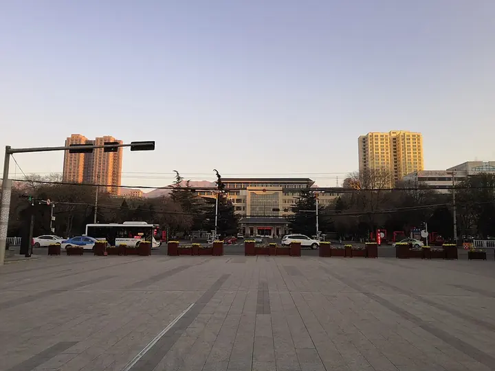
Photo adjustments
Full frame retained; proportionally resized and converted to WebP. No retouching or changes to the photographed subject. Card displays may crop the view.
- Administrative area
- District · 市辖区
- Part of
- Lanzhou
- Chinese name
- 红古区
- Local areas
- District guide
Area & population
- Area in the source
- 568.00 km²
- Population · 2019
- 143,000
Source: cited geographic source, as of the dates shown.
Setting and landscape
The land falls from north-west to south-east, from 2,455 metres to 1,580 metres, and the district stretches as a long strip beside the two rivers. Valley floors dominate, with river flats and bottomland cut by gullies into small plains one to three kilometres wide. With coal and other minerals in the ground, the area has long been nicknamed "Babaochuan" (八宝川) and "Metallurgy Valley" (冶金谷). The Datong, the Huangshui and four gravity-fed canals water its fields, and the district government calls it a base for "high-plateau summer vegetables" (高原夏菜).
History
Dinosaur fossils were found at Majiahu Gully (马家户沟) in Haishiwan (海石湾) in May 1947 by prospectors of the China Petroleum Corporation, among them Sun Jianchu (孙建初). Later digs recovered a fairly complete sauropod, 22 metres long when mounted, which Yang Zhongjian (杨钟健) assigned to Mamenchisaurus hochuanensis as the paratype. The district government also counts Honggu among the birthplaces of the Qijia (齐家) and Majiayao (马家窑) cultures.
Honggu District was created on 27 April 1960 around the Yaojie (窑街) coal mine, then described as the largest in Gansu. The government moved to Haishiwan, on the Lanzhou–Qinghai railway, in July 1989.
What to see
Xiangtang Gorge (享堂峡), on the old Tang–Tibet road at the Qinghai border, carries the Datong River for about 8 kilometres; its spray is called the "Haomen snow waves" (浩门雪浪). In 1905 a timber cantilever bridge was built at the south mouth with plaques calling the gorge "河湟锁钥" ("lock and key of the Yellow River–Huangshui country"). Chiang Ching-kuo (蒋经国), who crossed in 1941, wrote in a 1943 book that his driver called it the most dangerous stretch of road in China. Before 1949, sheepskin rafts carried Yaojie coal and pottery through the gorge to Lanzhou.
At the head of Tandong Gully (炭洞沟) in Yaojie, red cliffs of Danxia landform line the valley. Yaojie is also known for its "Fu" character lantern fair (窑街“福”字灯会), listed as intangible heritage by Honggu and Lanzhou: 361 pine poles, two metres apart and joined by cords, form a square maze whose layout stands for the character for good fortune, with a lamp on each pole. Walking out without getting lost or crossing a cord means a lucky year. The district reported in 2018 that none had been held since 2003.
Getting oriented
National Highway 109, the Beijing–Lhasa Expressway (京藏高速), the Lanzhou–Qinghai railway (兰青铁路) and the Lanzhou–Xinjiang high-speed railway (兰新高铁) all cross the district.
Highlights
- Xiangtang Gorge 享堂峡: About 8 km gorge of the Datong River on the Gansu–Qinghai border, once a feared stretch of road.
- Yaojie "Fu" character lantern fair 窑街“福”字灯会: A maze of 361 lamp poles whose layout stands for the character for fortune; on the Honggu and Lanzhou intangible heritage lists, last held in 2003.
- Haishiwan dinosaur site 海石湾恐龙化石: Majiahu Gully, where the Mamenchisaurus hochuanensis paratype was found from 1947.
Sources for this guide
红古区人民政府 红古概况 · Honggu District People's Government, Lanzhou
红古区人民政府 旅游观光 马门溪龙的发现 · Honggu District People's Government, Lanzhou
红古区人民政府 地情史话 风雨沧桑享堂峡 · Honggu District People's Government, Lanzhou
红古区人民政府 旅游观光 窑街福字灯会 · Honggu District People's Government, Lanzhou
红古区人民政府 旅游观光 壮美丹霞 · Honggu District People's Government, Lanzhou
红古区 - 维基百科 · Chinese Wikipedia · CC BY-SA 4.0
Original English written from the listed sources and checked sentence by sentence against quoted extracts by a separate reviewer. Updated 2026-09-23.
Explore Honggu District
Core places to explore, with English and Chinese names.
Honggu District 红古区
Plan your visit
Getting there
Honggu District is about 90 km in a straight line from central Lanzhou. Search for 红古区 in a map app to find stations and your accommodation.
Where to stay →More in Lanzhou
Sources & geographic information
Administrative names and parent areas: Official geographic directory · Reference date 2026-09-06.
Some facts checked against 红古区 — Wikipedia contributors, CC BY-SA 4.0.
Map data © OpenStreetMap contributors. Pins mark approximate centres, not entrances or boundaries.