


Get to know Lingtai County

- Administrative area
- County · 县
- Part of
- Pingliang
- Chinese name
- 灵台县
- Local areas
- County guide
Area & population
- Area in the source
- 2,038.00 km²
- Population · 2019
- 229,100
- Administrative seat
- Zhongtai
Source: cited geographic source, as of the dates shown.
Setting and landscape
The county stretches 78 km from east to west and 40 km from north to south, in loess gully country between about 890 and 1,520 m above sea level. The county government describes one tableland, one hill district and two river valleys: the Shizi tableland (什字塬), called the second-largest loess tableland of eastern Gansu, the southern hills, and the valleys of the Daxi River (达溪河) and the Hei River (黑河).
History
In the Shang and Zhou periods this was the land of the states of Mixu (密须国) and Mi (密). Mixu was famous for its war drums, and King Wen of Zhou’s campaign against it is sung in the "Huangyi" (皇矣) ode of the Book of Songs. The county is named after the "spirit terrace" (灵台) King Wen built to sacrifice to heaven after the conquest; Lingtai County was set up in 605, under the Sui.
The Qin created Chungu (鹑觚) and Yinmi (阴密) counties here; from the Tang and Song onward the others were abolished until only Lingtai remained. Natives include the Spring and Autumn period official Zuo Qiuming (左丘明) and the Tang chancellor Niu Sengru (牛僧孺).
What to see
The Ancient Lingtai (古灵台) and Jingshan Forest Park (荆山森林公园) is a national 4A scenic area of 417 hectares on Zhongtai Mountain (中台山). Its traditional-style buildings include a museum, the Shrine of the Three Worthies (三贤祠) and the Jade Emperor Pavilion (玉皇阁), with forest on the back hill and a lake in the Donggou valley (东沟).
Huangfu Mi died in 282 and was buried in today’s Dudian town (独店镇). The Huangfu Mi Cultural Park (皇甫谧文化园) on the tomb site, also 4A, has three exhibition halls on his life, historical documents and acupuncture. His "Systematic Classic of Acupuncture and Moxibustion" (《针灸甲乙经》) is credited with laying the foundations of acupuncture as a systematic, specialised discipline.
The county museum holds 7,547 objects and is best known for Western Zhou and Qin–Han bronzes. Other old sites include the Mixu state ruins (密须国遗址), the Mingchang iron bell (明昌铁钟) and the tombs of Niu Sengru and Zuo Qiuming; Gansu lists Lingtai as a provincial historic and cultural city.
Food and local products
Lingtai is one of Gansu's main grain and beef-cattle counties, and a national standardisation demonstration area for growing apples on dwarfing rootstock.
Highlights
- Ancient Lingtai and Jingshan Forest Park 古灵台·荆山森林公园: National 4A scenic area of 417 hectares on Zhongtai Mountain, named after King Wen of Zhou's spirit terrace.
- Huangfu Mi Cultural Park 皇甫谧文化园: National 4A park on the tomb site of the acupuncture pioneer, with three exhibition halls.
- Mixu state ruins 密须国遗址: Remains of the Shang-era state conquered by King Wen of Zhou.
- Shizi tableland 什字塬: Described by the county as the second-largest loess tableland of eastern Gansu.
Sources for this guide
灵台概况 · Lingtai County People's Government
灵台:针灸养生圣地 商周文化名城 · Lingtai County People's Government (County Culture and Tourism Bureau)
Original English written from the listed sources and checked sentence by sentence against quoted extracts by a separate reviewer. Updated 2026-09-23.
Explore Lingtai County
Core places to explore, with English and Chinese names.
Places to explore around Lingtai County
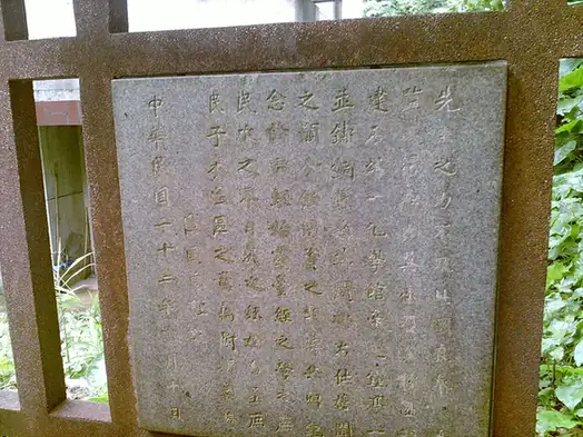 Lingtai Ancient Terrace ·
 Plan your visit
Getting there
Lingtai County is about 85 km in a straight line from central Pingliang. Search for 灵台县 in a map app to find stations and your accommodation.
Where to stay →Build your route
Start with Lingtai Ancient Terrace. The linked place guides have entrance and visit details.
Continue with Pingliang →More in Pingliang
Sources & geographic information
Administrative names and parent areas: Official geographic directory · Reference date 2026-09-06.
Photo: Lingtai Ancient Terrace · Source photographer · License not provided. EXIF orientation normalized; resized without changing aspect ratio; converted to WebP. No subject edits.
Map data © OpenStreetMap contributors. Pins mark approximate centres, not entrances or boundaries.