


Get to know Kongtong District
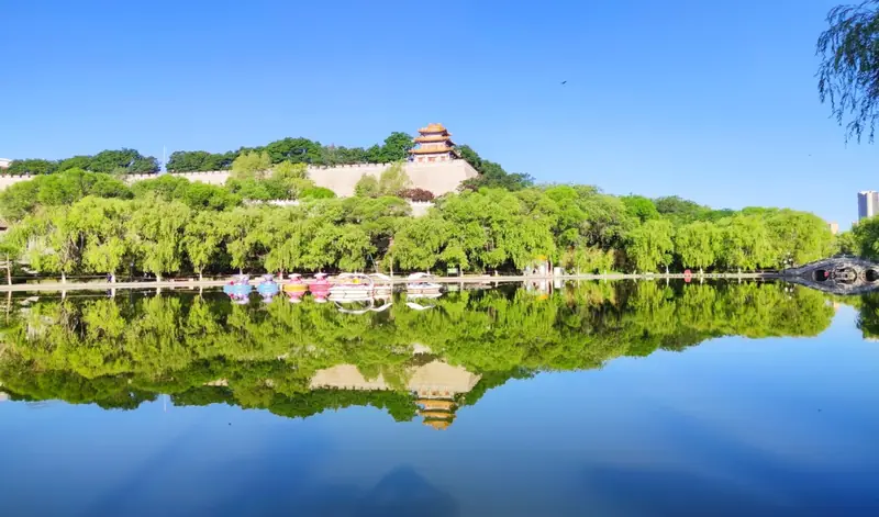
Photo adjustments
EXIF orientation normalized; resized without changing aspect ratio; converted to WebP. No subject edits.
- Administrative area
- District · 市辖区
- Part of
- Pingliang
- Chinese name
- 崆峒区
- Local areas
- District guide
Area & population
- Area in the source
- 1,936.00 km²
- Population · 2020 census
- 504,265
- Administrative seat
- Xijiao Subdistrict
Source: cited geographic source, as of the dates shown.
Getting oriented
The district borders Jingchuan County (泾川县) to the east, Huating (华亭市) and Chongxin (崇信县) to the south, Pengyang (彭阳县) and Zhenyuan (镇原县) to the north, and Jingyuan County (泾源县) and Guyuan (固原) in Ningxia to the west. The district government places it at the geographic centre of the area where Shaanxi, Gansu and Ningxia meet. The Xi'an–Pingliang railway, the G312 national road and the Qingdao–Lanzhou and Fuzhou–Yinchuan expressways cross it from east to west, while the Baoji–Zhongwei and Tianshui–Pingliang railways run north to south.
History
The district government traces the first county here to Emperor Wu of the Northern Zhou, in the first year of his Jiande reign, more than 1,450 years ago, and calls the town the first fortified pass on the Silk Road for travellers heading north-west towards Ganzhou and Liangzhou (甘凉). More than 150 ancient sites of the Yangshao, Qijia and Shang–Zhou periods have been found. Natives include the Eastern Han calligrapher Liang Hu (梁鹄) and Zhao Shichun (赵时春), one of the Ming "Eight Talents of the Jiajing era". Kongtong martial arts and Kongtong Xiaotan (崆峒笑谈, literally "Kongtong jokes") are listed as intangible cultural heritage.
In modern times the area was Pingliang County from 1949 and a county-level Pingliang city from 1950, reverted to a county in 1964, became a city again in 1983, and was reorganised as Kongtong District in June 2002.
What to see
Kongtong Mountain is a national 5A scenic area of 84 square km whose main peak rises to 2,123 m. The Jing and Yanzhi (胭脂河) rivers wrap round it and meet in front of Wangjia Hill (望驾山). Its Danxia landforms of purple-red conglomerate have flat tops, steep sides and gentle foothills. Pavilions, temples and pagodas are spread over the peaks, and the ancient building complex is a nationally protected monument. Tradition says the Yellow Emperor came here to ask the sage Guangchengzi (广成子) about government and long life, and in 646 Emperor Taizong of Tang endowed the Minghui Chan Monastery (明慧禅院) with land.
Inside the mountain's Falun Temple (法轮寺) stands the Lingkong Pagoda (凌空塔), an eight-sided, seven-storey brick pagoda 32 m tall, first built in the Northern Song Tiansheng era and repaired in 1585. Taitong Forest Park (太统森林公园), 9 km from the city, lies within the Taitong–Kongtong national nature reserve; its main peak reaches 2,234 m and the clouds that gather on it after summer rain were counted among Pingliang's eight old views.
Highlights
- Kongtong Mountain 崆峒山: National 5A scenic area of 84 square km with Danxia landforms and a nationally protected complex of Taoist and Buddhist buildings.
- Lingkong Pagoda 凌空塔: Eight-sided, seven-storey brick pagoda in Falun Temple, first built in the Northern Song and repaired in 1585.
- Taitong Forest Park 太统森林公园: 3A forest park 9 km from the city inside the Taitong–Kongtong national nature reserve; main peak 2,234 m.
- Kongtong martial arts 崆峒武术: Listed as intangible cultural heritage, according to the district government.
Sources for this guide
崆峒概况 · Kongtong District People's Government, Pingliang
崆峒山 · Kongtong District People's Government, Pingliang (republished from the Kongtong Mountain scenic area site)
崆峒文物 · Kongtong District People's Government, Pingliang
太统森林公园 · Kongtong District People's Government, Pingliang
崆峒区 - 维基百科,自由的百科全书 · Wikipedia (Chinese) · CC BY-SA 4.0
Original English written from the listed sources and checked sentence by sentence against quoted extracts by a separate reviewer. Updated 2026-09-23.
Explore Kongtong District
Core places to explore, with English and Chinese names.
Places to explore around Kongtong District
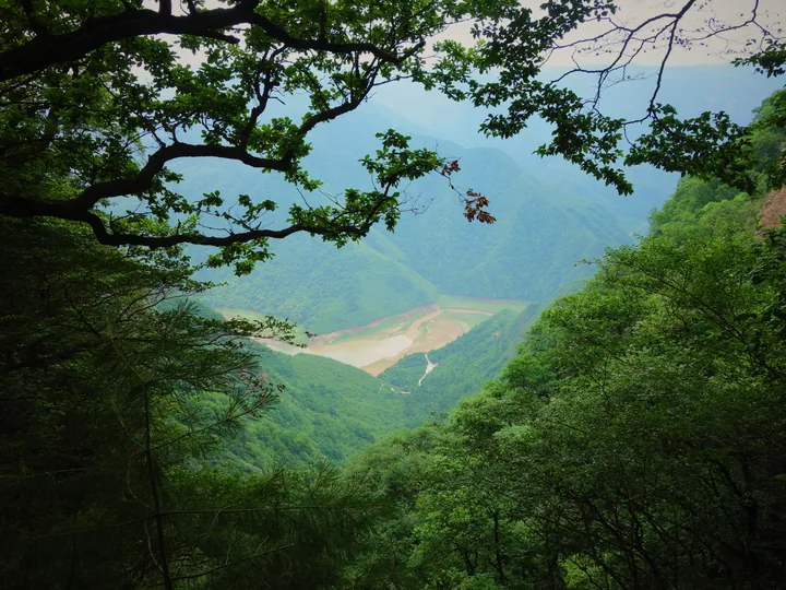 Kongtong Reservoir seen from Kongtong Mountain ·
 Plan your visit
Getting there
Kongtong District covers the centre of Pingliang. Search for 崆峒区 in a map app to find stations and your accommodation.
Where to stay →Build your route
Start with Kongtong Mountain. The linked place guides have entrance and visit details.
Continue with Pingliang →More in Pingliang
Sources & geographic information
Administrative names and parent areas: Official geographic directory · Reference date 2026-09-06.
Some facts checked against 崆峒区 — Wikipedia contributors, CC BY-SA 4.0.
Photo: Kongtong Mountain · DarthVachel · CC BY-SA 4.0. Full frame retained; proportionally resized and converted to WebP. No retouching or changes to the photographed subject. Card displays may crop the view.

Map data © OpenStreetMap contributors. Pins mark approximate centres, not entrances or boundaries.