


Get to know Xingning District
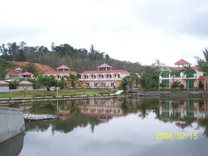
Photo adjustments
Full frame retained; proportionally resized and converted to WebP. No retouching or changes to the photographed subject. Card displays may crop the view.
- Administrative area
- District · 市辖区
- Part of
- Nanning
- Chinese name
- 兴宁区
- Local areas
- District guide
Area & population
- Area in the source
- 751.00 km²
- Population · 2020
- 615,485
- Administrative seat
- Xidong Subdistrict
Source: cited geographic source, as of the dates shown.
Setting and landscape
The district lies at the centre of the Nanning basin, south of the Tropic of Cancer, and slopes gently from northeast to southwest. Most of it is flat, but low mountains over 400 metres rise along parts of the northern and eastern edges, and the highest point, Baizao Mountain (白凿山, 1,004 metres), stands in Kunlun Town (昆仑镇). Summers are long, hot and wet, and winters short and slightly drier.
History
The district government dates Xingning as an administrative unit to 15 March 1953, when the government of Nanning's Third District was formed. Xingning District itself was set up in July 1958, renamed Chaoyang District (朝阳区) in 1979 and given back its old name in 1980; Kunlun and two other towns joined it from Yongning County in 2004. The origin of the name is not certain: it may come from Xingning Road in the city centre or from the old Xingning town, and a 2013 Guangxi place-name dictionary reads it as "reviving Nanning" or "prosperity and peace".
What to see
The Three Streets and Two Lanes are Xingning Road, Minsheng Road and Jiefang Road with Jinshi Lane (金狮巷) and Yinshi Lane (银狮巷), two lanes dating from the Ming and Qing. The quarter holds more than 20 protected relics and historic buildings, among them the Nanning City God Temple (南宁城隍庙) and the Jinshi Lane houses. Work to repair the old houses and city wall began in 2013 and the streets reopened in December 2018.
The Kunlun Pass battle site museum (昆仑关战役博物馆), at the old battlefield on the Binyang boundary, is Guangxi's first museum devoted to the War of Resistance against Japan. Its building, opened in 2008, was designed by Dai Fudong (戴复东), eldest son of General Dai Anlan (戴安澜), and it shows nearly 1,000 objects and historical photographs. Among the district's national 4A scenic areas are the Kunlun Pass Scenic Area (昆仑关风景区), Guangxi Gaofeng Forest Park (广西高峰森林公园), People's Park (人民公园) and the Guangxi Medicinal Botanical Garden (广西药用植物园).
Food and local products
The courtyard shops of the Three Streets and Two Lanes sell Guangxi snacks such as suanye (酸嘢, sour pickles), laoyou noodles (老友粉) and guilinggao (龟苓膏) jelly.
Getting oriented
Xingning measures about 52 kilometres from east to west but only 22 kilometres from north to south. It faces Jiangnan District (江南区) across the Yong River (邕江) to the south and borders Qingxiu (青秀区) to the southeast, Xixiangtang (西乡塘区) to the west and northwest, and Wuming (武鸣) to the north.
Highlights
- Three Streets and Two Lanes 三街两巷: Old Nanning quarter of three streets and two Ming–Qing lanes with more than 20 protected buildings; reopened in 2018.
- Nanning City God Temple 南宁城隍庙: Protected relic inside the Three Streets and Two Lanes quarter.
- Kunlun Pass battle site museum 昆仑关战役博物馆: Guangxi's first museum of the War of Resistance, opened in 2008 at the Kunlun Pass battlefield.
- Baizao Mountain 白凿山: The district's highest point at 1,004 metres, in Kunlun Town.
- Guangxi Medicinal Botanical Garden 广西药用植物园: One of the district's national 4A scenic areas.
Sources for this guide
历史沿革_概况信息_南宁市兴宁区人民政府 · Xingning District People's Government, Nanning (from the 2023 Xingning District Yearbook)
地理环境_概况信息_南宁市兴宁区人民政府 · Xingning District People's Government, Nanning
南宁三街两巷 | 老街巷变身文旅融合新地标_兴宁旅游_南宁市兴宁区人民政府 · Publicity Department of the CPC Xingning District Committee (Xingning District People's Government portal)
探访南宁市首批“小而美”公共文旅空间 昆仑关战役博物馆 - 南宁市兴宁区人民政府 · Nanning Daily, republished by the Xingning District People's Government
Original English written from the listed sources and checked sentence by sentence against quoted extracts by a separate reviewer. Updated 2026-09-24.
Explore Xingning District
Core places to explore, with English and Chinese names.
Places to explore around Xingning District
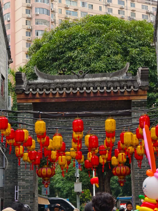 A lantern-hung traditional gateway in the Three Streets and Two Lanes historic quarter, Nanning ·
 Plan your visit
Getting there
Xingning District covers the centre of Nanning. Search for 兴宁区 in a map app to find stations and your accommodation.
Where to stay →Build your route
Start with Three Streets and Two Lanes. The linked place guides have entrance and visit details.
Continue with Nanning →More in Nanning
Sources & geographic information
Administrative names and parent areas: Official geographic directory · Reference date 2026-09-06.
Photo: Three Streets and Two Lanes · MspreilsCN · CC0. Full frame retained; proportionally resized and converted to WebP. No retouching or changes to the photographed subject. Card displays may crop the view.

Map data © OpenStreetMap contributors. Pins mark approximate centres, not entrances or boundaries.