


Get to know Wuming District
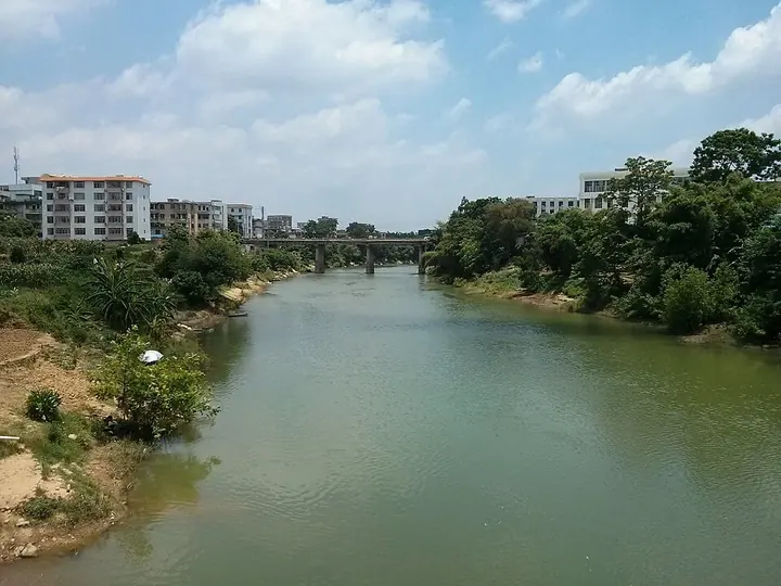
Photo adjustments
Full frame retained; proportionally resized and converted to WebP. No retouching or changes to the photographed subject. Card displays may crop the view.
- Administrative area
- District · 市辖区
- Part of
- Nanning
- Chinese name
- 武鸣区
- Local areas
- District guide
Area & population
- Area in the source
- 3,378.36 km²
- Population · 2019
- 722,000
- Administrative seat
- Chengxiang
Source: cited geographic source, as of the dates shown.
Setting and landscape
The district stretches 111 kilometres from east to west and 97 kilometres from north to south. The climate is subtropical and monsoonal, with long, wet summers and short, dry winters, and 138 rivers and streams cross the land. The main town draws its water from Lingshui (灵水), a spring where groundwater rises to the surface.
History
Before 1912 the area was Wuyuan County (武缘县), whose seat settled at Chengxiang in 1368; in 1528 the seat of Si'en Prefecture (思恩府) moved to today's Fucheng (府城镇). In 1912 the county took the name Wuming, meaning "to resound through the land by martial valour". It came under Nanning city in 1983, and became a district in 2015.
At Matou (马头镇), excavations in 1985–1986 cleared 330 Western Zhou tombs at Yuanlongpo (元龙坡), with bronzes, pottery, jade and stone casting moulds; the Andengyang (安等秧) cemetery, also at Matou, yielded 86 Warring States tombs. The two sites became autonomous-region protected relics on 8 December 2017.
What to see
Mingxiu Garden (明秀园) in Chengxiang began as a Qing private orchard. Lu Rongting (陆荣廷), then inspector-general of Guangdong and Guangxi, bought and renamed it in 1919, and in 1955–1956, when the Guangxi Zhuang script committee was based there, Chinese and Soviet linguists devised the written Zhuang script in the garden. It is an autonomous-region protected site (2000) and a national 3A scenic area (2020).
Qifengshan Temple (起凤山庙) in Chengxiang dates from 1844. Qifeng Hill carries 41 inscriptions, mostly Ming to Republican and mostly on its eastern peak's cliffs; the largest is a single character "feng" (凤, phoenix) carved in 1839, 4 metres high. Yiling Cave (伊岭岩), a national 4A scenic area in Shuangqiao Town (双桥镇), lies 18 kilometres from Nanning, and its Zhuang culture garden displays farm tools, stone implements and homespun Zhuang clothing.
Food and local products
Local Zhuang food runs sweet. Five-colour glutinous rice (五色糯米饭) is steamed with plant or food colourings and given to friends and relatives at festivals, and shuijing bao (水晶包) are buns filled with diced pork fat and sugar. For the Spring Festival families make baozong (包粽), a large rice dumpling of glutinous rice and pork. The district chronicles office names eight-treasure yusheng (八宝鱼生), lemon duck (柠檬鸭) and Lingma catfish (灵马鲶鱼) as its signature dishes.
Getting oriented
Wuming borders Mashan (马山) to the north, Binyang (宾阳) to the east, Xixiangtang (西乡塘) to the south and Long'an (隆安) to the west. Wuming is served by Nanning North Station, opened in 2023 on the Guiyang–Nanning high-speed line.
Highlights
- Yiling Cave 伊岭岩: National 4A scenic area in Shuangqiao Town, 18 km from Nanning, with a Zhuang culture garden.
- Mingxiu Garden 明秀园: Former orchard bought by Lu Rongting in 1919, where the Zhuang script was devised in 1955–1956.
- Qifengshan Temple 起凤山庙: 1844 temple on a hill with 41 cliff inscriptions, including a 4-metre "feng" character of 1839.
- Yuanlongpo and Andengyang tombs 元龙坡、安等秧古墓群: Western Zhou and Warring States cemeteries at Matou; regional protected site since 2017.
- Five-colour glutinous rice 五色糯米饭: Zhuang festival rice steamed with colourings and exchanged as a gift.
Sources for this guide
武鸣概况_广西南宁市武鸣区人民政府门户网站 · Wuming District History and Chronicles Office, Nanning
历史人文遗存_广西南宁市武鸣区人民政府门户网站 · Wuming District History and Chronicles Office, Nanning
物产·风俗_广西南宁市武鸣区人民政府门户网站 · Wuming District History and Chronicles Office, Nanning
壮乡武鸣伊岭岩_武鸣旅游_广西南宁市武鸣区人民政府门户网站 · Wuming District Bureau of Culture, Radio, Television, Sports and Tourism
Wuming, Nanning - Wikipedia · Wikipedia (English) · CC BY-SA 4.0
Original English written from the listed sources and checked sentence by sentence against quoted extracts by a separate reviewer. Updated 2026-09-24.
Explore Wuming District
Core places to explore, with English and Chinese names.
Places to explore around Wuming District
 Yiling Cave ·
 Plan your visit
Getting there
Wuming District is about 40 km in a straight line from central Nanning. Search for 武鸣区 in a map app to find stations and your accommodation.
Where to stay →Build your route
Start with Yiling Cave. The linked place guides have entrance and visit details.
Continue with Nanning →More in Nanning
Sources & geographic information
Administrative names and parent areas: Official geographic directory · Reference date 2026-09-06.
Some facts checked against Wuming, Nanning — Wikipedia contributors, CC BY-SA 4.0.
Photo: Yiling Cave · Source photographer · License not provided. EXIF orientation normalized; resized without changing aspect ratio; converted to WebP. No subject edits.
Map data © OpenStreetMap contributors. Pins mark approximate centres, not entrances or boundaries.