


Get to know Huachuan County
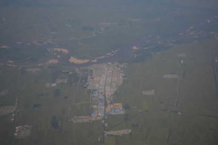
Photo adjustments
Full frame retained; proportionally resized and converted to WebP. No retouching or changes to the photographed subject. Card displays may crop the view.
- Administrative area
- County · 县
- Part of
- Jiamusi
- Chinese name
- 桦川县
- Local areas
- County guide
Area & population
- Area in the source
- 2,260.00 km²
- Population · 2010
- 202,827
Source: cited geographic source, as of the dates shown.
Setting and landscape
The land steps down in four tiers from higher ground in the south-west to low ground in the north-east. A local saying sums up the county as 'two parts mountain, half a part water and seven parts fields'. Besides the Songhua, whose bank runs for 73 kilometres along the county, there are six rivers and a reservoir, and the county counts about 390,000 mu (some 26,000 hectares) of wetland and 460,000 mu (some 30,700 hectares) of forest. Its tourism bureau describes the layout as 'mountains to the south, water to the north, the town to the east and the villages to the west'.
What to see
The county government presents Huachuan as an important cradle of Liao and Jin culture. The Wali Huotun ancient city ruins (瓦里霍吞古城遗址) are a national cultural relics protection site. The old city forms one part of the Huachuan National Forest Park (桦川国家森林公园), 7,850.9 hectares in all, where the remains connect with eight islands in the Songhua and riverside wetland; the other part, Wanjing Mountain (万景山), has forest cover above 85 percent, with oak, birch and dozens of other plants. A riverside belt along the Songhua links wetland boardwalks and viewing platforms, and spring brings migrating birds.
Huachuan is the home town of Leng Yun (冷云), one of the 'eight women who threw themselves into the river' (八女投江) of the anti-Japanese resistance. Leng Yun Square (冷云广场) on the Songhua shore commemorates her, and the county museum presents local revolutionary history. In Xinghuo Korean Ethnic Township (星火朝鲜族乡), the Xinghuo hall tells the story of what the county calls New China's first collective farm, founded in 1948. The Xinghuo Rice Village (星火稻乡) scenic area, rated national AAAA, creates designs in its paddy fields with a new theme each year, and a tower more than 40 metres high looks over the fields; its workshop lets visitors pound rice cakes and pickle Korean cabbage.
Food and local products
County publicity calls Huachuan's Xinghuo rice (星火大米) the 'white pearl' of the Sanjiang Plain. Wood-ear fungus and royal fern (薇菜) are its noted mountain products, and in summer the county has held a crayfish festival alongside an intangible-heritage food festival.
Highlights
- Wali Huotun ancient city ruins 瓦里霍吞古城遗址: National cultural relics protection site, linked to Songhua islands and wetland in the national forest park.
- Xinghuo Rice Village 星火稻乡: AAAA-rated scenic area with yearly rice-field art and a lookout tower over 40 metres high.
- Leng Yun Square 冷云广场: Songhua riverside square honouring Leng Yun, one of the eight women who threw themselves into the river.
- Xinghuo rice 星火大米: The county's rice brand, promoted as the 'white pearl' of the Sanjiang Plain.
Sources for this guide
魅力桦川 · Huachuan County People's Government
文化旅游 · Huachuan County Culture and Tourism Bureau
人文地理 · Huachuan County People's Government (county Party publicity department)
Original English written from the listed sources and checked sentence by sentence against quoted extracts by a separate reviewer. Updated 2026-09-24.
Explore Huachuan County
Core places to explore, with English and Chinese names.
Huachuan County 桦川县
Plan your visit
Getting there
Huachuan County is about 40 km in a straight line from central Jiamusi. Search for 桦川县 in a map app to find stations and your accommodation.
Where to stay →More in Jiamusi
Sources & geographic information
Administrative names and parent areas: Official geographic directory · Reference date 2026-09-06.
Map data © OpenStreetMap contributors. Pins mark approximate centres, not entrances or boundaries.