


Get to know Tangyuan County
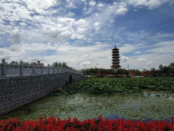
Photo adjustments
Full frame retained; proportionally resized and converted to WebP. No retouching or changes to the photographed subject. Card displays may crop the view.
- Administrative area
- County · 县
- Part of
- Jiamusi
- Chinese name
- 汤原县
- Local areas
- County guide
Area & population
- Area in the source
- 3,230.00 km²
- Population · 2010
- 255,211
Source: cited geographic source, as of the dates shown.
Setting and landscape
Tangyuan lies between the cities of Jiamusi, Hegang (鹤岗) and Yichun (伊春), and faces Huachuan (桦川) and Yilan (依兰) across the Songhua. The land falls from north-west to south-east: outliers of the Lesser Khingan curve round the north in a horseshoe of mountains rising to 847 metres, with old-growth Korean pine seed forests; the middle is rolling upland and grassland; the south is a broad river plain.
In the north-east the Heiyupao (黑鱼泡) provincial nature reserve protects 22,088 hectares of wetland on a main bird-migration route of north-east Asia and Siberia; the county records the oriental white stork and red-crowned crane there. The county gives an annual mean of 2.8°C, a recorded low of −41.1°C and about 137 frost-free days.
History
The Qing opened the Tangyuan street plan to settlers in 1905 with a Tangwang River land-reclamation bureau, and the county was formally created on 15 February 1906 under Yilan Prefecture. It then ran more than a thousand li from south-west to north-east, close to 60,000 square kilometres, said to be bigger than a prefecture. As the Great Northern Wilderness (北大荒) was settled it shrank: during the Republican period land east of the Wutong River (梧桐河) went to Luobei (萝北), Heli County (鹤立县) was carved out in 1939, Xingshan (兴山, today's Hegang) in 1947 and Yichun in 1952.
What to see
Daliangzi River National Forest Park (大亮子河国家森林公园), a national 4A scenic area of 7,175 hectares on the southern slopes of the Lesser Khingan, is built around 2,400 hectares of primitive Korean pine forest with trees 300 to 600 years old, which the county describes as one of the few such stands left in China. The park also holds Yuanhai Temple (愿海寺) and the site of the headquarters of the Sixth Army of the Northeast Anti-Japanese United Army.
The Ding Ling Memorial Hall (丁玲纪念馆), built in 2017, follows the writer Ding Ling through six sections covering 1904 to 1986, with reconstructed scenes of a literacy class and of places she lived.
Food and local products
In 2020 the county government ran a vote for Tangyuan's ten best local dishes. The winners include boiled tripe with noodles (涮肚面), pig-slaughter stew (杀猪菜), Tangyuan skewers (汤原小串), Korean-style kimchi (朝鲜族泡菜), braised goose (㸆大鹅), boiled silkworm pupae (水煮蚕蛹), iron-pot stew (铁锅炖), big steamed buns filled with wild mountain greens (山野菜大包子) and chicken stewed with mushrooms and glass noodles (蘑菇粉炖小鸡). The county also has a Tangwang Korean Ethnic Township (汤旺朝鲜族乡).
Highlights
- Daliangzi River National Forest Park 大亮子河国家森林公园: National 4A scenic area with 2,400 hectares of primitive Korean pine, trees 300 to 600 years old.
- Heiyupao Nature Reserve 黑鱼泡省级自然保护区: Provincial wetland reserve of 22,088 hectares on a bird-migration route, with oriental white storks and red-crowned cranes.
- Ding Ling Memorial Hall 丁玲纪念馆: Built in 2017; six sections on the life of the writer Ding Ling.
- Tangyuan skewers 汤原小串: One of the county's ten best dishes chosen in 2020.
Sources for this guide
历史沿革 · Tangyuan County People's Government
自然地理 · Tangyuan County People's Government
美食特产 · Tangyuan County People's Government
人口状况 · Tangyuan County People's Government
大亮子河国家级森林公园 · Tangyuan County People's Government
丁玲纪念馆 · Tangyuan County People's Government
Original English written from the listed sources and checked sentence by sentence against quoted extracts by a separate reviewer. Updated 2026-09-24.
Explore Tangyuan County
Core places to explore, with English and Chinese names.
Tangyuan County 汤原县
Plan your visit
Getting there
Tangyuan County is about 30 km in a straight line from central Jiamusi. Search for 汤原县 in a map app to find stations and your accommodation.
Where to stay →More in Jiamusi
Sources & geographic information
Administrative names and parent areas: Official geographic directory · Reference date 2026-09-06.
Map data © OpenStreetMap contributors. Pins mark approximate centres, not entrances or boundaries.