


Get to know Xiangyang District
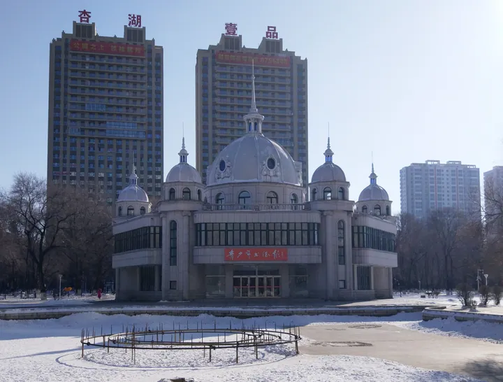
Photo adjustments
Full frame retained; proportionally resized and converted to WebP. No retouching or changes to the photographed subject. Card displays may crop the view.
- Administrative area
- District · 市辖区
- Part of
- Jiamusi
- Chinese name
- 向阳区
- Local areas
- District guide
Area & population
- Area in the source
- 38.00 km²
- Population · 2012
- 234,000
- Administrative seat
- Guangfu Road No.1081 (光复路1081号 )
Source: cited geographic source, as of the dates shown.
History
The district government calls Xiangyang the place where the town of Jiamusi began and the first part of the city to be developed. It also records that the city's first Communist Party group and branch, and the underground Jiamusi municipal Party committee, were all founded here.
What to see
Two rivers, the Wangsanwu (王三五河) and the Yinggetu (英格吐河), run 4.7 km through the district. To the south the Sifeng Mountain (四丰山) scenic area is in view, and to the north lies the Songhua. The district government names Chenxing Island, Riverside Park (沿江公园), Xingmei Park (兴梅公园), Xinglin Lake Park (杏林湖公园), Shuangyong Park (双拥公园) and Waitan Square (外滩广场) as spots that draw many visitors.
Jiamusi University (佳木斯大学) and Jiamusi No. 1 Middle School (佳木斯第一中学) are in the district, which is also home to the city's Central Hospital and the First Affiliated Hospital of Jiamusi University.
Highlights
- Chenxing Island 晨星岛: Island in the Songhua at the district's northern edge; named by the district among spots that draw many visitors.
- Xinglin Lake Park 杏林湖公园: One of the parks the district government names among spots that draw many visitors.
- Jiamusi University 佳木斯大学: University located in the district.
Sources for this guide
区情介绍 · Xiangyang District People's Government, Jiamusi
Original English written from the listed sources and checked sentence by sentence against quoted extracts by a separate reviewer. Updated 2026-09-24.
Explore Xiangyang District
Core places to explore, with English and Chinese names.
Xiangyang District 向阳区
Plan your visit
Getting there
Xiangyang District is about 4 km in a straight line from central Jiamusi. Search for 向阳区 in a map app to find stations and your accommodation.
Where to stay →More in Jiamusi
Sources & geographic information
Administrative names and parent areas: Official geographic directory · Reference date 2026-09-06.
Map data © OpenStreetMap contributors. Pins mark approximate centres, not entrances or boundaries.