


Get to know Qianjin District
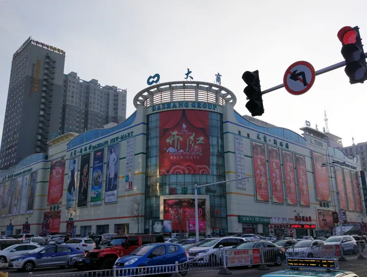
Photo adjustments
Full frame retained; proportionally resized and converted to WebP. No retouching or changes to the photographed subject. Card displays may crop the view.
- Administrative area
- District · 市辖区
- Part of
- Jiamusi
- Chinese name
- 前进区
- Local areas
- District guide
Area & population
- Area in the source
- 13.72 km²
- Population · 2020 census
- 180,893
- Administrative seat
- Yong'an Subdistrict
Source: cited geographic source, as of the dates shown.
History
The district government describes Qianjin as the seat of the Hejiang Provincial Government (合江省政府), which it calls the Communist Party's earliest provincial-level people's government, in one of the first cities taken by the Party. Later, during the reclamation of the Great Northern Wilderness (北大荒), the Northeast Land Reclamation Bureau and the headquarters of the Heilongjiang Production and Construction Corps were based here. The district's 14th Five-Year Plan lists 'Little Yan'an of the Northeast' (东北小延安) among the red-tourism assets it builds on.
What to see
The former Hejiang Provincial Government building (合江省政府旧址) stands at the junction of Baowei Road (保卫路) and Zhongshan Street. Its I-shaped plan joins a front block and a rear block by a corridor. It served the Japanese puppet Sanjiang Province from October 1934 to August 1945 and the Hejiang Provincial Government from 1945 to 1949, and was listed as a Heilongjiang provincial protected site in the sixth batch in 2014.
The former Northeast Bank (东北银行旧址) was built in 1938 as the Jiamusi branch of the puppet Central Bank. When Nationalist forces took Shenyang, the Northeast Bank's head office moved to Jiamusi, and a banknote printing works was set up in the city in May 1946. The 400-square-metre exhibition shows sample notes and coins, 335 pieces, printed by the bank and the Jiamusi works. In 1951 the bank became the Northeast office of the People's Bank of China.
Educated Youth Square (知青广场) on the Songhua, which the district also identifies as the landing place of the Soviet Red Army, was built in 2008 for the 40th anniversary of the send-down movement. Its 15-metre sail-shaped sculpture carries Mao Zedong's calligraphy 'the vast land offers great scope' (广阔天地,大有作为).
Xilin Park (西林公园) began in 1940 as a Japanese memorial park to Colonel Tōmiya Kaneo (东宫铁男). It was renamed after Sun Xilin (孙西林), who was assassinated by Nationalist agents in the mayor's office and buried here in 1946. A martyrs' tower of more than 30 metres followed in July 1949; a Soviet Red Army memorial tower of August 1945, inscribed in Russian and Chinese, stands beside steles carrying the names of 35 Soviet soldiers.
Getting oriented
Heping Subdistrict (和平街道) in the middle of the district contains Jiamusi railway station and the passenger bus station, and Yong'an Subdistrict (永安街道), which reaches north to Yanjiang Road (沿江路), contains the Jiamusi Museum (佳木斯市博物馆).
Highlights
- Former Hejiang Provincial Government 合江省政府旧址: I-shaped building used by Sanjiang Province (1934–1945) and Hejiang Province (1945–1949); provincial protected site since 2014.
- Former Northeast Bank 东北银行旧址: 1938 bank building with an exhibition of 335 sample notes and coins from the liberation-war era.
- Educated Youth Square 知青广场: Riverside square built in 2008 with a 15-metre sculpture; also the Soviet Red Army landing place.
- Xilin Park 西林公园: Park with the 1949 martyrs' tower and the 1945 Soviet Red Army memorial tower.
Sources for this guide
前进概况 · Qianjin District People's Government, Jiamusi
Original English written from the listed sources and checked sentence by sentence against quoted extracts by a separate reviewer. Updated 2026-09-24.
Explore Qianjin District
Core places to explore, with English and Chinese names.
Qianjin District 前进区
Plan your visit
Getting there
Qianjin District is about 4 km in a straight line from central Jiamusi. Search for 前进区 in a map app to find stations and your accommodation.
Where to stay →More in Jiamusi
Sources & geographic information
Administrative names and parent areas: Official geographic directory · Reference date 2026-09-06.
Map data © OpenStreetMap contributors. Pins mark approximate centres, not entrances or boundaries.