


Get to know Fularji District
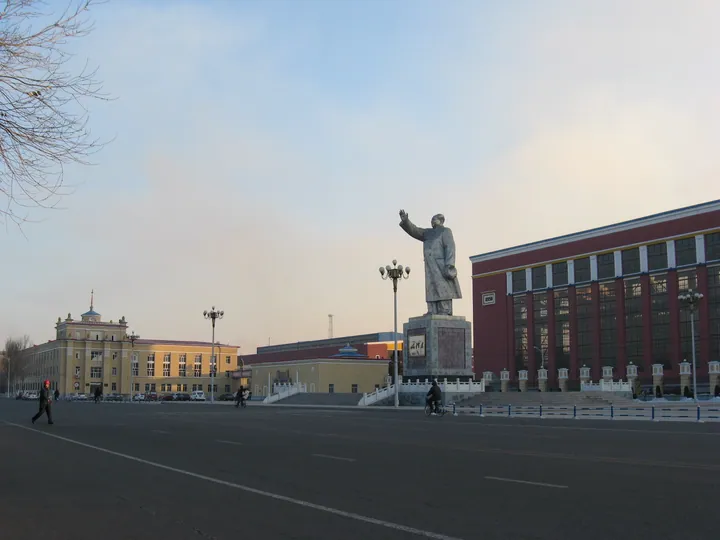
Photo adjustments
Full frame retained; proportionally resized and converted to WebP. No retouching or changes to the photographed subject. Card displays may crop the view.
- Administrative area
- District · 市辖区
- Part of
- Qiqihar
- Chinese name
- 富拉尔基区
- Local areas
- District guide
Area & population
- Area in the source
- 375.00 km²
- Population · 2003
- 270,000
Source: cited geographic source, as of the dates shown.
Setting and landscape
The district sits on the Nen River plain at an average height of 146 metres. The Nen runs along the east of the town, the Kule River (库勒河) flows past its west side into the Nen, and the Ergou River (二沟河) flows through its north into the Nen. The built-up area is long and narrow, 4.5 kilometres east to west and 12.7 kilometres north to south. January averages −16.8°C and July 24.1°C. A complete fossil skeleton of a woolly rhinoceros was dug up on the west bank of the Nen in the town, and it is now in the Heilongjiang Provincial Museum.
History
A settlement formed here in the early Qing. Fularji station on the Chinese Eastern Railway (中东铁路) was built in 1902, and the town grew around it. In 1946 the Longjiang County (龙江县) government moved here, and in October 1954 the area passed to Qiqihar as a city district.
The district government says Fularji was built on its factories and grew with them. Three of the 156 key projects of the first Five-Year Plan were built here: China First Heavy Industries (中国一重), the Beiman special steel works (北满特钢) and a thermal power plant, and the government calls the district a "cradle" of the People's Republic's industry. In 1958 Harbin Institute of Technology set up a heavy-machinery college here; in 1997 its main campus moved to Qinhuangdao and it was renamed Yanshan University (燕山大学).
Food and local products
Fularji warm-water rice (富拉尔基温水大米) is a Chinese geographical-indication product. Local natural waters yield river shrimp, catfish, pike, carp and crucian carp.
Getting oriented
The Binzhou railway (滨洲铁路) crosses the district from east to west. Neighbours are Ang'angxi District (昂昂溪区) to the east, Longjiang County to the west, Tailai County (泰来县) to the south and Meilisi Daur District (梅里斯达斡尔族区) to the north. Qiqihar Sanjiazi Airport is 23 kilometres away.
Highlights
- Fularji warm-water rice 富拉尔基温水大米: Chinese geographical-indication product.
- China First Heavy Industries 中国一重: One of three first Five-Year Plan key projects built in Fularji.
Sources for this guide
富拉尔基区情简介 — 富拉尔基区人民政府 · Fularji District People's Government, Qiqihar
富拉尔基地理与气候 — 富拉尔基区人民政府 · Fularji District People's Government, Qiqihar
富拉尔基区 — 维基百科 · Wikipedia (Chinese) · CC BY-SA 4.0
Original English written from the listed sources and checked sentence by sentence against quoted extracts by a separate reviewer. Updated 2026-09-24.
Explore Fularji District
Core places to explore, with English and Chinese names.
Fularji District 富拉尔基区
Plan your visit
Getting there
Fularji District is about 25 km in a straight line from central Qiqihar. Search for 富拉尔基区 in a map app to find stations and your accommodation.
Where to stay →More in Qiqihar
Sources & geographic information
Administrative names and parent areas: Official geographic directory · Reference date 2026-09-06.
Some facts checked against 富拉尔基区 — Wikipedia contributors, CC BY-SA 4.0.
Map data © OpenStreetMap contributors. Pins mark approximate centres, not entrances or boundaries.