


Get to know Nianzishan District
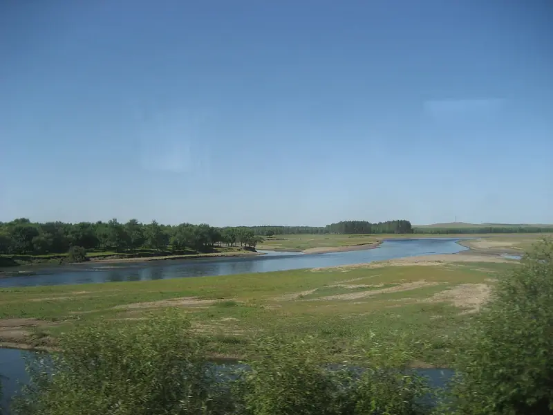
Photo adjustments
Full frame retained; EXIF orientation normalized, proportionally resized to at most 800 pixels and converted to WebP. No generated pixels or subject changes. Cards may crop the display.
- Administrative area
- District · 市辖区
- Part of
- Qiqihar
- Chinese name
- 碾子山区
- Local areas
- District guide
Area & population
- Area in the source
- 290.00 km²
- Population · 2010
- 72,151
Source: cited geographic source, as of the dates shown.
Setting and landscape
Longjiang County surrounds the district on the east, south and west; Gannan County (甘南县) lies to the northeast and Zalantun (扎兰屯) in Inner Mongolia to the northwest. By rail the city centre is 113 kilometres away. The hills are mainly Hercynian granite with Yanshanian granite porphyry, and the land is low mountain and rolling hill country with more than 170 hills. The low mountain Dahei Mountain (大黑山) is known as the first peak of Hecheng (鹤城), the 'Crane City'.
The Yalu River (雅鲁河) runs about 35 kilometres through the district from northwest to southeast, and the man-made Qiyi Canal (七一运河) crosses the urban area from west to east. The district government notes that Nianzishan is the only one of Qiqihar's seven districts set between hills and water.
History
A settlement formed here in 1897 and first appeared on Longjiang County maps in 1913. After 1946 it was a district of Longjiang County, then a town from 1952; it passed to Qiqihar in 1960 as Hua'an District (华安区) and took the name Nianzishan District in 1983. Stone tools from Shedong Mountain (蛇洞山), a Palaeolithic site, were identified by the archaeologist Jia Lanpo (贾兰坡). A local legend says the Blue Dragon and the White Tiger fought each other here and were then made gods of the stone roller and the millstone, which, the story goes, is why farmers never keep the two together.
What to see
The Yalu River National Wetland Park (雅鲁河国家湿地公园) has a campsite with the Shedong Mountain and Dahei Mountain scenic areas behind it, and a camping festival held at the campsite on 5 August 2017 included rafting among its activities. In Century Square (世纪广场) stands the Century Tripod (世纪宝鼎), a granite vessel 5 metres tall and 4.5 metres across, completed in June 2002.
Food and local products
Quarrying and stone-working are the district's mainstay industry. Stonemasons from Shandong, Hebei, Liaoning and Inner Mongolia arrived in 1881, and the district works granite into hundreds of products. Maifan stone (麦饭石) occurs at Erdaogou village (二道沟村) and is made into tea sets, wine vessels and bottled mineral water; in 2001 the district was named China's home of maifan stone. The brewing technique of Beiguosong liquor (北国颂酒) is on the district's first intangible heritage list.
Highlights
- Dahei Mountain 大黑山: Low mountain known as the first peak of Hecheng, the 'Crane City'.
- Shedong Mountain 蛇洞山: Palaeolithic site whose stone tools were identified by Jia Lanpo.
- Yalu River National Wetland Park 雅鲁河国家湿地公园: Riverside campsite that hosted a camping festival with rafting in August 2017.
- Century Tripod 世纪宝鼎: Granite tripod 5 metres tall in Century Square, completed in 2002.
- Maifan stone 麦饭石: Mineral worked into tea sets and mineral water; China's home of maifan stone since 2001.
Sources for this guide
走进山城_ 碾子山区人民政府 · Nianzishan District People's Government, Qiqihar
地理位置_碾子山区人民政府 · Nianzishan District People's Government, Qiqihar
地质地貌_碾子山区人民政府 · Nianzishan District People's Government, Qiqihar
山城传说_碾子山区人民政府 · Nianzishan District People's Government, Qiqihar
山城特产_碾子山区人民政府 · Nianzishan District People's Government, Qiqihar
碾子山区第一批区级非物质文化遗产代表性项目公布政策解读 · Nianzishan District People's Government, Qiqihar
齐齐哈尔碾子山举办山地露营大会-国际在线 · China Radio International (CRI Online), carrying a Northeast Net report
Original English written from the listed sources and checked sentence by sentence against quoted extracts by a separate reviewer. Updated 2026-09-24.
Explore Nianzishan District
Core places to explore, with English and Chinese names.
Places to explore around Nianzishan District
 Nianzishan Mountain Scenic Area ·
 Plan your visit
Getting there
Nianzishan District is about 80 km in a straight line from central Qiqihar. Search for 碾子山区 in a map app to find stations and your accommodation.
Where to stay →Build your route
Start with Nianzishan Mountain Scenic Area. The linked place guides have entrance and visit details.
Continue with Qiqihar →More in Qiqihar
Sources & geographic information
Administrative names and parent areas: Official geographic directory · Reference date 2026-09-06.
Photo: Nianzishan Mountain Scenic Area · Source photographer · License not provided. EXIF orientation normalized; resized without changing aspect ratio; converted to WebP. No subject edits.
Map data © OpenStreetMap contributors. Pins mark approximate centres, not entrances or boundaries.