


Get to know Longjiang County
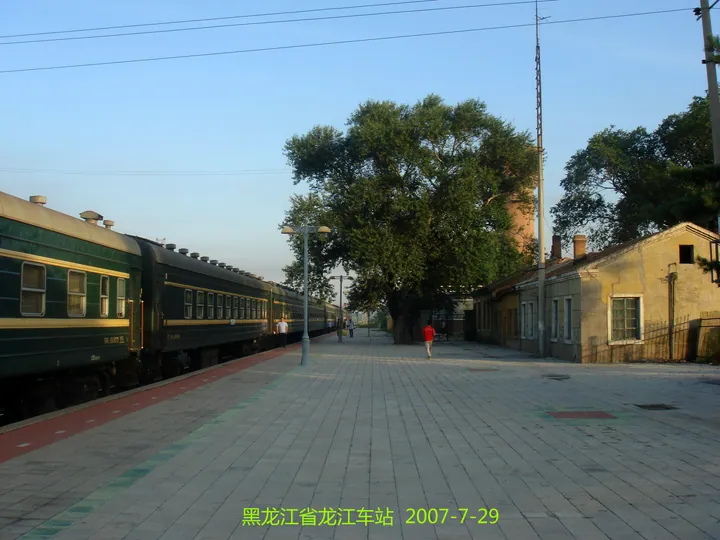
Photo adjustments
Full frame retained; proportionally resized and converted to WebP. No retouching or changes to the photographed subject. Card displays may crop the view.
- Administrative area
- County · 县
- Part of
- Qiqihar
- Chinese name
- 龙江县
- Local areas
- County guide
Area & population
- Area in the source
- 6,197.00 km²
- Population · 2018
- 580,847
Source: cited geographic source, as of the dates shown.
Setting and landscape
Mountains, hills and plains interlock across the county's 6,175 square kilometres, a pattern known as 'three mountains, three ridges and four plains'. The county government counts one major river and eleven smaller ones. The climate is mid-temperate continental monsoon: windy, dry springs, short warm summers that bring the rain, quick-changing autumns prone to early frost, and long, cold, dry winters. The coldest month averages -16.9°C and the warmest 22.9°C, and the frost-free season lasts 148 days.
History
People lived here by the late Palaeolithic. Under the Qing the east and north of today's county belonged to the Heilongjiang General and the Qiqihar deputy lieutenant-general, while land south of the Yalu River (雅鲁河) and Jiqin River (济沁河) was under the Khorchin Jirim League (科尔沁哲里木盟). The Heishui sub-prefecture (黑水厅) set up at Qiqihar in 1905 became Longjiang prefecture (龙江府), and in 1913 Longjiang County.
Chinese Wikipedia records that the city of Qiqihar itself was split off from Longjiang County in 1936. The county seat moved to Fularji (富拉尔基) in 1946 and to Zhujiakan (朱家坎镇) in 1955; Zhujiakan was renamed Longjiang Town (龙江镇) in 1958. It also lists Zhai Zhigang (翟志刚), China's first astronaut to walk in space, among the county's people.
What to see
The county government names four sights: the Halahai Wetland (哈拉海湿地), which it calls the most primitive in Northeast Asia; Chaoyang Mountain (朝阳山), the highest peak in Qiqihar; the Shuanglongshan Cave (双龙山溶洞), a karst cave; and Zhang Mansion (张公馆), a typical Republican-era building of the Northeast.
Food and local products
Maize, rice, potatoes and a range of minor grains and beans are the main crops. The county is a production base for Northeast fine-wool sheep, and farms also keep dairy cows, beef cattle, sheep, pigs and poultry.
Getting oriented
The Binzhou railway (滨洲铁路) crosses the county, and its roads join the Beijing–Jiagedaqi national highway (京加公路) and the Suiman expressway (绥满高速), linking it with Harbin, Qiqihar, Daqing, Ulanhot, Hulunbuir and Manzhouli.
Highlights
- Halahai Wetland 哈拉海湿地: Described by the county government as the most primitive wetland in Northeast Asia.
- Chaoyang Mountain 朝阳山: The highest peak in Qiqihar, according to the county government.
- Shuanglongshan Cave 双龙山溶洞: A karst cave.
- Zhang Mansion 张公馆: A typical Republican-era building of Northeast China.
Sources for this guide
龙江概况 (Longjiang overview) · Longjiang County People's Government
走进龙江 (About Longjiang) · Longjiang County People's Government
龙江县 · Wikipedia (Chinese) · CC BY-SA 4.0
Original English written from the listed sources and checked sentence by sentence against quoted extracts by a separate reviewer. Updated 2026-09-24.
Explore Longjiang County
Core places to explore, with English and Chinese names.
Longjiang County 龙江县
Plan your visit
Getting there
Longjiang County is about 55 km in a straight line from central Qiqihar. Search for 龙江县 in a map app to find stations and your accommodation.
Where to stay →More in Qiqihar
Sources & geographic information
Administrative names and parent areas: Official geographic directory · Reference date 2026-09-06.
Some facts checked against 龙江县 — Wikipedia contributors, CC BY-SA 4.0.
Map data © OpenStreetMap contributors. Pins mark approximate centres, not entrances or boundaries.