


Get to know Jinlin District

- Administrative area
- District · 市辖区
- Part of
- Yichun
- Chinese name
- 金林区
- Local areas
- District guide
Area & population
- Area in the source
- 2,307.00 km²
- Population · 2010
- 91,959
Source: cited geographic source, as of the dates shown.
What to see
Jinshan Deer Park (金山鹿苑), a 3A scenic area at kilometre 75 of the Hegang–Yichun road (鹤伊公路), keeps sika and red deer, combining hand-rearing with open grazing, and also breeds deer and processes deer products. The district government notes that it was a main filming location for the Yichun promotional film "Green Yichun" (绿色伊春).
The Jiufengshan Yangxin Valley (九峰山养心谷) scenic area, rated 4A in 2016, covers 5,280 hectares and is run as a forest-wellness and summer-retreat area, with 6 km of mountain boardwalk, 7 km of forest paths, a bamboo-raft route and a waterfall. Jinmi Cave (金秘洞) is described by the district government as the first cave-themed attraction in the Lesser Khingan region: 3,500 square metres are open in seven chambers and a corridor, the cave stays at about 6°C all year, and natural ice stalagmites form in winter. A hall inside presents the life of the Jin-dynasty Jurchen ancestors, who, the district government says, used the cave as a stopping place on their hunting migrations.
History
Jinzu Peak (金祖峰), formerly called Daxishan (大西山), rises to 568 metres and is the highest point in Jinshantun town. It takes its name from a Jin-dynasty Jurchen garrison office that the district government says was set up on the mountain. The scenic area, rated 3A in 2017, presents late-Neolithic and Jin history, mainly Buddhist religious culture, the story of the Anti-Japanese United Army (抗联) and the history of the forestry workers. It is climbed for sunrise and for the autumn "five-flower" colours, and in 2024 the China Meteorological Service Association recognised its sea of clouds as a weather and climate landscape viewing site.
Highlights
- Jinshan Deer Park 金山鹿苑: 3A scenic area where sika and red deer are raised by part-grazing.
- Jiufengshan Yangxin Valley 九峰山养心谷: 4A forest wellness area since 2016, with 6 km of mountain boardwalk.
- Jinmi Cave 金秘洞: Cave attraction held at about 6°C all year, with ice stalagmites in winter.
- Jinzu Peak 金祖峰: 568-metre highest point of Jinshantun town, named after a Jin-dynasty Jurchen garrison.
Sources for this guide
金林区 - 维基百科,自由的百科全书 · Chinese Wikipedia · CC BY-SA 4.0
金山鹿苑_景区介绍_ · Jinlin District People's Government, Yichun
九峰山养心谷景区_景区介绍_ · Jinlin District People's Government, Yichun
金秘洞_景区介绍_ 金林区人民政府 · Jinlin District People's Government, Yichun
金祖峰景区_景区介绍_ · Jinlin District People's Government, Yichun
Original English written from the listed sources and checked sentence by sentence against quoted extracts by a separate reviewer. Updated 2026-09-24.
Explore Jinlin District
Core places to explore, with English and Chinese names.
Places to explore around Jinlin District
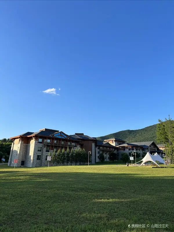 Jinshan Deer Park ·
 Plan your visit
Getting there
Jinlin District is about 55 km in a straight line from central Yichun. Search for 金林区 in a map app to find stations and your accommodation.
Where to stay →Build your route
Start with Jinshan Deer Park. The linked place guides have entrance and visit details.
Continue with Yichun →More in Yichun
Sources & geographic information
Administrative names and parent areas: Official geographic directory · Reference date 2026-09-06.
Some facts checked against 金林区 — Wikipedia contributors, CC BY-SA 4.0.
Photo: Jinshan Deer Park · Source photographer · License not provided. EXIF orientation normalized; resized without changing aspect ratio; converted to WebP. No subject edits.
Map data © OpenStreetMap contributors. Pins mark approximate centres, not entrances or boundaries.