


Get to know Wucui District
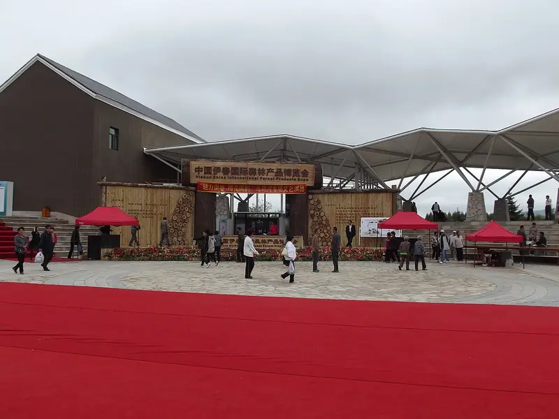
Photo adjustments
Full frame retained; EXIF orientation normalized, proportionally resized to at most 800 pixels and converted to WebP. No generated pixels or subject changes. Cards may crop the display.
- Administrative area
- District · 市辖区
- Part of
- Yichun
- Chinese name
- 乌翠区
- Local areas
- District guide
Area & population
- Area in the source
- 2,814.00 km²
- Population · 2010
- 76,376
Source: cited geographic source, as of the dates shown.
History
The two halves of the name come from the old districts: Wumahe was named after the Wuma River (乌马河) that runs through it, and Cuiluan took the name of its seat, which the district government explains by the dense forest and green hills that once covered it. After the Japanese occupation of the Northeast began, hunters and gatherers of wild fruit and medicinal herbs entered these hills and called the area "Yisong Dianzi" (伊松甸子). In 1942 a railway was built from Nancha (南岔) to Yisong Dianzi, and the station added the next year was named Cuiluan Station.
Forestry shaped the modern district. A Cuiluan log-driving station was set up in April 1948 and a forestry office in June 1949, and in July 1953 it became the Cuiluan Forest Industry Bureau. In August 1964 the district government and the Cuiluan Forestry Bureau were merged into a single body combining local government and the forestry enterprise. On 29 June 2019 the State Council approved abolishing Cuiluan District and creating Wucui District in its place.
Setting and landscape
The Yichun River (伊春河), called the Jianshan River (尖山河) in its upper course, rises on the eastern slope of Height 601 on the border between western Wucui and Suiling County (绥棱县). It flows east into the Xing'anhu Reservoir (兴安湖水库, also called the Xishan Reservoir), then through the urban areas of Wucui and Yimei before joining the Tangwang River (汤旺河). Its middle and upper reaches run between high, densely forested hills. The former Cuiluan District measured about 40 km east to west and 64 km north to south, with its seat 16 km from Yichun city.
What to see
The district government's tourism gallery presents Wucui by season: winter hot springs at the Xiling Forest Eco-tourism Resort (西岭森林生态旅游度假区), autumn red leaves at Qixiufeng Forest Park (奇秀峰森林公园), and summer views of the Xing'anhu Reservoir. It also features the exhibition hall of the Yongda woodcraft study base (永达木艺研学基地).
Highlights
- Xiling Forest Eco-tourism Resort 西岭森林生态旅游度假区: Shown by the district government for its winter hot springs.
- Qixiufeng Forest Park 奇秀峰森林公园: Shown by the district government for autumn red leaves.
- Xing'anhu Reservoir 兴安湖水库: Reservoir on the Yichun River upstream of the urban area.
Sources for this guide
走进乌翠区_乌翠区人民政府 · Wucui District People's Government, Yichun
历史沿革_乌翠区人民政府 · Wucui District People's Government, Yichun
地理气候_乌翠区人民政府 · Wucui District People's Government, Yichun
乌翠区 - 维基百科,自由的百科全书 · Wikipedia (Chinese) · CC BY-SA 4.0
伊春河 - 维基百科,自由的百科全书 · Wikipedia (Chinese) · CC BY-SA 4.0
Original English written from the listed sources and checked sentence by sentence against quoted extracts by a separate reviewer. Updated 2026-09-30.
Explore Wucui District
Core places to explore, with English and Chinese names.
Wucui District 乌翠区
Plan your visit
Getting there
Wucui District is about 15 km in a straight line from central Yichun. Search for 乌翠区 in a map app to find stations and your accommodation.
Where to stay →More in Yichun
Sources & geographic information
Administrative names and parent areas: Official geographic directory · Reference date 2026-09-06.
Some facts checked against 乌翠区 — Wikipedia contributors, CC BY-SA 4.0.
Some facts checked against 伊春河 — Wikipedia contributors, CC BY-SA 4.0.
Map data © OpenStreetMap contributors. Pins mark approximate centres, not entrances or boundaries.