


Get to know Biyang County
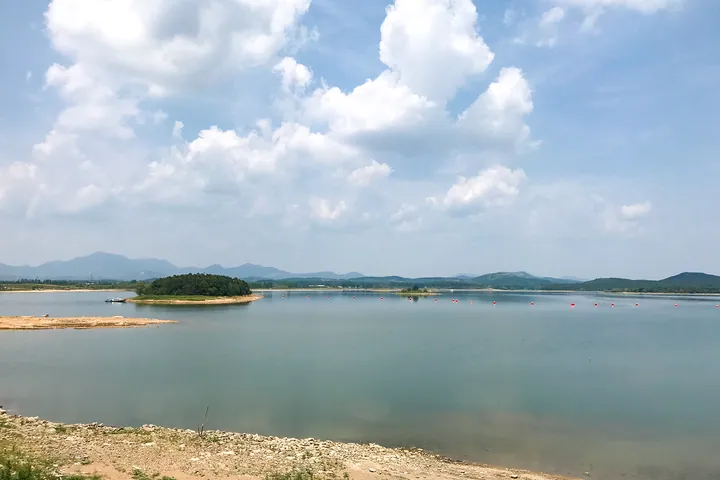
Photo adjustments
Full frame retained; proportionally resized and converted to WebP. No retouching or changes to the photographed subject. Card displays may crop the view.
- Administrative area
- County · 县
- Part of
- Zhumadian
- Chinese name
- 泌阳县
- Local areas
- County guide
Area & population
- Population · 2019
- 675,500
Source: cited geographic source, as of the dates shown.
Setting and landscape
The county sits on the eastern side of the Nanyang Basin (南阳盆地), on the Qinling–Huaihe line. Mountains cover 43 per cent of the land, hills 41 per cent and plains 16 per cent. Baimaodu (白茅堵), the main peak of Baiyun Mountain (白云山), rises to 983 metres, the highest point in Zhumadian. The county seat stands north of the Biyang River (泌阳河), which gives the county its name.
History
Of eight ancient sites excavated in the county, three are Palaeolithic and five belong to the Neolithic Longshan culture. Known in antiquity as Biyang (比阳), the area belonged to Chu in the Spring and Autumn period; the present name was fixed in 1380. The county government lists rock art, Northern Wei cave carvings, a stretch of the Chu Great Wall and the Xiahe (下河) ancient iron-smelting site. In August 1975 the Banqiao Reservoir (板桥水库), then in Biyang, burst after extreme rain, and about 30 counties and cities were flooded.
What to see
The Tongshan Scenic Area (铜山风景名胜区), approved as a provincial scenic area in 1994, covers 132 square kilometres in three parts: Tongshan (铜山) itself, Tongshan Lake (铜山湖) and Yunwu Peak (云雾峰). It is a national AAA scenic area and national forest park.
Pangu Mountain (盘古山), in Chenzhuang township (陈庄乡) some 25 li south of the county seat, is presented by the county government as the place where Pangu (盘古) and his consort gave rise to humankind. Its 459-metre summit carries three temples, the main hall holding a seated Pangu dressed in oak leaves, and a temple fair gathers there on the third day of the third lunar month. In December 2005 the China Folk Literature and Art Association named Biyang the Pangu Holy Land of China. Henan's provincial heritage list here includes the Pozishan cliff carvings (婆子山摩崖造像) and the tomb of the Ming grand secretary Jiao Fang (焦芳墓).
Food and local products
Biyang has a long tradition of growing shiitake, and Biyang flower mushrooms (泌阳花菇) are a Chinese geographical indication product. The county is also where Xianan cattle (夏南牛), which the county government calls China's first beef cattle breed, were developed. Other local products include the Biyang donkey, Maogutian (马谷田) pears and Yangce (羊册) cabbage.
Getting oriented
The county government puts Biyang about 100 kilometres from each of Zhumadian, Nanyang (南阳), Xinyang (信阳), Pingdingshan (平顶山) and Suizhou (随州). No railway runs through the county today; a narrow-gauge line to Minggang (明港), opened in 1986, has been abandoned.
Highlights
- Tongshan Scenic Area 铜山风景名胜区: 132 sq km of mountain, lake and forest in three parts; provincial scenic area since 1994 and national AAA scenic area.
- Pangu Mountain 盘古山: 459 m peak with three temples to Pangu and a fair on the 3rd day of the 3rd lunar month.
- Baiyun Mountain 白云山: Its peak Baimaodu, 983 m, is the highest point in Zhumadian.
- Biyang flower mushrooms 泌阳花菇: Shiitake with Chinese geographical indication status.
Sources for this guide
泌阳县 - 维基百科,自由的百科全书 · Wikipedia (Chinese) · CC BY-SA 4.0
泌阳县概况_泌阳县人民政府 · Biyang County People's Government
铜山风景名胜区_泌阳县人民政府 · Biyang County People's Government
盘古山_泌阳县人民政府 · Biyang County People's Government
Original English written from the listed sources and checked sentence by sentence against quoted extracts by a separate reviewer. Updated 2026-09-24.
Explore Biyang County
Core places to explore, with English and Chinese names.
Places to explore around Biyang County
 AI illustration · AI
 Plan your visit
Getting there
Biyang County is about 70 km in a straight line from central Zhumadian. Search for 泌阳县 in a map app to find stations and your accommodation.
Where to stay →Build your route
Start with Mount Tong. The linked place guides have entrance and visit details.
Continue with Zhumadian →More in Zhumadian
Sources & geographic information
Administrative names and parent areas: Official geographic directory · Reference date 2026-09-06.
Some facts checked against 泌阳县 — Wikipedia contributors, CC BY-SA 4.0.
Map data © OpenStreetMap contributors. Pins mark approximate centres, not entrances or boundaries.