


Get to know Zhengyang County
- Administrative area
- County · 县
- Part of
- Zhumadian
- Chinese name
- 正阳县
- Local areas
- County guide
Area & population
- Area in the source
- 1,904.00 km²
- Population · 2019
- 623,800
Source: cited geographic source, as of the dates shown.
Setting and landscape
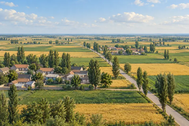
The land is flat, sloping gently from the north-west, where the Songdian ridge (宋店岗) reaches 102 metres, to 37 metres in the east of Runanbu town (汝南埠镇). The Huai runs 45 kilometres through the county and the Ru about 75 kilometres, mostly along its old course. Zhengyang sits in the transition between the subtropical and warm-temperate zones, and paddy soils are found south of the Qingshui River (清水河).
History
The county government regards Zhengyang as the place where the Jiang (江) surname began: the capital of the ancient Jiang state (江国) is placed at Tudian village (涂店村) in Dalin town (大林镇), a site 2 kilometres long where pottery of the Shang and Zhou has been found. The county was created in 118 BC as Shenyang (慎阳), named for its position north of the Shen River (慎水). Under the Liu Song dynasty it became Zhenyang (真阳), and in 1723 the character "zhen" was changed to "zheng" (正) to avoid the personal name of the Yongzheng Emperor.
In August 1947 the Liu–Deng army (刘邓大军) reached the Ru River here on its march to the Dabie Mountains (大别山). Blocked ahead, pursued from behind, bombed from the air and facing the fast-flowing river, the army was rallied by commander Liu Bocheng (刘伯承) with the slogan "when enemies meet on a narrow road, the brave one wins". After two days and nights of fighting it won the battle of Leigang (雷岗) and crossed.
What to see
Two sites are on the national list. The Eastern Han Zhengyang stone gate towers (正阳石阙), tomb pillars known locally as the "homeward-gazing terrace", stand in the martyrs' cemetery at the east gate of the county town; only the subsidiary tower survives. The Shang dynasty Runlou site (闰楼遗址) lies on two ridges 14 kilometres north-east of the county town. The Memorial to the Liu–Deng Army's Crossing of the Ru River (刘邓大军强渡汝河纪念馆) opened on 1 July 2021 and is a 3A scenic area.
Food and local products
The county government puts its traditional peanut area at more than 1.6 million mu, 80 per cent of the farmland, on heavy Shajiang black soil. Local dishes include Xiyandian steamed chicken (西严店蒸鸡), peanut-braised pig's trotters (花生炆猪手), cured ribs from Dalin (大林腊排) and Runanbu guokui flatbread (汝南埠锅盔馍). Wangwuqiao vinegar (王勿桥醋), whose handmade brewing was added to Henan's intangible heritage list in December 2011, is tied by local legend to Liu Xiu (刘秀), who passed Wangwuqiao while fleeing Wang Mang (王莽) at the start of the Eastern Han.
Highlights
- Zhengyang stone gate towers 正阳石阙: Eastern Han tomb pillars on the national protected list, in the east-gate martyrs' cemetery.
- Runlou site 闰楼遗址: Shang dynasty site on the national list, 14 km north-east of the county town.
- Liu–Deng Army Ru River Crossing Memorial 刘邓大军强渡汝河纪念馆: Opened 1 July 2021, recalling the August 1947 crossing and the battle of Leigang.
- Wangwuqiao vinegar 王勿桥醋: Handmade vinegar brewing on Henan's intangible heritage list since 2011.
Sources for this guide
正阳概况_正阳县人民政府 · Zhengyang County People's Government
Original English written from the listed sources and checked sentence by sentence against quoted extracts by a separate reviewer. Updated 2026-09-24.
Explore Zhengyang County
Core places to explore, with English and Chinese names.
Zhengyang County 正阳县
Plan your visit
Getting there
Zhengyang County is about 55 km in a straight line from central Zhumadian. Search for 正阳县 in a map app to find stations and your accommodation.
Where to stay →More in Zhumadian
Sources & geographic information
Administrative names and parent areas: Official geographic directory · Reference date 2026-09-06.
Map data © OpenStreetMap contributors. Pins mark approximate centres, not entrances or boundaries.