


Get to know Pingyu County
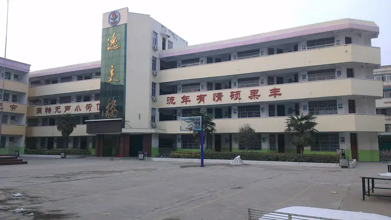
Photo adjustments
EXIF orientation normalized; resized without changing aspect ratio; converted to WebP. No subject edits.
- Administrative area
- County · 县
- Part of
- Zhumadian
- Chinese name
- 平舆县
- Local areas
- County guide
Area & population
- Area in the source
- 1,285.00 km²
- Population · 2019
- 714,100
Source: cited geographic source, as of the dates shown.
Setting and landscape
The county is on the Huaibei Plain, 39 to 47 metres above sea level, tilting very gently from northwest to southeast. The Hong River (洪河) crosses the north and the Ru River (汝河) the south, both in the Huai River system. According to the county government, 71 per cent of the soil is lime-concretion black soil (砂姜黑土).
History
In the Xia and Shang the area was the land of Zhi (挚), and under the Zhou it was the state of Shen (沈国). Qin made it a county with its seat at the old town site in present-day Sheqiao (射桥镇). The Yuan abolished the county and folded it into Ruyang (汝阳县), later renamed Runan; Pingyu was re-established only in April 1951. The county counts itself the ancestral home of the Shen and Zhou surnames. The county government also names it the home of Xi Zhong (奚仲), credited with inventing the cart, and of Tairen (太任), mother of King Wen of Zhou. The Eastern Han statesman Chen Fan (陈蕃), grand tutor under Emperor Ling, was a Pingyu man; he was killed after a failed plot against the court eunuchs.
What to see
Two national key cultural relics protection sites are in the county: the ancient city of the Shen state (沈国故城), dating from the Spring and Autumn period to the Han, and the Jin-dynasty stupa of the precept master Xiugong (秀公戒师和尚塔). Chen Fan's tomb survives on the northern edge of the county town, where the county has built Chen Fan Park and an exhibition hall on his record as an honest official. The Taizisi site (台子寺遗址) and the Ancheng ancient city ruins (安城故城遗址) are Henan provincial heritage sites.
Food and local products
Pingyu white sesame (平舆白芝麻) has been a Chinese geographical indication product since 2003. The seeds are thin-skinned and white, hold 52 to 55 per cent oil, and are the raw material for stone-ground sesame oil as well as being eaten whole or used in sweets and pastries. The county gazetteer describes sesame stalks piled up in courtyards in the late Ming and early Qing, when Yangbu (杨埠镇) became a sesame trading market and the Qing government placed an inspectorate there.
Getting oriented
The county government puts Pingyu 50 kilometres east of the Beijing–Guangzhou high-speed railway and the Beijing–Hong Kong–Macau expressway, and 80 kilometres west of the Beijing–Kowloon railway. National highways 328 and 106 cross the county, and the Daqing–Guangzhou expressway meets two others there.
Highlights
- Ancient city of the Shen state 沈国故城: National key site; remains from the Spring and Autumn period to the Han.
- Stupa of precept master Xiugong 秀公戒师和尚塔: Jin-dynasty stupa listed as a national key site.
- Tomb of Chen Fan 陈蕃墓: Eastern Han grand tutor's tomb on the northern edge of the county town, with a memorial park and exhibition hall.
- Pingyu white sesame 平舆白芝麻: Geographical indication since 2003; thin-skinned white seeds with 52-55% oil.
Sources for this guide
平舆县 - 维基百科,自由的百科全书 · Wikipedia (Chinese) · CC BY-SA 4.0
平舆概况_平舆县人民政府 · Pingyu County People's Government
奚仲造车_平舆县人民政府 · Pingyu County People's Government
平舆白芝麻_平舆县人民政府 · Pingyu County People's Government
平舆县各级文物保护单位列表 - 维基百科,自由的百科全书 · Wikipedia (Chinese) · CC BY-SA 4.0
东汉太傅陈蕃_平舆县人民政府 · Pingyu County People's Government
Original English written from the listed sources and checked sentence by sentence against quoted extracts by a separate reviewer. Updated 2026-09-24.
Explore Pingyu County
Core places to explore, with English and Chinese names.
Pingyu County 平舆县
Plan your visit
Getting there
Pingyu County is about 55 km in a straight line from central Zhumadian. Search for 平舆县 in a map app to find stations and your accommodation.
Where to stay →More in Zhumadian
Sources & geographic information
Administrative names and parent areas: Official geographic directory · Reference date 2026-09-06.
Some facts checked against 平舆县 — Wikipedia contributors, CC BY-SA 4.0.
Some facts checked against 平舆县各级文物保护单位列表 — Wikipedia contributors, CC BY-SA 4.0.
Map data © OpenStreetMap contributors. Pins mark approximate centres, not entrances or boundaries.