


Get to know Runan County
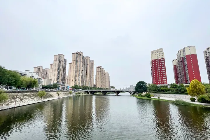
Photo adjustments
Full frame retained; proportionally resized and converted to WebP. No retouching or changes to the photographed subject. Card displays may crop the view.
- Administrative area
- County · 县
- Part of
- Zhumadian
- Chinese name
- 汝南县
- Local areas
- County guide
Area & population
- Area in the source
- 1,306.00 km²
- Population · 2019
- 655,300
Source: cited geographic source, as of the dates shown.
Setting and landscape
The county borders Pingyu (平舆县) to the east, Queshan (确山县), Yicheng District (驿城区) and Suiping (遂平县) to the west and Shangcai (上蔡县) to the north, and faces Zhengyang (正阳县) across a river to the south. The county government explains that most of its land lies on the north bank of the Ru, which is why the county was once called Ruyang (汝阳县). West of the county town lies Suya Lake Reservoir (宿鸭湖水库), begun in 1958 and covering 239 square kilometres; it held through the great flood of August 1975 because it had been reinforced and emptied beforehand.
History
The county government dates a Han commandery named Runan to 203 BC. In 416 the commandery seat moved to Xuanhu, and under the Yuan in 1293 Caizhou (蔡州) became Runing Prefecture (汝宁府), governed from Xuanhu. In 817 Li Su (李愬) entered Caizhou on a snowy night and put down Wu Yuanji (吴元济), and in 1234 Emperor Aizong of Jin (金哀宗), who had fled to Caizhou from the Mongols, hanged himself there and the Jin dynasty fell. The prefecture was abolished in 1913, when Ruyang was renamed Runan. Henan named it a historic and cultural city in 1989.
What to see
National key heritage sites in the county include the Ming-dynasty Wuying Pagoda (悟颖塔), the Neolithic Tiantang Temple site (天堂寺遗址) and the Ming stone bridge of Runing (汝宁石桥). Provincial sites include the Ming Hall of Great Achievement of the Confucian temple (汝南文庙大成殿) on West Street and the Ming and Qing Xiaonanhai buildings (小南海古建筑群), whose garden the county dates to the Song. Tianzhong Mountain (天中山) is where the county places a sun-shadow gnomon set up by the Duke of Zhou; the Tang calligrapher Yan Zhenqing (颜真卿), held captive in Caizhou, wrote its name before his death. The county also promotes Nanhai Chan Temple (南海禅寺), a national 4A scenic area, and calls itself the home of the Butterfly Lovers, Liang Shanbo (梁山伯) and Zhu Yingtai (祝英台).
Food and local products
Horseshoe sanzi (马蹄馓子) is dough pulled thinner than noodles, looped into a half-circle and deep-fried; it is eaten dry or simmered in soup. Chicken balls (鸡肉丸子) are made from chicken and starch, fried, soaked to swell and brought to the boil in hen broth. Tofu pudding with shao (带潲豆腐脑) fills half the bowl, hot-pepper soup the other half; the shao holds cherry-sized beef balls, gluten, wood ear and vermicelli. Runan sesame oil (汝南小磨香油) is made by roasting sesame, grinding it on a stone mill and settling the paste with boiling water.
Highlights
- Wuying Pagoda 悟颖塔: Ming-dynasty pagoda listed as a national key heritage site.
- Runing Stone Bridge 汝宁石桥: Ming-dynasty bridge listed as a national key heritage site.
- Suya Lake Reservoir 宿鸭湖水库: Reservoir begun in 1958, 8 km west of the county town, covering 239 square kilometres.
- Tianzhong Mountain 天中山: Linked by the county to the Duke of Zhou's gnomon and to Yan Zhenqing's inscription.
- Horseshoe sanzi 马蹄馓子: Very thin fried dough looped into a horseshoe shape, eaten dry or in soup.
Sources for this guide
汝南县 - 维基百科,自由的百科全书 · Wikipedia (Chinese) · CC BY-SA 4.0
汝南县情_汝南县人民政府 · Runan County People's Government
汝南建置沿革_汝南县人民政府 · Runan County People's Government
土特名产_汝南县人民政府 · Runan County People's Government
宿鸭湖水库 - 维基百科,自由的百科全书 · Wikipedia (Chinese) · CC BY-SA 4.0
汝南县各级文物保护单位列表 - 维基百科,自由的百科全书 · Wikipedia (Chinese) · CC BY-SA 4.0
Original English written from the listed sources and checked sentence by sentence against quoted extracts by a separate reviewer. Updated 2026-09-24.
Explore Runan County
Core places to explore, with English and Chinese names.
Runan County 汝南县
Plan your visit
Getting there
Runan County is about 30 km in a straight line from central Zhumadian. Search for 汝南县 in a map app to find stations and your accommodation.
Where to stay →More in Zhumadian
Sources & geographic information
Administrative names and parent areas: Official geographic directory · Reference date 2026-09-06.
Some facts checked against 汝南县 — Wikipedia contributors, CC BY-SA 4.0.
Some facts checked against 宿鸭湖水库 — Wikipedia contributors, CC BY-SA 4.0.
Some facts checked against 汝南县各级文物保护单位列表 — Wikipedia contributors, CC BY-SA 4.0.
Map data © OpenStreetMap contributors. Pins mark approximate centres, not entrances or boundaries.