


Get to know Xiping County
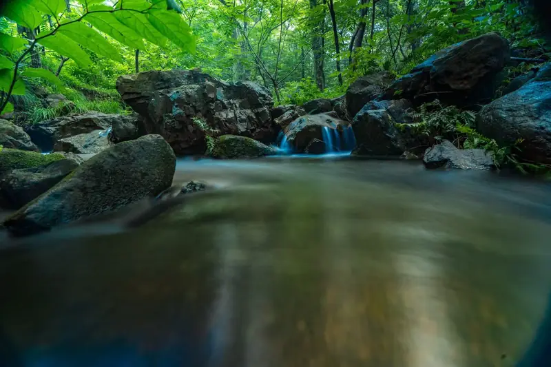
Photo adjustments
EXIF orientation normalized; resized without changing aspect ratio; converted to WebP. No subject edits.
- Administrative area
- County · 县
- Part of
- Zhumadian
- Chinese name
- 西平县
- Local areas
- County guide
Area & population
- Area in the source
- 1,098.00 km²
- Population · 2019
- 682,200
Source: cited geographic source, as of the dates shown.
Setting and landscape
The county stretches 60 kilometres from east to west and 32 kilometres from north to south. Shangcai County (上蔡县) lies to the east, Wugang (舞钢) and Wuyang County (舞阳县) to the west, Suiping County (遂平县) to the south, and the Yuanhui (源汇区) and Zhaoling (召陵区) districts of Luohe (漯河) to the north. Wheat, maize, rapeseed, sesame and tobacco are the main crops.
In the western hills, Tangxiyuan National Forest Park (棠溪源国家级森林公园) lies 42 kilometres south-west of the county town in Chushan town (出山镇). It covers 38 square kilometres with more than 95 per cent forest cover, and joins the Jiutouya (九头崖) scenic area to the west while facing Chaya Mountain (嵖岈山) to the south.
History
A county was first set up here in the early Western Han. Xiping claims Leizu (嫘祖), the principal wife of the Yellow Emperor and the goddess credited with sericulture, as a native, and calls itself a cradle of Chinese iron-smelting culture; national bodies have named it a home of Leizu culture and of iron-smelting and sword-casting culture.
What to see
Baoyan Temple Pagoda (宝严寺塔) stands inside the county town. It was first built under the Northern Song, repaired in 1546 and 1902, and rebuilt with provincial funds in 1980. Baoyan Temple Park, finished in November 2017, surrounds the pagoda and a memorial tower to soldiers killed in the war against Japan.
Tangxiyuan forest park is divided into four areas: Tangxi Lake (棠溪湖), Tangxi Gorge (棠溪峡), Zhizhu Mountain (蜘蛛山) and Paomaling (跑马岭). Tangxi Gorge is a canyon of pools, waterfalls, cliffs and old trees made up of the Youlougou (油篓沟) and Maoyagou (茅芽沟) valleys. The park also has a Leizu Palace (嫘祖宫), cliff inscriptions and the remains of an ancient millstone-making site.
In the county town, the Leizu Culture Park (嫘祖文化苑) covers more than 500 mu at the junction of Xiping Avenue and National Highway 107. It is laid out around a north–south axis and a ring of water, with areas on silkworm and mulberry culture and farming.
Highlights
- Baoyan Temple Pagoda 宝严寺塔: Northern Song pagoda in the county town, repaired in 1546 and 1902 and rebuilt in 1980.
- Tangxiyuan National Forest Park 棠溪源国家级森林公园: 38 square kilometres of forested hills in Chushan town, including the Tangxi Gorge.
- Leizu Culture Park 嫘祖文化苑: Theme park on Leizu and sericulture at the junction of Xiping Avenue and National Highway 107.
Sources for this guide
西平概况_西平县人民政府 · Xiping County People's Government (county annals office)
宝严寺塔_西平县人民政府 · Xiping County People's Government
棠溪源_西平县人民政府 · Xiping County People's Government
嫘祖文化苑_西平县人民政府 · Xiping County People's Government
Original English written from the listed sources and checked sentence by sentence against quoted extracts by a separate reviewer. Updated 2026-09-24.
Explore Xiping County
Core places to explore, with English and Chinese names.
Xiping County 西平县
Plan your visit
Getting there
Xiping County is about 40 km in a straight line from central Zhumadian. Search for 西平县 in a map app to find stations and your accommodation.
Where to stay →More in Zhumadian
Sources & geographic information
Administrative names and parent areas: Official geographic directory · Reference date 2026-09-06.
Map data © OpenStreetMap contributors. Pins mark approximate centres, not entrances or boundaries.