


Get to know Shangcai County
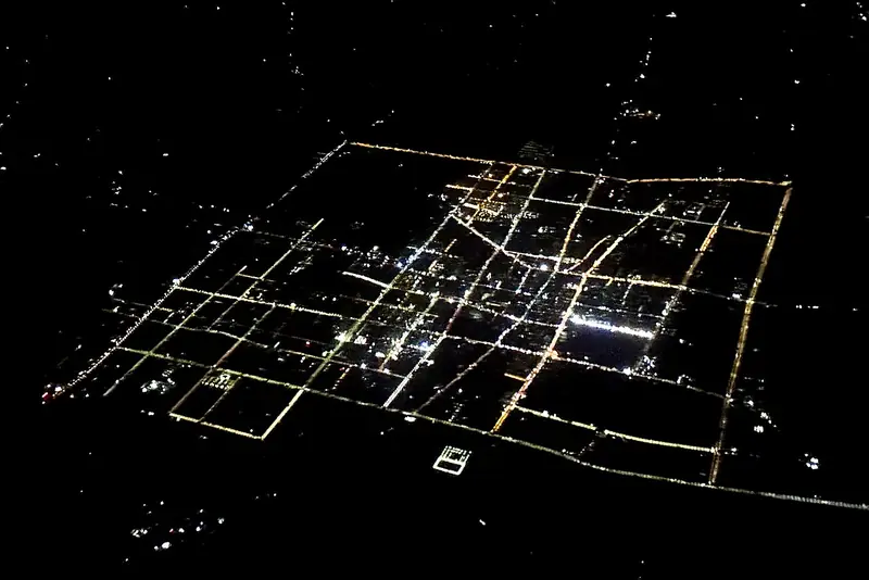
Photo adjustments
EXIF orientation normalized; resized without changing aspect ratio; converted to WebP. No subject edits.
- Administrative area
- County · 县
- Part of
- Zhumadian
- Chinese name
- 上蔡县
- Local areas
- County guide
Area & population
- Area in the source
- 1,517.00 km²
- Population · 2019
- 975,100
Source: cited geographic source, as of the dates shown.
History
The county government dates its written history to the start of the Western Zhou, about 3,000 years ago, when King Wu of Zhou (周武王) granted the land of Cai (蔡) to his younger brother Shu Du (叔度). Pressed by the state of Chu, the Cai rulers later moved their capital, first to Xincai (新蔡) and then to Zhoulai (州来), today's Fengtai (凤台) in Anhui, which they renamed Xiacai (下蔡, "Lower Cai"). The old capital was therefore called Shangcai, "Upper Cai", and the Qin set up Shangcai County here. The name has stayed in use since the Sui dynasty, and the county has belonged to Zhumadian since 1965.
Local tradition links the name itself to divination: the character cai (蔡) is read as grass (草) plus sacrifice (祭), after the milfoil stalks (蓍草) that grew on Caigang (蔡岗) east of the town and were used to cast oracles. The county presents itself as the ancestral home of the Cai (蔡) surname, a home of Double Ninth Festival (重阳节) culture and the birthplace of the Qin chancellor Li Si (李斯).
What to see
The Fuxi Shrine (伏羲祠), also called Baigui Temple (白圭庙), stands in Baiguimiao village 15 kilometres east of the county town. Legend places Fuxi (伏羲), ancestor of humankind, here, casting trigrams with milfoil and a white turtle, and the temple was built in his memory.
Li Si's Tomb (李斯墓) is in Lisilou village (李斯楼村), where Li Si was born and raised; it became a Henan provincial protected site in 2000. Li Si helped the First Emperor of Qin unify the six states and standardise writing, weights and measures, and was executed at Xianyang (咸阳) in 208 BC. Villagers, all surnamed Li, build no mounds over their graves in his memory because, they say, Li Si was killed without his head. West of the tomb are the Paomagang ridge (跑马岗) and Yinmajian gully (饮马涧), where he is said to have ridden as a young man. Tang poet Hu Zeng (胡曾) and Song poet Liu Chang (刘敞) both wrote poems on the tomb.
Food and local products
Taqiao pig's trotters (塔桥猪蹄) come from Taqiao town (塔桥镇), where the braising craft goes back to the Kangxi reign of the Qing. The Zhang family recipe simmers the trotters in an old master stock with 38 herbs; they are eaten hot, when the meat falls off the bone, or cold. The county is also a designated base for low-erucic rapeseed and pure white sesame.
Highlights
- Fuxi Shrine 伏羲祠: Also called Baigui Temple, 15 km east of the county town, built in memory of Fuxi.
- Li Si's Tomb 李斯墓: Provincial protected site since 2000 in Lisilou village, the Qin chancellor's birthplace.
- Taqiao pig's trotters 塔桥猪蹄: Trotters braised in an old master stock with 38 herbs, a craft dated to the Kangxi reign.
Sources for this guide
上蔡简介_上蔡县人民政府 · Shangcai County People's Government
上蔡县 历史_上蔡县人民政府 · Shangcai County People's Government
李斯墓_上蔡县人民政府 · Shangcai County People's Government
伏羲祠_上蔡县人民政府 · Shangcai County People's Government
塔桥猪蹄_上蔡县人民政府 · Shangcai County People's Government
Original English written from the listed sources and checked sentence by sentence against quoted extracts by a separate reviewer. Updated 2026-09-24.
Explore Shangcai County
Core places to explore, with English and Chinese names.
Shangcai County 上蔡县
Plan your visit
Getting there
Shangcai County is about 35 km in a straight line from central Zhumadian. Search for 上蔡县 in a map app to find stations and your accommodation.
Where to stay →More in Zhumadian
Sources & geographic information
Administrative names and parent areas: Official geographic directory · Reference date 2026-09-06.
Map data © OpenStreetMap contributors. Pins mark approximate centres, not entrances or boundaries.