


Get to know Jianghua Yao Autonomous County
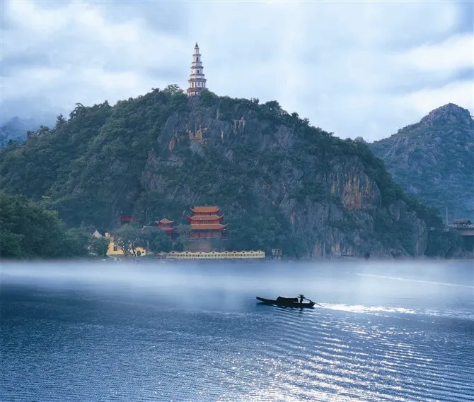
Photo adjustments
Full frame retained; proportionally resized and converted to WebP. No retouching or changes to the photographed subject. Card displays may crop the view.
- Administrative area
- Autonomous county · 自治县
- Part of
- Yongzhou
- Chinese name
- 江华瑶族自治县
- Local areas
- Autonomous county guide
Area & population
- Area in the source
- 3,216.03 km²
- Population · 2020
- 448,200
- Administrative seat
- Tuojiang
Source: cited geographic source, as of the dates shown.
Setting and landscape
The Mengzhu Range (萌渚岭), part of the Five Ranges (五岭), spans the county, and its spurs run right across it. The south, north and east are high, generally above 600 metres, while the west drops to between 100 and 200 metres. Mountains, hills, basins, plains and water all appear, and the climate is humid mid-subtropical monsoon, broken into many local microclimates by the rugged ground. The county government gives distances from the county town of 460 km to Changsha, 370 km to Guangzhou and 430 km to Nanning.
History
The name comes from the position of the old county seat, on the south side of the river at Yanghua Rock (阳华岩). Jianghua County was split off from Fengcheng County (冯乘县) in 621 under the Tang; Fengcheng itself had been set up in 111 BC. Under Empress Wu Zetian the county was renamed Yunxi (云溪县), and the old name returned under Emperor Zhongzong. In 1462 the seat moved to Huangtougang (黄头岗), today's Tuojiang town (沱江镇).
The Yao autonomous county was founded on 25 November 1955, and the seat moved to Shuikou town (水口镇). It returned to Tuojiang in November 1985. The county government also records that the first Communist Party organisation in what is now Yongzhou was founded here, as the Jianghua county branch.
What to see
Among its heritage the county government names three sights. The Xiaohe Ancient Road (潇贺古道) has run for a hundred li and more than a thousand years. The Yanghua scenery was praised by Yuan Jie (元结) in the line "九嶷万峰,不如阳华" (the ten thousand peaks of Jiuyi are no match for Yanghua). The Jianghua Confucian Temple (江华文庙) is described as the earliest built in Yongzhou.
Yaoshan Water City (瑶山水城) is rated a 4A scenic area, and five more are rated 3A: the Yao Culture Park (瑶族文化园), Xiangcaoyuan (香草源), Qinyan (秦岩), Baojing (宝镜) and Tongchongkou (桐冲口). The Yao long-drum dance (瑶族长鼓舞) and the Panwang song cycle (盘王大歌) are on the national intangible heritage list, and the Yao Panwang Festival (盘王节) is named one of Hunan's four major minority festivals. The county has also been named China's home of honey-scented black tea (蜜香红茶).
Highlights
- Yao Culture Park 瑶族文化园: Rated a 3A scenic area by the county.
- Yaoshan Water City 瑶山水城: The county's 4A-rated scenic area.
- Xiaohe Ancient Road 潇贺古道: An old road the county says has run for over a thousand years.
- Jianghua Confucian Temple 江华文庙: Described by the county as the earliest-built Confucian temple in Yongzhou.
- Yao long-drum dance 瑶族长鼓舞: On the national intangible cultural heritage list.
Sources for this guide
江华瑶族自治县县情简介 · Jianghua Yao Autonomous County People's Government
江华历史沿革 · Jianghua Yao Autonomous County People's Government
自然地理 · Jianghua Yao Autonomous County People's Government
Original English written from the listed sources and checked sentence by sentence against quoted extracts by a separate reviewer. Updated 2026-09-24.
Explore Jianghua Yao Autonomous County
Core places to explore, with English and Chinese names.
Places to explore around Jianghua Yao Autonomous County
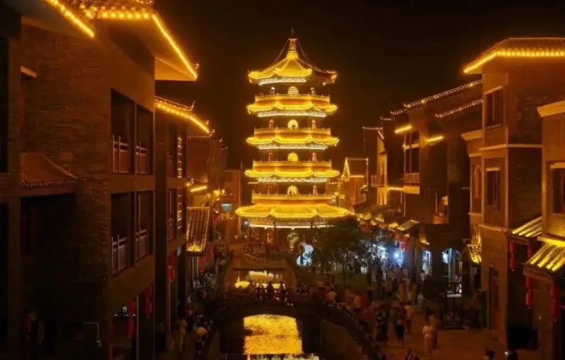 Yao Culture Park and Yaodu Water Street ·
 Plan your visit
Getting there
Jianghua Yao Autonomous County is about 140 km in a straight line from central Yongzhou. Search for 江华瑶族自治县 in a map app to find stations and your accommodation.
Where to stay →Build your route
Start with Yao Culture Park and Yaodu Water Street. The linked place guides have entrance and visit details.
Continue with Yongzhou →More in Yongzhou
Sources & geographic information
Administrative names and parent areas: Official geographic directory · Reference date 2026-09-06.
Photo: Yao Culture Park and Yaodu Water Street · Source photographer · License not provided. EXIF orientation normalized; resized without changing aspect ratio; converted to WebP. No subject edits.
Map data © OpenStreetMap contributors. Pins mark approximate centres, not entrances or boundaries.