


Get to know Qingshan District
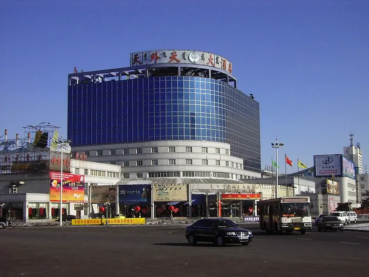
Photo adjustments
Full frame retained; proportionally resized and converted to WebP. No retouching or changes to the photographed subject. Card displays may crop the view.
- Administrative area
- District · 市辖区
- Part of
- Baotou
- Chinese name
- 青山区
- Local areas
- District guide
Area & population
- Area in the source
- 283.00 km²
- Population · 2020
- 719,255
- Administrative seat
- Qingfu
Source: cited geographic source, as of the dates shown.
Setting and landscape
The district covers about 280 square kilometres, with Hondlon District (昆都仑区) to the west, Guyang County (固阳县) to the north, Shiguai District (石拐区) to the north-east, Jiuyuan District (九原区) to the south-east and the Baotou rare-earth high-tech zone to the south. The district government describes a mid-temperate, semi-arid continental monsoon climate: spring arrives late, summer is hot and short, autumn cools early and winter is long and cold, with much wind, little rain, long sunshine and a wide gap between day and night temperatures.
History
Before 1949 the area never formed a county-level unit of its own. In the late Qing and early Republic, farmers and craftsmen from Shanxi, Shaanxi and Hebei settled here and founded villages such as Gonghudong (公忽洞). In 1953 the Inner Mongolia No. 1 and No. 2 Machinery Plants chose sites in the area, large-scale building began in 1954, and in August 1956 Baotou split its new urban office into Qingshan, centred on the two plants and their housing, and Hondlon, centred on Baotou Steel. The plants are today's First Machinery Group (一机集团) and North Heavy Industries (北重集团). According to Chinese Wikipedia, the urban area is mostly home to descendants of the 1950s industrial migrants from north China and uses Mandarin, while the surrounding villages speak the Dabao (大包) variety of Jin Chinese.
What to see
Northern Weapons City (北方兵器城) is described by People's Daily Inner Mongolia as a combined red-education and defence-industry tourism base presenting North Heavy Industries' contribution to national defence; the district links it with the First Machinery exhibition hall (一机展厅) and the Military Industry Culture Square (军工文化广场) as an ordnance-industry tourism route. The site holds an exhibition hall on Wu Yunduo (吴运铎), celebrated as "China's Pavel Korchagin", and the district's May Day programmes there have included tank rides and rocket-launcher experiences. The district also lists a Northern Military Experience Base (北方军事体验基地), newly opened in 2025.
Baomian 1958 (包棉1958) is a themed block in former factory buildings, where the district presents its industrial remains, old workshops and weathered walls. Dongdashan resort (东达山度假村), which the district also promotes, has an art district.
Highlights
- Northern Weapons City 北方兵器城: Defence-industry tourism base of North Heavy Industries, with a Wu Yunduo exhibition hall.
- Baomian 1958 包棉1958: Themed block in old factory buildings.
- Dongdashan resort 东达山度假村: Resort with an art district.
Sources for this guide
青山区区情概况 · Qingshan District People's Government, Baotou
历史沿革 · Qingshan District People's Government, Baotou
地理气候 · Qingshan District People's Government, Baotou
五一嗨玩青山!5天快乐给你安排得妥妥的 · Qingshan District People's Government, Baotou
“春遇鹿城 花漾包头”2025“五一”乐游季 50场文旅活动点亮五一假期!青山文旅生动诠释 · Qingshan District People's Government, Baotou
青山区 (包头市) · Chinese Wikipedia · CC BY-SA 4.0
特色军工游 · People's Daily Online, Inner Mongolia channel
Original English written from the listed sources and checked sentence by sentence against quoted extracts by a separate reviewer. Updated 2026-09-25.
Explore Qingshan District
Core places to explore, with English and Chinese names.
Qingshan District 青山区
Plan your visit
Getting there
Qingshan District is about 6 km in a straight line from central Baotou. Search for 青山区 in a map app to find stations and your accommodation.
Where to stay →More in Baotou
Sources & geographic information
Administrative names and parent areas: Official geographic directory · Reference date 2026-09-06.
Some facts checked against 青山区 (包头市) — Wikipedia contributors, CC BY-SA 4.0.
Map data © OpenStreetMap contributors. Pins mark approximate centres, not entrances or boundaries.