


Get to know Guyang County
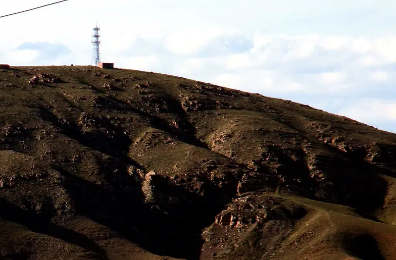
Photo adjustments
EXIF orientation normalized; resized without changing aspect ratio; converted to WebP. No subject edits.
- Administrative area
- County · 县
- Part of
- Baotou
- Chinese name
- 固阳县
- Local areas
- County guide
Area & population
- Area in the source
- 4,981.00 km²
- Population · 2020
- 118,624
- Administrative seat
- Jinshan
Source: cited geographic source, as of the dates shown.
History
The name comes from the Han-dynasty county of Guyang (稒阳县). Under the Qing the north belonged to the Muminggan banner (茂明安旗) and the southwest to the eastern duke's banner of the Urad (乌喇特); in 1919 the Beiyang government set up an administrative office here to manage land reclamation, and it became Guyang County in 1926. The county was briefly turned into a district of Baotou in 1958 and restored in 1961. On 3 May 1996 a magnitude 6.4 earthquake struck Guyang, killing 26 people.
What to see
The Guyang Qin Great Wall site (固阳秦长城遗址) is a national key cultural relics protection unit. Ma'an Mountain (马鞍山), about 58 kilometres southeast of the county town, rises to 1,984 metres and takes its name from its saddle-shaped summit; it is part of the Jiufeng Mountain (九峰山) national nature reserve, with more than 6,000 mu of old-growth forest in its valleys, including birch woods. Peng Deda (彭德大), head of the political department of the Daqing Mountain guerrilla detachment, was killed near the mountain in 1940 and buried below Huangma Ridge (黄麻岭).
At Chunkun Mountain (春坤山) scenic area an obo (敖包) ceremony is held each year in late June or early July: local people and visitors in festival dress walk three times each way around the cairn. Dayingtu village (大英图村), 45 kilometres east of the county town, is a Yuan-dynasty site; the village shows about a hundred stone rollers and millstones found there, has a village history hall in old cave dwellings, and plants sunflowers and other crops along Provincial Road 311 for visitors.
Food and local products
The county government calls Guyang youmian (莜面), flour from naked oats, the best in Inner Mongolia. The oats are roasted before milling, the flour is mixed with boiling water, and the shaped dough is steamed, then dipped in a salted broth or mutton broth. Steamed youmian alone comes in 17 forms, including wowo (窝窝).
Highlights
- Guyang Qin Great Wall Site 固阳秦长城遗址: National key cultural relics protection unit.
- Ma'an Mountain 马鞍山: Saddle-shaped peak of 1,984 metres in the Jiufeng Mountain national nature reserve, with old-growth forest.
- Chunkun Mountain 春坤山: Scenic area with an annual obo ceremony in late June or early July.
- Guyang youmian 固阳莜面: Naked-oat flour roasted, scalded and steamed; described by the county as the best in Inner Mongolia.
Sources for this guide
固阳县 · Wikipedia (Chinese) · CC BY-SA 4.0
固阳概况 · Guyang County People's Government (county archives and gazetteer office)
固阳县旅游景点推荐——大英图村 · Guyang County Culture, Sports, Tourism, Radio and Television Bureau
莜面 · Guyang County People's Government
内蒙古自治区境内的全国重点文物保护单位列表 · Wikipedia (Chinese) · CC BY-SA 4.0
春坤山祭敖包 · Guyang County People's Government
原始森林-马鞍山 · Guyang County Culture, Sports, Tourism, Radio and Television Bureau
Original English written from the listed sources and checked sentence by sentence against quoted extracts by a separate reviewer. Updated 2026-09-26.
Explore Guyang County
Core places to explore, with English and Chinese names.
Guyang County 固阳县
Plan your visit
Getting there
Guyang County is about 45 km in a straight line from central Baotou. Search for 固阳县 in a map app to find stations and your accommodation.
Where to stay →More in Baotou
Sources & geographic information
Administrative names and parent areas: Official geographic directory · Reference date 2026-09-06.
Some facts checked against 固阳县 — Wikipedia contributors, CC BY-SA 4.0.
Some facts checked against 内蒙古自治区境内的全国重点文物保护单位列表 — Wikipedia contributors, CC BY-SA 4.0.
Map data © OpenStreetMap contributors. Pins mark approximate centres, not entrances or boundaries.