


Get to know Darhan Muminggan United Banner
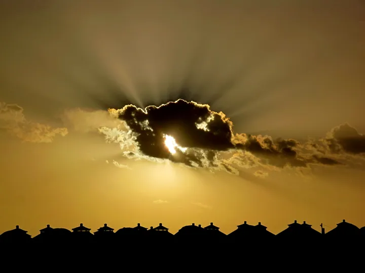
Photo adjustments
Full frame retained; proportionally resized and converted to WebP. No retouching or changes to the photographed subject. Card displays may crop the view.
- Administrative area
- Banner · 旗
- Part of
- Baotou
- Chinese name
- 达尔罕茂明安联合旗
- Local areas
- Banner guide
Area & population
- Area in the source
- 17,482.29 km²
- Population · 2020
- 69,563
- Administrative seat
- Bailingmiao
Source: cited geographic source, as of the dates shown.
Setting and landscape
The land slopes gently from hills in the south to high plains in the north, at an average altitude of 1,367 metres. The climate is semi-arid, with long cold winters, windy dry springs and short cool summers; most of the 256 millimetres of annual rain falls in July and August. Natural grassland covers about 16,600 square kilometres; wild animals include the Mongolian wild ass and the Mongolian gazelle.
History
Darhan and Muminggan are the names of two Mongol groups. The Darhan banner was formed in 1653 from part of the Tüsheet Khan (土谢图汗) division of the Khalkha, and the two banners were merged in October 1952; the banner government glosses Darhan as "sacred and inviolable" and Muminggan as "thousand-household tribe". In February 1936 Bailingmiao saw an armed uprising against the Japanese led by the Communist Party, and in November of that year Fu Zuoyi (傅作义) fought the Battle of Bailingmiao. In the 1950s the banner's people gave up Bayan Obo (白云鄂博), a mountain they had worshipped for generations, for the Baotou steelworks. The banner moved from Ulanqab (乌兰察布) to Baotou in 1996.
What to see
Xilamuren Grassland (希拉穆仁草原) was the first tourist area opened in Inner Mongolia. It lies in Xilamuren town (希拉穆仁镇) in the southeast of the banner, 90 kilometres from the seat; the town also has Puhui Temple (普会寺), a grassland folk museum and remains of the Northern Wei Great Wall. Visitors ride horses and camels there and watch wrestling and horse races. The ruined city of Aolun Sumu (敖伦苏木古城遗址) and the Jin dynasty border trench (金堑壕遗址) are national key cultural relics protection units. At Ming'an (明安镇) are the memorial hall of Qasar (哈布图哈萨尔), brother of Genghis Khan, whose rites are on the regional intangible heritage list, and the former home of Longmei (龙梅) and Yurong (玉荣), the sisters who protected the collective flock in the 1960s. Bailingmiao has Guangfu Temple (广福寺) and the Kangxi Camp (康熙营盘).
Food and local products
The banner sells its potatoes, beef, mutton, hides, wool and cashmere across China. On Xilamuren Grassland visitors eat Mongolian dairy foods, milk tea, hand-grabbed mutton (手扒肉), roast leg of lamb and whole roast lamb.
Highlights
- Xilamuren Grassland 希拉穆仁草原: The first tourist area opened in Inner Mongolia; Puhui Temple and a grassland folk museum are in the same town.
- Aolun Sumu Ancient City Site 敖伦苏木古城遗址: A national key cultural relics protection unit.
- Qasar Memorial Hall 哈布图哈萨尔祭奠堂: Hall for Genghis Khan's brother Qasar; his rites are regional intangible heritage.
- Guangfu Temple 广福寺: Temple in the banner seat of Bailingmiao.
Explore Darhan Muminggan United Banner
Core places to explore, with English and Chinese names.
Places to explore around Darhan Muminggan United Banner
Plan your visit
Getting there
Darhan Muminggan United Banner is about 125 km in a straight line from central Baotou. Search for 达尔罕茂明安联合旗 in a map app to find stations and your accommodation.
Where to stay →Build your route
Start with Xilamuren Grassland. The linked place guides have entrance and visit details.
Continue with Baotou →More in Baotou
Sources & geographic information
Administrative names and parent areas: Official geographic directory · Reference date 2026-09-06.
Photo: Xilamuren Grassland · Nyx Ning · CC BY-SA 3.0. Full frame retained; proportionally resized and converted to WebP. No retouching or changes to the photographed subject. Card displays may crop the view.

Map data © OpenStreetMap contributors. Pins mark approximate centres, not entrances or boundaries.