


Get to know Holingol
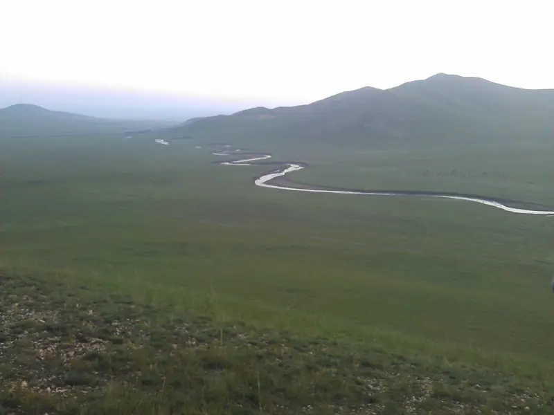
Photo adjustments
Full frame retained; EXIF orientation normalized, proportionally resized to at most 800 pixels and converted to WebP. No generated pixels or subject changes. Cards may crop the display.
- Administrative area
- County-level city · 县级市
- Part of
- Tongliao
- Chinese name
- 霍林郭勒市
- Local areas
- County-level city guide
Area & population
- Area in the source
- 585.00 km²
- Population · 2020
- 138,676
- Administrative seat
- Mostai Subdistrict
Source: cited geographic source, as of the dates shown.
History
Tongliao's culture and tourism service lists finds of stone tools, Western Zhou (西周) bronzes, Liao-dynasty tombs, Jin-dynasty border trenches, mammoth tusks and petrified wood from the area.
Local herders found the coalfield in 1958. In June 1975 Premier Zhou Enlai (周恩来) wrote on an internal news bulletin that developing it with Jilin's resources alone would be too slow. Crews moved in from February 1976, and 19 April 1976, when Jilin set up the mine construction headquarters, is kept as the mine's founding day. Among the first workers were 3,500 educated youths organised as militia, who lived in dugouts (地窨子). The first phase of the southern open-pit mine began production on 1 September 1984, and Holingol became a county-level city on 9 November 1985. Chinese Wikipedia lists the mine among China's five big open-pit coal mines and as the country's first large modern open-pit mine designed and built by Chinese teams.
What to see
The Aobao Xianghui Khan Mountain (敖包相会可汗山) area, a 4A scenic area 3 kilometres north of the city, is the main sight. Its Khan Mountain section has an entrance gate, a Path of the Blue Wolf (苍狼之路), a Mongol-Yuan army formation and a group of Mongol-Yuan emperor statues. Guaishan (怪山), also called Guanyin Mountain (观音山), turns red with autumn leaves.
Out on the grassland, the Erlun (额仑) grassland area lies 40 kilometres north of the city; its reserve records more than 130 animal species, including the great bustard. The Huitenur (辉特淖尔) grassland, a 3A scenic area, is 30 kilometres southwest. Hongyan Lake (鸿雁湖), 25 kilometres west, is formed by three lakes where swan geese, swans, grey cranes and ducks arrive each spring to breed. The same Tongliao feature points to glacial relics: "ice potholes" (冰臼) and large erratic boulders.
Setting and landscape
Holingol lies in cold upland, and heavy winter snow supports skiing, skating and ice sculpture. Its grassland wedding festival stages weddings in Mongolian folk style, alongside Naadam and aobao (敖包) ceremonies.
Highlights
- Aobao Xianghui Khan Mountain 敖包相会可汗山: 4A scenic area 3 km north of the city with Mongol-Yuan emperor statues and the Path of the Blue Wolf.
- Hongyan Lake 鸿雁湖: Three lakes 25 km west of the city where swan geese, swans and cranes breed.
- Erlun grassland 额仑草原: Grassland 40 km north of the city with more than 130 animal species, including the great bustard.
Sources for this guide
游在霍市 · Holingol Municipal People's Government
城市建设总体情况 · Holingol Municipal People's Government Office
爱上内蒙古| 走进多彩草原霍林郭勒 感受独特风光-新闻中心-内蒙古新闻网 · Inner Mongolia News (nmgnews.com.cn), from Tongliao Culture, Tourism, Radio and Television
霍林郭勒市 - 维基百科,自由的百科全书 · Wikipedia (Chinese) · CC BY-SA 4.0
Original English written from the listed sources and checked sentence by sentence against quoted extracts by a separate reviewer. Updated 2026-09-26.
Explore Holingol
Core places to explore, with English and Chinese names.
Holingol 霍林郭勒市
Plan your visit
Getting there
Holingol is about 295 km in a straight line from central Tongliao. Search for 霍林郭勒市 in a map app to find stations and your accommodation.
Where to stay →More in Tongliao
Sources & geographic information
Administrative names and parent areas: Official geographic directory · Reference date 2026-09-06.
Some facts checked against 霍林郭勒市 — Wikipedia contributors, CC BY-SA 4.0.
Map data © OpenStreetMap contributors. Pins mark approximate centres, not entrances or boundaries.