


Get to know Horqin Left Rear Banner
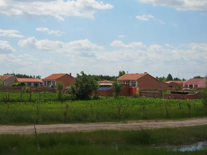
Photo adjustments
Full frame retained; proportionally resized and converted to WebP. No retouching or changes to the photographed subject. Card displays may crop the view.
- Administrative area
- Banner · 旗
- Part of
- Tongliao
- Chinese name
- 科尔沁左翼后旗
- Local areas
- Banner guide
Area & population
- Area in the source
- 11,500.00 km²
- Population · 2020
- 321,438
- Administrative seat
- Ganjig
Source: cited geographic source, as of the dates shown.
History
The banner was created in 1650. Its name comes from the Horqin (科尔沁), a Mongolian word that Chinese Wikipedia glosses as "people carrying bows". The Qing general Senggelinqin (僧格林沁) came from here; after he was made Bodolgatai Prince (博多勒噶台亲王) in the Xianfeng reign the banner was popularly called the Bo Wang Banner (博王旗). As Han settlers farmed opened land, Changtu (1806) and Kangping (1880) were set up on former banner territory.
What to see
Daqinggou (大青沟), in the banner's southwest in the heart of the Horqin Desert (科尔沁沙漠), is both a national nature reserve and a 4A scenic area of 8,183 hectares, combining forest, springs, lakes and desert. It is divided into an "underground primeval forest" in the gully, rafting in the Sanchakou gorge (三岔口) and the Xiaoqing Lake (小青湖) area, and is also an autonomous-region geopark.
The Senggelinqin Mansion (僧格林沁王府) in Jirgalang Town (吉尔嘎朗镇) was built by the banner's seventh prince, Qimuteduoerji (齐默特多尔济), and completed in 1740; its 85 buildings with 375 rooms stand on three parallel axes. As a museum it holds 845 objects from the Xiajiadian culture (夏家店文化) to recent times. In the same town, the Wudantala Maple Forest Park (乌旦塔拉五角枫森林公园), an autonomous-region nature reserve, has maples over 500 years old that turn red in early October.
Food and local culture
The banner plants about 300,000 mu of rice on weakly alkaline soil, and Horqin Left Rear Banner rice (科左后旗大米) became a national geographical-indication product in 2017. Horqin folk songs are performed by a single storyteller-singer, the huurchi (胡尔其), with a bass four-string fiddle; songs sung here include "Gada Meiren" (嘎达梅林) and "Senggelinqin". The Inner Mongolia culture department named the banner a home of Horqin folk song in 2008. Mongolian bone-setting, haolaibao (好来宝) rhymed storytelling and Mongolian saddlery are its three national intangible heritage items.
Highlights
- Daqinggou 大青沟: National nature reserve and 4A scenic area of forest, springs and lakes in the Horqin Desert.
- Senggelinqin Mansion 僧格林沁王府: Banner prince's residence completed in 1740, 85 buildings on three axes, now a museum.
- Wudantala Maple Forest Park 乌旦塔拉五角枫森林公园: Maples over 500 years old that turn red in early October.
- Horqin Left Rear Banner rice 科左后旗大米: National geographical-indication product since 2017, grown on weakly alkaline soil.
Sources for this guide
科左后旗概况 · Horqin Left Rear Banner People's Government
旅游之乡 · Horqin Left Rear Banner People's Government
大青沟国家AAAA级旅游景区 · Horqin Left Rear Banner People's Government
科左后旗僧格林沁王府博物馆 · Horqin Left Rear Banner People's Government
乌旦塔拉五角枫森林公园 · Horqin Left Rear Banner People's Government
科尔沁民歌之乡 · Horqin Left Rear Banner People's Government
绿色水稻之乡 · Horqin Left Rear Banner People's Government
科尔沁左翼后旗 - 维基百科,自由的百科全书 · Wikipedia (Chinese) · CC BY-SA 4.0
Original English written from the listed sources and checked sentence by sentence against quoted extracts by a separate reviewer. Updated 2026-09-26.
Explore Horqin Left Rear Banner
Core places to explore, with English and Chinese names.
Places to explore around Horqin Left Rear Banner
 Daqinggou ·
 Plan your visit
Getting there
Horqin Left Rear Banner is about 80 km in a straight line from central Tongliao. Search for 科尔沁左翼后旗 in a map app to find stations and your accommodation.
Where to stay →Build your route
Start with Daqinggou. The linked place guides have entrance and visit details.
Continue with Tongliao →More in Tongliao
Sources & geographic information
Administrative names and parent areas: Official geographic directory · Reference date 2026-09-06.
Some facts checked against 科尔沁左翼后旗 — Wikipedia contributors, CC BY-SA 4.0.
Photo: Daqinggou · Source photographer · License not provided. EXIF orientation normalized; resized without changing aspect ratio; converted to WebP. No subject edits.
Map data © OpenStreetMap contributors. Pins mark approximate centres, not entrances or boundaries.