


Get to know Jarud Banner
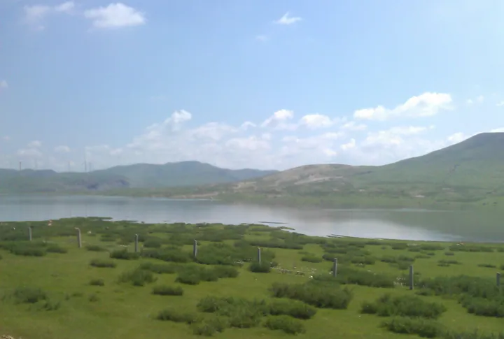
Photo adjustments
Full frame retained; proportionally resized and converted to WebP. No retouching or changes to the photographed subject. Card displays may crop the view.
- Administrative area
- Banner · 旗
- Part of
- Tongliao
- Chinese name
- 扎鲁特旗
- Local areas
- Banner guide
Area & population
- Area in the source
- 16,490.00 km²
- Population · 2020
- 251,806
- Administrative seat
- Lubei
Source: cited geographic source, as of the dates shown.
Setting and landscape
The Tejin Han Mountain reserve lies about 120 kilometres northwest of Lubei and has more than ten peaks over 1,000 metres; the highest, Tunter Peak (吞特尔峰), reaches 1,444.2 metres. Over ten rivers run through it, including the Huolin and the Arkundelen (阿日昆都楞河), and both the Huolin and the Dalelin (达勒林河), the upper course of the Xinkai River (新开河), rise inside the reserve. The banner government lists great bustards and golden eagles among its birds, azaleas and wild apricot blossom in spring and red leaves in autumn.
Further south, the Nanbaoligaotu (南宝力皋吐) area in the south of the banner sits on the Horqin grassland (科尔沁草原), between the Greater Khingan (大兴安岭) to the north and the West Liao River (西辽河) to the south.
What to see
The Namuhan Secret Valley tourist area (那慕汗秘境山谷旅游区) covers grassland in the north of the banner, with the Saiwai Shenquan self-drive campsite (塞外神泉自驾车露营地) and the Hanshan forest farm spring area (罕山林场神泉旅游区). The campsite offers grass sliding, archery and horse riding, and the banner government calls the valley an open-air museum of Mongolian nomadic culture. Herders along National Highway 304 in Wendur Hada village (温都尔哈达嘎查), Bayartu Hushuo town (巴雅尔吐胡硕镇), run horse-riding grounds for visitors.
The Nanbaoligaotu site is a late Neolithic settlement and cemetery about 4,500 to 5,000 years old, named after the village where it was found; a museum with a digital exhibition hall presents it. The banner has also held a winter fishing and ice festival at Huangtaiji Lake (皇太极湖) and apricot-blossom and azalea festivals.
History
Under the Qing the Jarud people of Inner Mongolia were organised as two banners, Left and Right, which Manchukuo merged into a single Jarud Banner in April 1935. In November 1985 the State Council carved Huolingol (霍林郭勒市) out of the banner's Huolin River office as a separate city.
Highlights
- Tejin Han Mountain National Nature Reserve 特金罕山自然保护区: Mountain reserve in the northwest with Tunter Peak at 1,444.2 m and the source of the Huolin River.
- Namuhan Secret Valley tourist area 那慕汗秘境山谷旅游区: Northern grassland valley with a self-drive campsite, riding and archery.
- Nanbaoligaotu site and museum 南宝力皋吐遗址: Late Neolithic settlement and cemetery about 4,500 to 5,000 years old.
Sources for this guide
扎鲁特旗:擦亮文旅融合底色 绘就全域旅游新画卷 · Jarud Banner People's Government
南宝力皋吐博物馆数字化展厅开馆啦! · Jarud Banner People's Government
特金罕山自然保护区 · Jarud Banner People's Government
扎鲁特旗 - 维基百科 · Wikipedia (Chinese) · CC BY-SA 4.0
Original English written from the listed sources and checked sentence by sentence against quoted extracts by a separate reviewer. Updated 2026-09-26.
Explore Jarud Banner
Core places to explore, with English and Chinese names.
Jarud Banner 扎鲁特旗
Plan your visit
Getting there
Jarud Banner is about 145 km in a straight line from central Tongliao. Search for 扎鲁特旗 in a map app to find stations and your accommodation.
Where to stay →More in Tongliao
Sources & geographic information
Administrative names and parent areas: Official geographic directory · Reference date 2026-09-06.
Some facts checked against 扎鲁特旗 — Wikipedia contributors, CC BY-SA 4.0.
Map data © OpenStreetMap contributors. Pins mark approximate centres, not entrances or boundaries.