


Get to know Horqin District
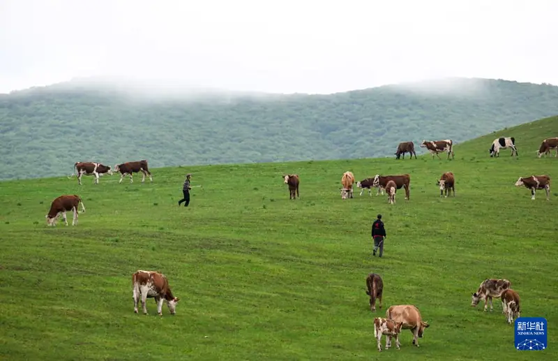
Photo adjustments
EXIF orientation normalized; resized without changing aspect ratio; converted to WebP. No subject edits.
- Administrative area
- District · 市辖区
- Part of
- Tongliao
- Chinese name
- 科尔沁区
- Local areas
- District guide
Area & population
- Area in the source
- 3,487.00 km²
- Population · 2020
- 921,808
- Administrative seat
- Yongqing Subdistrict
Source: cited geographic source, as of the dates shown.
History
Tongliao began in 1918 as a county carved out of Liaoyuan County (辽源县); the name means "reaching through to Liaodong". It became a city in 1951. When Jirem League (哲里木盟) was abolished on 13 January 1999 and Tongliao became a prefecture-level city, the old county-level city was renamed Horqin District. It borders Horqin Left Rear Banner to the south, Kailu County to the west and Horqin Left Middle Banner to the north and east.
What to see
In the city, the Tongliao Museum (通辽市博物馆) was founded in 1975 as the Jirem League Museum, moved to its present building in October 2003 and was rated a national second-grade museum in 2009. Liao River Park (辽河公园), between the old and new parts of town, has sculpture groups on the song "Aobao Xianghui", an old morin khuur player and Horqin folk songs, plus a 100-metre gallery of prints. Xar Moron Park (西拉木伦公园) in the centre is laid out around a lake and a group of horse-head fiddle sculptures. The Jixiang Michengdalelin Temple (吉祥密乘大乐林寺), a Tibetan Buddhist temple also in the centre, has halls, a Kalachakra stupa of ten thousand Buddhas and a longevity stupa.
West of the city, in Molimiao Sumu (莫力庙苏木), the Fuju city site (辽代福巨古城遗址) lies about 2.5 kilometres north of Fuju village; surface finds date it to the Liao dynasty. It measures about 5,100 metres round, with an inner city in the northwest of the outer one. Molimiao Sand Lake (莫力庙沙湖), 43 kilometres southwest of the city, is described by the district as Asia's largest desert reservoir and has been a city nature reserve since 2002. Jining Temple (集宁寺), 30 kilometres west, stands on the district's highest point.
Food and local products
The Molimiao sheep-breeding farm (莫力庙种羊场) grows grapes on sandy land, with more than thirty varieties including Kyoho and Muscat Hamburg. Xianguang village (鲜光村) in Dalin Town (大林镇), Tongliao's only Korean village, serves Korean dishes such as soybean-paste soup.
Highlights
- Tongliao Museum 通辽市博物馆: Founded in 1975 as the Jirem League Museum; national second-grade museum since 2009.
- Fuju city site 辽代福巨古城遗址: City site about 5,100 m round near Fuju village, dated by surface finds to the Liao dynasty.
- Molimiao Sand Lake 莫力庙沙湖: Desert reservoir 43 km southwest of the city; city nature reserve since 2002.
- Jixiang Michengdalelin Temple 吉祥密乘大乐林寺: Tibetan Buddhist temple in the city centre with a Kalachakra stupa.
Sources for this guide
地理位置 · Horqin District People's Government, Tongliao
历史沿革 · Horqin District People's Government, Tongliao
游在科尔沁 · Horqin District People's Government, Tongliao
科尔沁区 - 维基百科,自由的百科全书 · Wikipedia (Chinese) · CC BY-SA 4.0
Original English written from the listed sources and checked sentence by sentence against quoted extracts by a separate reviewer. Updated 2026-09-26.
Explore Horqin District
Core places to explore, with English and Chinese names.
Horqin District 科尔沁区
Plan your visit
Getting there
Horqin District is about 4 km in a straight line from central Tongliao. Search for 科尔沁区 in a map app to find stations and your accommodation.
Where to stay →More in Tongliao
Sources & geographic information
Administrative names and parent areas: Official geographic directory · Reference date 2026-09-06.
Some facts checked against 科尔沁区 — Wikipedia contributors, CC BY-SA 4.0.
Map data © OpenStreetMap contributors. Pins mark approximate centres, not entrances or boundaries.