


Get to know Duolun County
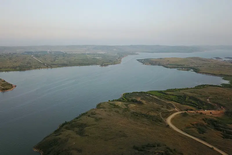
Photo adjustments
Full frame retained; EXIF orientation normalized, proportionally resized to at most 800 pixels and converted to WebP. No generated pixels or subject changes. Cards may crop the display.
- Administrative area
- County · 县
- Part of
- Xilingol League
- Chinese name
- 多伦县
- Local areas
- County guide
Area & population
- Area in the source
- 3,876.00 km²
- Population · 2020
- 103,736
- Administrative seat
- Dolonnur Town
Source: cited geographic source, as of the dates shown.
Setting and landscape
The county lies on the southern edge of the Hunshandake sandland (浑善达克沙地), where offshoots of the Greater Khingan (大兴安岭) and Yan (燕山) mountains meet the northern flank of the Yin Mountains (阴山). It has 47 perennial rivers and 62 lakes. Lake Duolun (多伦湖), with some 20,000 mu of water surface, is a key link in the scheme that carries Luan River water to Tianjin. The county government also points to what it calls Asia's only surviving natural old-growth elm forest and to a sunken forest in the sands.
History
In 1691, after his campaign against Galdan, the Kangxi Emperor held the Dolon Nor assembly (多伦诺尔会盟) here with the Khalkha Mongol tribes and ordered Huizong Temple (汇宗寺) built; the Yongzheng Emperor added Shanyin Temple (善因寺) in 1731. After the assembly Dolon Nor grew quickly into a centre for merchants trading into Mongolia; a Qing sub-prefecture was set up in 1732 as trade grew, and it became a county in 1913. In 1933 General Ji Hongchang (吉鸿昌) retook Duolun at the head of the Anti-Japanese Allied Army; the county government calls it the first military stronghold China recovered in the war. Excavation of a Liao-dynasty imperial consort's tomb, named one of China's top ten archaeological finds of 2015, showed the area was a domain of the Xiao aristocratic clan.
What to see
Huizong Temple was listed as a national key cultural relic site in 2001, and the Dolon Nor group of old buildings followed in 2006; Shanyin Temple and the Yuan-era tombs at Zhenzishan (砧子山) are also among the county's four national sites. The Shanxi Guild Hall (山西会馆) in the southwest of town, built in 1745, still stages Shanxi clapper opera (山西梆子) from the 13th day of the fifth lunar month, peaking at the Duolun temple fair in the sixth month. Huizong Temple and the Shanxi Guild Hall are among the first sites put forward for the Tea Road World Heritage nomination. Beyond the town, Lake Duolun, Girl Lake (姑娘湖) and Yumuchuan (榆木川) are among the county's natural scenic areas.
Highlights
- Huizong Temple 汇宗寺: Built on the Kangxi Emperor's order after the 1691 Dolon Nor assembly; national key site since 2001.
- Shanxi Guild Hall 山西会馆: Merchants' hall built in 1745, part of the Tea Road World Heritage nomination.
- Lake Duolun 多伦湖: Lake of about 20,000 mu, a key link in the scheme carrying Luan River water to Tianjin.
- Shanyin Temple 善因寺: Second imperially commissioned temple in the town, ordered by the Yongzheng Emperor in 1731.
Sources for this guide
文化旅游 · Duolun County People's Government
内蒙古:边墙内外买卖城 · China Tourism News
多伦县 · Wikipedia (Chinese) · CC BY-SA 4.0
Original English written from the listed sources and checked sentence by sentence against quoted extracts by a separate reviewer. Updated 2026-09-26.
Explore Duolun County
Core places to explore, with English and Chinese names.
Places to explore around Duolun County
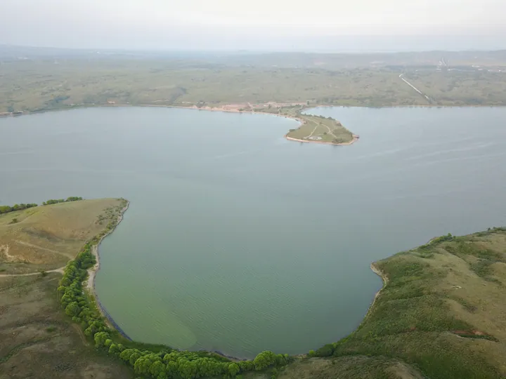 Aerial view of Duolun Lake, with a wooded peninsula reaching into the water ·
 Plan your visit
Getting there
Duolun County is about 195 km in a straight line from central Xilingol League. Search for 多伦县 in a map app to find stations and your accommodation.
Where to stay →Build your route
Start with Duolun Lake. The linked place guides have entrance and visit details.
Continue with Xilingol League →More in Xilingol League
Sources & geographic information
Administrative names and parent areas: Official geographic directory · Reference date 2026-09-06.
Some facts checked against 多伦县 — Wikipedia contributors, CC BY-SA 4.0.
Photo: Duolun Lake · Charlie fong · CC BY-SA 4.0. Full frame retained; proportionally resized and converted to WebP. No retouching or changes to the photographed subject. Card displays may crop the view.

Map data © OpenStreetMap contributors. Pins mark approximate centres, not entrances or boundaries.