


Get to know Zhengxiangbai Banner
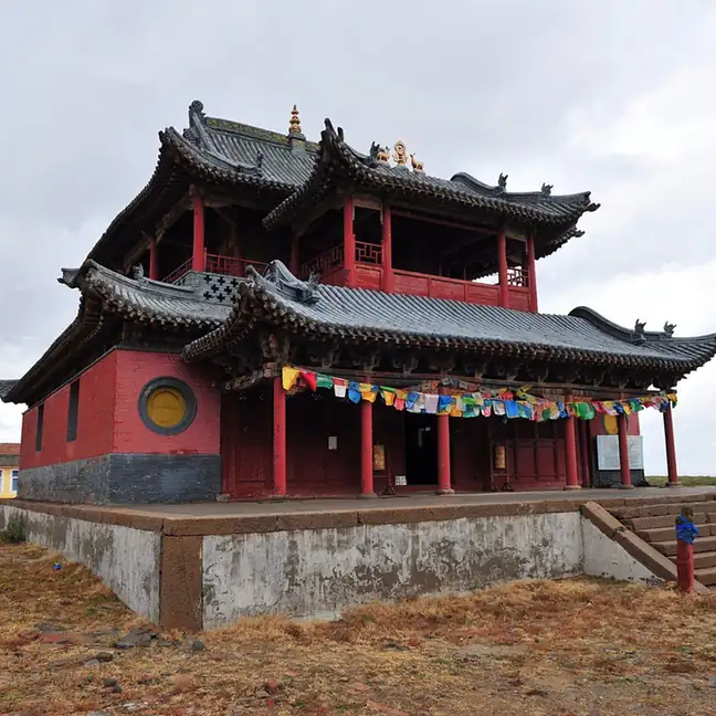
Photo adjustments
EXIF orientation normalized; resized without changing aspect ratio; converted to WebP. No subject edits.
- Administrative area
- Banner · 旗
- Part of
- Xilingol League
- Chinese name
- 正镶白旗
- Local areas
- Banner guide
Area & population
- Area in the source
- 6,253.00 km²
- Population · 2020
- 42,950
- Administrative seat
- Minggant
Source: cited geographic source, as of the dates shown.
Setting and landscape
The banner falls into three bands: the Hunshandake Sandy Land (浑善达克沙地) in the north, low hills and grassland in the middle, and a farming plain in the south. Grassland covers most of the land, followed by woodland, and the economy mixes herding with farming, with herding the larger part.
History
The Plain White and Bordered White banners of the Chahar Mongols were both set up in 1635, named after the colours of Qing army flags: all white for one, white with a red border for the other. From 1761 they answered to the military governor at Zhangjiakou (张家口). In 1945 the Plain White Banner governed 18 companies from Hanahada Temple (哈那哈达庙), and the Bordered White Banner 16 from Baga Hailigen (巴嘎海力根). They merged in March 1949 as a joint banner, which took its present name in 1956, and joined Xilingol League in 1958.
The banner government names three local figures: Mingantu (明安图), an 18th-century Mongol mathematician, surveyor and astronomer; the Tibetologist, historian and calendar scholar Luobusheng Zhulitumu (罗布生朱力图木); and the writer Yixidanjin Wangjila (伊希丹金旺吉拉).
What to see
On the grassland near Mingantu town stands the Mingantu Observing Station (明安图观测基地) of the National Astronomical Observatories. Its 100 white dish antennas form a solar radio spectroheliograph, which Xinhua calls the grassland's "sky eye" (天眼). The National Space Science Center of the Chinese Academy of Sciences lists a Mingantu field station, set up in the banner in 2008, with this 100-antenna array and two 20-metre dishes among its instruments. The banner has a museum, which doubles as its cultural relics centre, and an Ulan Muqir (乌兰牧骑) touring troupe.
Getting oriented
The league government puts Mingantu about 400 kilometres from Beijing, from Hohhot (呼和浩特) and from the Erenhot (二连浩特) border crossing. The Jining–Tongliao railway (集通铁路), with a Zhengxiangbai station, and national roads G5511 and G510 run east–west through the banner, and provincial road S222 runs north–south.
Highlights
- Mingantu Observing Station 明安图观测基地: Solar radio spectroheliograph of 100 white dish antennas on the grassland near Mingantu town.
- Mingantu 明安图: 18th-century Mongol mathematician, surveyor and astronomer from the banner; the seat bears his name.
Sources for this guide
正镶白旗 - 维基百科,自由的百科全书 · Chinese Wikipedia · CC BY-SA 4.0
正镶白旗_锡林郭勒盟行政公署 · Xilingol League Administrative Office
历史沿革_正镶白旗人民政府 · Zhengxiangbai Banner People's Government
文化教育_正镶白旗人民政府 · Zhengxiangbai Banner People's Government
走近明安图草原“天眼”--地方--人民网 · People's Daily Online (Xinhua report)
明安图野外科学观测研究站----国家空间科学中心 · National Space Science Center, Chinese Academy of Sciences
Original English written from the listed sources and checked sentence by sentence against quoted extracts by a separate reviewer. Updated 2026-09-26.
Explore Zhengxiangbai Banner
Core places to explore, with English and Chinese names.
Zhengxiangbai Banner 正镶白旗
Plan your visit
Getting there
Zhengxiangbai Banner is about 200 km in a straight line from central Xilingol League. Search for 正镶白旗 in a map app to find stations and your accommodation.
Where to stay →More in Xilingol League
Sources & geographic information
Administrative names and parent areas: Official geographic directory · Reference date 2026-09-06.
Some facts checked against 正镶白旗 — Wikipedia contributors, CC BY-SA 4.0.
Map data © OpenStreetMap contributors. Pins mark approximate centres, not entrances or boundaries.