


Get to know Lushan City
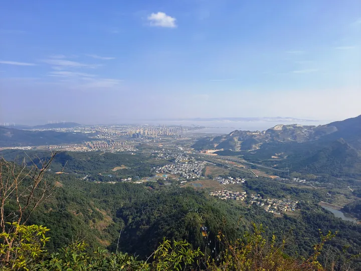
Photo adjustments
Full frame retained; proportionally resized and converted to WebP. No retouching or changes to the photographed subject. Card displays may crop the view.
- Administrative area
- County-level city · 县级市
- Part of
- Jiujiang
- Chinese name
- 庐山市
- Local areas
- County-level city guide
Area & population
- Area in the source
- 913.00 km²
- Population · 2017
- 244,755
- Administrative seat
- Nankang
Source: cited geographic source, as of the dates shown.
Setting and landscape
Mount Lu has 171 named peaks, led by Dahanyang Peak (大汉阳峰) at 1,474 metres. It was inscribed on the World Heritage List as a cultural site in December 1996 and joined the first list of world geoparks in 2004. Guling (牯岭), a long-famous summer resort, has forest cover of 90.7 percent, and the botanist Hu Xiansu (胡先骕) founded China's first subtropical mountain botanical garden on the mountain. More than 600 villas in the styles of over 20 countries survive, and the mountain served as the Republic's "summer capital". The city's share of Poyang Lake covers 373.4 square kilometres, where more than 100,000 migratory birds spend the winter, and the Gan, Fu, Rao, Xin and Xiu rivers meet in the waters to its southeast.
History
Between 929 and 935 the Wu state of the Five Dynasties period set up a garrison town south of Mount Lu called Xingzi, "star", after a rock that floats on the water like a star, the Luoxing Dun (落星墩). Xingzi became a county in 978, and from 982 it was the seat of Nankang, whose prefecture stayed there from the Song to the Qing. On 30 May 2016 Xingzi County was abolished and Lushan City created, taking in Guling town. The city government credits Tao Yuanming (陶渊明) with founding Chinese pastoral poetry here and the monk Huiyuan (慧远) with founding the Pure Land school at Donglin Temple (东林寺). It also says Li Bai (李白) wrote "Viewing the Waterfall at Mount Lu" (望庐山瀑布) and Su Shi (苏轼) "Written on the Wall of Xilin Temple" (题西林壁) in this area.
What to see
White Deer Grotto Academy (白鹿洞书院), southeast of Wulao Peak (五老峰), is a national protected site; the city government dates it from the Tang, when Li Bo (李渤) lived here to study in the 785-805 period and kept a white deer. Zhu Xi (朱熹) later rebuilt it to teach Neo-Confucianism. Xiufeng (秀峰), on the southern foot of Mount Lu, is named after a temple founded in the Southern Tang and destroyed in the Taiping period; its cliff inscriptions, from the Tang to the Republic, have been a national protected site since 2006 and include the characters "Qingyu Gorge" (青玉峡), traditionally attributed to Mi Fu (米芾).
The local Jinxing inkstone (金星宋砚), a bluestone inkstone named by the Song emperor Huizong according to the city government, was placed on the first national intangible-heritage list.
Highlights
- Mount Lu 庐山: World Heritage cultural site since 1996 and world geopark since 2004; main peak 1,474 metres.
- White Deer Grotto Academy 白鹿洞书院: Academy southeast of Wulao Peak, dating from the Tang and rebuilt by Zhu Xi; national protected site.
- Xiufeng cliff inscriptions 秀峰摩崖: Tang to Republican inscriptions on the southern foot of Mount Lu, national protected site since 2006.
- Jinxing inkstone 金星宋砚: Bluestone inkstone on the first national intangible-heritage list.
Sources for this guide
庐山市简介,庐山市人民政府,印象庐山,庐山市简介 · Lushan City People's Government
历史沿革,庐山市人民政府,印象庐山,历史沿革 · Lushan City People's Government
白鹿洞书院,庐山市人民政府,印象庐山,人文圣山 · Lushan City People's Government
秀峰摩崖 - 维基百科,自由的百科全书 · Chinese Wikipedia · CC BY-SA 4.0
Original English written from the listed sources and checked sentence by sentence against quoted extracts by a separate reviewer. Updated 2026-09-25.
Explore Lushan City
Core places to explore, with English and Chinese names.
Places to explore around Lushan City
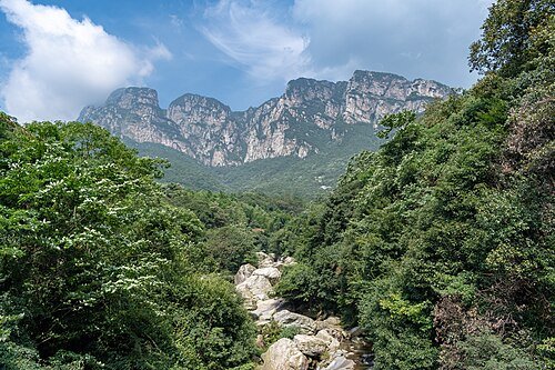 Mt. Lushan National Park · 庐山
Lushan庐山
Lushan combines a highland resort town with rocky valleys, lakes and a remarkable concentration of literary and religious sites. Around Guling, historic villas recall its development as a summer retreat, while the Flower Path…
Read the place guide →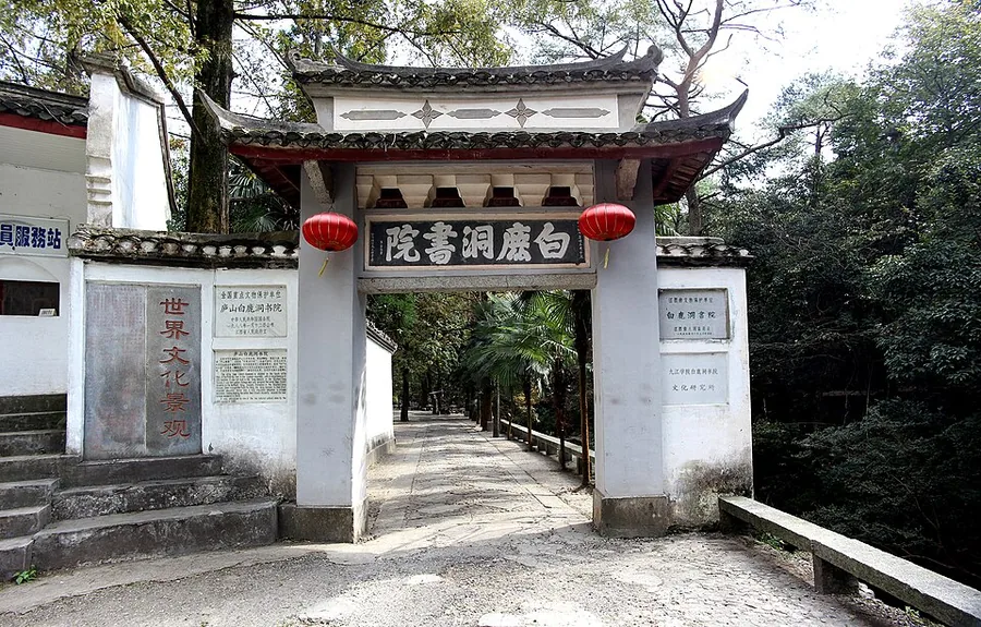 White Deer Grotto Academy (Bailudong Shuyuan), Lushan, Jiangxi.
White Deer Grotto Academy白鹿洞书院
White Deer Grotto Academy occupies a wooded hollow below Lushan’s Wulao peaks. Its courtyards bring together spaces for Confucian ritual and study: Lisheng Hall honours Confucius, while Minglun Hall recalls the teaching…
Read the place guide →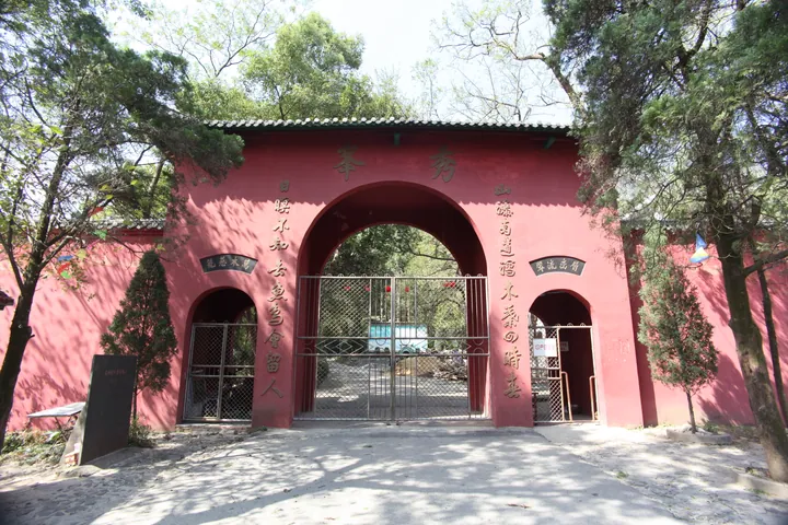 A red-painted entrance gate: a three-arched wall under a grey tiled roof, the central arch lettered 秀峰 in gold with a couplet down each pier, side arches labelled 门票处, iron grilles closing the openings, a dark stone stele on the ground at the left and mature trees at both sides.
Xiufeng Scenic Area秀峰
Xiufeng (秀峰) is a cluster of peaks, waterfalls and temple ground on the southern slope of Lushan, in Bailu town in Lushan city, Jiangxi. The name is short for Xiufeng Temple and also stands for the group of summits behind it, with Hanyang Peak, the highest point of the mountain, rising at its back and Poyang Lake spread out in front.
Read the place guide →Plan your visit
Getting there
Lushan City is about 25 km in a straight line from central Jiujiang. Search for 庐山市 in a map app to find stations and your accommodation.
Where to stay →Build your route
Lushan and White Deer Grotto Academy are about 6 km apart in a straight line. The linked place guides have entrance and visit details.
Continue with Jiujiang →More in Jiujiang
Sources & geographic information
Administrative names and parent areas: Official geographic directory · Reference date 2026-09-06.
Some facts checked against 秀峰摩崖 — Wikipedia contributors, CC BY-SA 4.0.
Photo: Lushan · xiquinhosilva · CC BY 2.0. Wikimedia thumbnail; fitted to the ranking-card frame.
.jpg)
Photo: White Deer Grotto Academy · Gisling · CC BY 3.0. Proportionally resized and converted to WebP without cropping, retouching or changing the photographed subject.

Photo: Xiufeng Scenic Area · Gisling · CC BY-SA 3.0. Full frame retained; proportionally resized and converted to WebP. No retouching or changes to the photographed subject. Card displays may crop the view.

Map data © OpenStreetMap contributors. Pins mark approximate centres, not entrances or boundaries.