


Get to know Helong
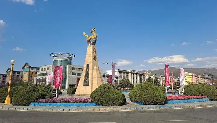
Photo adjustments
Full frame retained; resized proportionally to a maximum dimension of 960 pixels and converted to WebP quality 88. No crop, retouch, generated elements, or subject alteration. Final website rendition: full frame retained, proportionally resized to at most 720 pixels and converted to WebP. No additional retouching or subject alteration. Card displays may crop the view.
- Administrative area
- County-level city · 县级市
- Part of
- Yanbian Korean Autonomous Prefecture
- Chinese name
- 和龙市
- Local areas
- County-level city guide
Area & population
- Area in the source
- 5,069.00 km²
- Population · 2017
- 181,000
- Administrative seat
- Wenhua Subdistrict
Source: cited geographic source, as of the dates shown.
Setting and landscape
The city government describes mountainous country that falls from west to east, with the Nangang range (南岗山脉) across the middle and 1,086 peaks above 1,000 metres. The highest is Zengfeng Mountain (甑峰山) in the west at 1,676.6 metres, while the river basins of the centre and north sit around 500 metres. The border with North Korea runs for 177.9 kilometres and has two national land crossings, at Nanping (南坪) and Guchengli (古城里). Winters are long: the frost-free season is about 138 days. The mild, semi-humid zone along the rivers of the north-east, on the Pinggang (平岗) valley plain, is classed by the government as its plains rice zone.
History
The name began as Helongyu (和龙峪): helong is Manchu for two hills with a gully between them, and yu is Chinese for valley, so the name joins the two languages. It first appears in an 1883 Qing trade regulation with Korea; a trade office opened at Helongyu in 1884, and in 1910 the post became Helong County. That original Helongyu is now in neighbouring Longjing (龙井). In the Bohai kingdom (渤海国), founded in 698, the area belonged to its Central Capital district. The county seat moved to Sandaogou (三道沟), today's city centre, in July 1940, and Helong became a county-level city in July 1993.
What to see
Xianjingtai (仙景台) is a national scenic area in Nanping town, across the river from North Korea, known for its rock peaks, pines, waterfalls and sunrise over the clouds. Two Bohai walled sites survive: Xigucheng (西古城), the Central Capital of the kingdom, laid out like the capitals at Dongjingcheng and Baliancheng and listed by Jilin province in 1982, and Henantun (河南屯). The Longtoushan tombs (龙头山古墓群) at Toudao town include the joint grave of Princess Zhenxiao (贞孝公主), fourth daughter of the third Bohai ruler, Da Qinmao (大钦茂).
Guangdong Village (光东村) is a Korean village on the Hailan River (海兰江) that President Xi Jinping visited in 2015. China National Radio describes raised wooden walkways over its paddies and fields planted with rice of different colours to spell words in Korean and Chinese.
Food and local products
Rice is the signature product. China National Radio describes the fields around Guangdong Village, which villagers call the Pinggang oasis, as Yanbian's largest rice base, notes that the area grew tribute rice for the Qing court, and reports that Guangdong villagers now sell organic rice under the brand Masida (吗西达), Korean for good.
Highlights
- Xianjingtai 仙景台: National scenic area of rock peaks and pines in Nanping town, across the Tumen from North Korea.
- Guangdong Village 光东村: Korean rice village on the Hailan River with walkways over paddies planted as pictures and lettering.
- Xigucheng 西古城: Walled site of the Bohai kingdom's Central Capital, listed by Jilin province in 1982.
- Longtoushan tombs 龙头山古墓群: Bohai cemetery at Toudao that includes the tomb of Princess Zhenxiao.
Sources for this guide
和龙概况 - 和龙市人民政府 · Helong City People's Government
人文历史 - 和龙市人民政府 · Helong City People's Government
和龙市 - 维基百科,自由的百科全书 · Wikipedia (Chinese) · CC BY-SA 4.0
[重访“光东”看变化]水稻产业富“光东”_央广网 · China National Radio (cnr.cn)
Original English written from the listed sources and checked sentence by sentence against quoted extracts by a separate reviewer. Updated 2026-09-25.
Explore Helong
Core places to explore, with English and Chinese names.
Places to explore around Helong
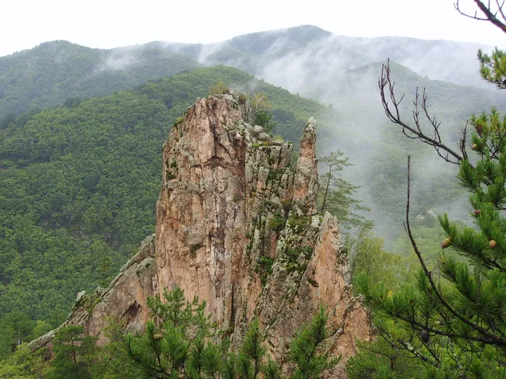 A granite rock peak at Xianjingtai scenic area, Helong, Yanbian Prefecture · 延边朝鲜族自治州和龙市仙景台奇峰 Source-recorded photograph date: Taken on 9 September 2007.
Xianjingtai仙景台
Xianjingtai is a mountain landscape in the Helong area of Yanbian, associated with distinctive granite peaks and exposed rock forms.
Read the place guide →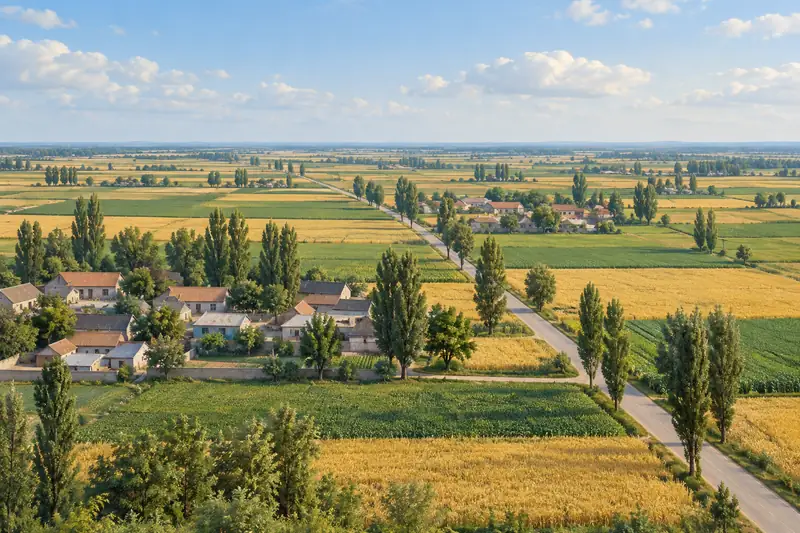 AI illustration · AI 示意图(仅供参考,非该地点实拍)
Guangdong Village in Helong光东村
Guangdong Village, written 光东村, is a Korean ethnic village in Dongcheng Town, Helong, in the Yanbian region of Jilin.
Read the place guide →Plan your visit
Getting there
Helong is about 65 km in a straight line from central Yanbian Korean Autonomous Prefecture. Search for 和龙市 in a map app to find stations and your accommodation.
Where to stay →Build your route
Xianjingtai and Guangdong Village in Helong are both listed here. The linked place guides have entrance and visit details.
Continue with Yanbian Korean Autonomous Prefecture →More in Yanbian Korean Autonomous Prefecture
Sources & geographic information
Administrative names and parent areas: Official geographic directory · Reference date 2026-09-06.
Some facts checked against 和龙市 — Wikipedia contributors, CC BY-SA 4.0.
Photo: Xianjingtai · 冥想 · CC BY 3.0. Full frame retained; proportionally resized and converted to WebP. No retouching or changes to the photographed subject. Card displays may crop the view.

Map data © OpenStreetMap contributors. Pins mark approximate centres, not entrances or boundaries.