


Get to know Hunchun
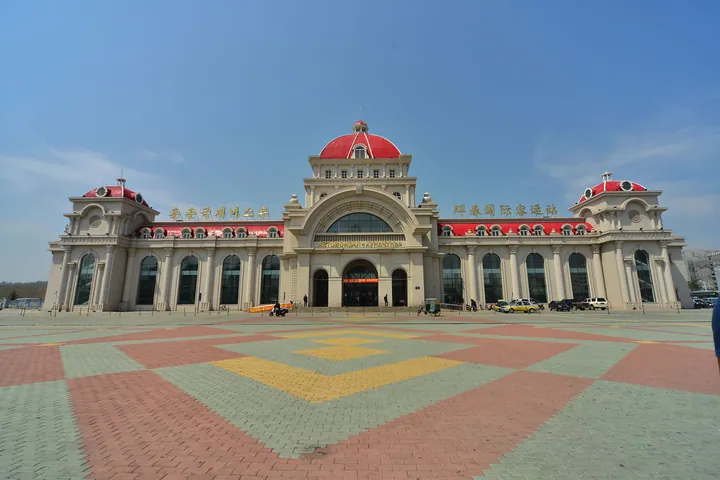
Photo adjustments
Full frame retained; proportionally resized and converted to WebP. No retouching or changes to the photographed subject. Card displays may crop the view.
- Administrative area
- County-level city · 县级市
- Part of
- Yanbian Korean Autonomous Prefecture
- Chinese name
- 珲春市
- Local areas
- County-level city guide
Area & population
- Area in the source
- 5,145.40 km²
- Population · 2017
- 271,000
- Administrative seat
- Xin'an Subdistrict
Source: cited geographic source, as of the dates shown.
Setting and landscape
Forest covers more than 86 percent of the city's land, according to the city government, which also counts part of the Northeast China Tiger and Leopard National Park (东北虎豹国家公园) within its bounds and says Hunchun has more wild tigers and leopards than anywhere else in China. More than a million migratory birds stop here each year. At the river mouth, the Jingxin Wetland (敬信湿地) is a provincial wetland reserve of 5,874 hectares.
History
The name comes from a Jurchen word, later Manchu, meaning borderland. In the Tang period the Bohai kingdom (渤海国) had its capital at Baliancheng (八连城) in Hunchun. The Qing appointed a garrison commander here in 1714, the first official record of the place name. Between 1869 and 1875 large numbers of Koreans fleeing famine and war crossed the Tumen to farm, the start of Hunchun's Korean community. In 1886 the Qing official Wu Dacheng (吴大澂) signed a boundary treaty with Russia that redrew the border here and confirmed China's right of passage to the sea along the Tumen. In summer 1938 Japanese and Soviet troops fought over the Zhanggufeng (张鼓峰) and Shacaofeng (沙草峰) heights at Fangchuan. The county became a city in 1988, and in March 1992 the State Council opened it as a border city.
What to see
Fangchuan (防川) is a national scenic area at the point where China, Russia and North Korea meet. From its Wanghai Pavilion (望海阁) a small Russian town lies to the left and a North Korean town to the right. Fangchuan village, at the south of the scenic area and 59.3 kilometres from the city, sits 5 metres above sea level, the lowest point in Jilin, and all its residents are Korean. Baliancheng, at the western end of the Hunchun plain, is the site of the Bohai Eastern Capital (东京龙源府), with outer, inner and palace walls. The China–Russia boundary marker known as the Tuzi Stele (土字碑) was listed as a national key cultural relic in 2019.
Food and local traditions
The city government's food pages include Yanbian cold noodles (延边冷面): thin buckwheat noodles rinsed cold and served in chilled beef broth, topped with shredded kimchi, pear slices, egg strips, sliced beef, fried pine nuts and coriander. Local intangible heritage includes the Korean dongxiao (洞箫) bamboo flute, the plate dance (碟子舞) and Manchu paper-cutting (满族剪纸).
Highlights
- Fangchuan 防川: National scenic area on the China–Russia–North Korea border; its village, all Korean, is the lowest point in Jilin at 5 metres.
- Baliancheng 八连城: Walled site of the Bohai kingdom's Eastern Capital on the Hunchun plain.
- Jingxin Wetland 敬信湿地: Provincial wetland reserve of 5,874 hectares at the mouth of the Tumen.
- Yanbian cold noodles 延边冷面: Buckwheat noodles in chilled beef broth with kimchi, pear, egg, beef and pine nuts.
Sources for this guide
珲春概况 - 珲春市人民政府 · Hunchun City People's Government
珲春历史沿革 - 珲春市人民政府 · Hunchun City People's Government
防川民俗村 - 珲春市人民政府 · Hunchun City People's Government
延边冷面 - 珲春市人民政府 · Hunchun City People's Government
珲春市 - 维基百科,自由的百科全书 · Wikipedia (Chinese) · CC BY-SA 4.0
Original English written from the listed sources and checked sentence by sentence against quoted extracts by a separate reviewer. Updated 2026-09-25.
Explore Hunchun
Core places to explore, with English and Chinese names.
Places to explore around Hunchun
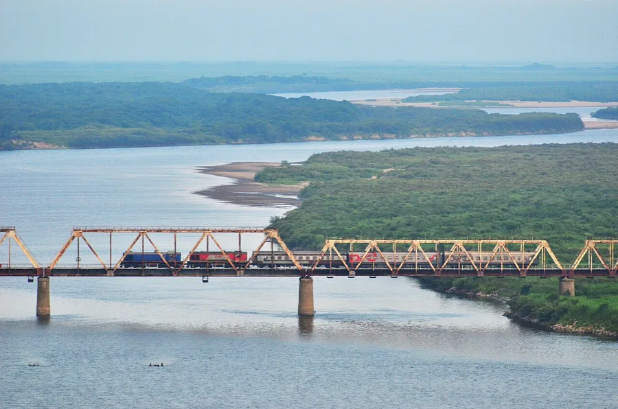 The Korea–Russia Friendship Bridge and Tumen River seen from the Fangchuan border area, July 2014.
Plan your visit
Getting there
Hunchun is about 100 km in a straight line from central Yanbian Korean Autonomous Prefecture. Search for 珲春市 in a map app to find stations and your accommodation.
Where to stay →Build your route
Start with Fangchuan. The linked place guides have entrance and visit details.
Continue with Yanbian Korean Autonomous Prefecture →More in Yanbian Korean Autonomous Prefecture
Sources & geographic information
Administrative names and parent areas: Official geographic directory · Reference date 2026-09-06.
Some facts checked against 珲春市 — Wikipedia contributors, CC BY-SA 4.0.
Photo: Fangchuan · TowerCard · CC BY-SA 3.0. Proportionally resized and converted to WebP without cropping, retouching or changing the photographed subject.

Map data © OpenStreetMap contributors. Pins mark approximate centres, not entrances or boundaries.