


Get to know Antu County
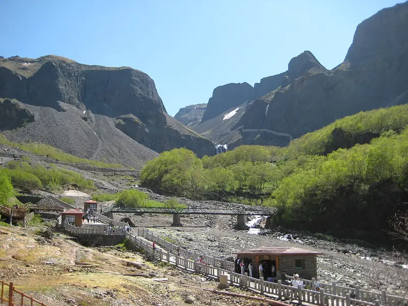
Photo adjustments
Full frame retained; EXIF orientation normalized, proportionally resized to at most 800 pixels and converted to WebP. No generated pixels or subject changes. Cards may crop the display.
- Administrative area
- County · 县
- Part of
- Yanbian Korean Autonomous Prefecture
- Chinese name
- 安图县
- Local areas
- County guide
Area & population
- Area in the source
- 7,444.00 km²
- Population · 2020
- 195,000
- Administrative seat
- Mingyue
Source: cited geographic source, as of the dates shown.
Setting and landscape
The Changbai range runs south to north through the county, so the land is higher in the south and east and lower in the north and west. The Huanggou ridge (荒沟岭) divides it into two climate zones: the southern zone is cooler and wetter, with a frost-free season of 95 to 110 days. Tianchi is the source of three rivers, the Songhua, the Tumen and the Yalu. Wild plants include ginseng, fritillary and schisandra, and pine mushrooms (松茸), bracken and hedgehog fungus grow in its forests.
History
The Qing treated the Changbai area as their ancestral homeland and closed it from 1677; because Antu lay at its heart and produced ginseng, the ban was especially strict until it was lifted in 1881. On 6 December 1909 the Northeast viceroy Xiliang (锡良) asked for a new county on the upper Tumen, and it was approved on 16 January 1910 with the name Antu, meaning "keeping the Tumen frontier secure". It has been under the Yanbian Korean Autonomous Prefecture since 1955, when the Yanbian Korean autonomous region became a prefecture.
What to see
The Changbai Mountain shrine site (长白山神庙遗址), also called the Baomacheng site (宝马城遗址), stands on a terrace north-west of Erdaobaihe town (二道白河镇). It was a Jin-dynasty (1115–1234) imperial site for sacrifices to Changbai Mountain, was listed as a national key cultural relic site in 2019 and became a national archaeological park in 2023. At Wanbao town (万宝镇), Hongqi village (红旗朝鲜族民俗村) is a village of 86 households, all Korean, that has run folk tourism since 2003 with Korean food and folk performances; its farmers also raise sika deer. Shuangmufeng (双目峰) is a border port that the county government describes as the only land port on the China–North Korea border.
Food and local products
The county government names ginseng among medicinal herbs, pine mushrooms and black wood-ear among fungi, blueberries and black chokeberry among berries, and bracken and hazel mushrooms among wild greens. It styles Antu the home of mineral water, ginseng and honeybees, and has recorded 106 high-quality mineral springs.
Highlights
- Changbai Mountain shrine site 长白山神庙遗址: A Jin-dynasty imperial sacrificial site near Erdaobaihe, national key site in 2019 and national archaeological park in 2023.
- Hongqi Korean folk village 红旗朝鲜族民俗村: An all-Korean village at Wanbao town running folk tourism since 2003.
- Pine mushrooms 松茸: Named by the county among its main edible fungi.
Sources for this guide
安图县简介 - 安图县人民政府 · Antu County People's Government
地理地貌 - 安图县人民政府 · Antu County People's Government
历史沿革 - 安图县人民政府 · Antu County People's Government
安图县 - 维基百科 · Chinese Wikipedia · CC BY-SA 4.0
长白山神庙遗址 - 维基百科 · Chinese Wikipedia · CC BY-SA 4.0
安图县万宝红旗村 - 安图县人民政府 · Antu County People's Government
Original English written from the listed sources and checked sentence by sentence against quoted extracts by a separate reviewer. Updated 2026-09-25.
Explore Antu County
Core places to explore, with English and Chinese names.
Antu County 安图县
Plan your visit
Getting there
Antu County is about 25 km in a straight line from central Yanbian Korean Autonomous Prefecture. Search for 安图县 in a map app to find stations and your accommodation.
Where to stay →More in Yanbian Korean Autonomous Prefecture
Sources & geographic information
Administrative names and parent areas: Official geographic directory · Reference date 2026-09-06.
Some facts checked against 安图县 — Wikipedia contributors, CC BY-SA 4.0.
Some facts checked against 长白山神庙遗址 — Wikipedia contributors, CC BY-SA 4.0.
Map data © OpenStreetMap contributors. Pins mark approximate centres, not entrances or boundaries.