


Get to know Ganjingzi District
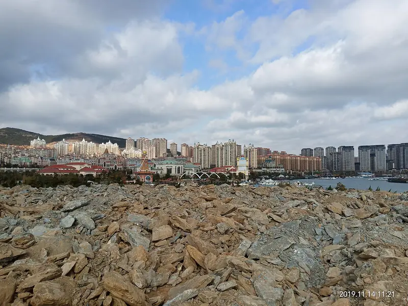
Photo adjustments
Full frame retained; EXIF orientation normalized, proportionally resized to at most 800 pixels and converted to WebP. No generated pixels or subject changes. Cards may crop the display.
- Administrative area
- District · 市辖区
- Part of
- Dalian
- Chinese name
- 甘井子区
- Local areas
- District guide
Area & population
- Area in the source
- 451.52 km²
- Population · 2020
- 1,798,458
- Administrative seat
- No. 1 Mingzhu Square (明珠广场1号)
Source: cited geographic source, as of the dates shown.
Setting and landscape
The district is broad in the south-west and narrow in the north-east, about 40 kilometres east to west and 35 kilometres north to south. Jinzhou District (金州区) adjoins it to the north-east, Shahekou District (沙河口区) to the south and Lüshunkou District (旅顺口区) to the south-west. The district government counts 157 kilometres of coastline and describes a warm-temperate climate without severe winters or very hot summers, with mountains, lakes, forest and wetland as well as sea. Lingshui (凌水街道) and Qixianling (七贤岭街道) subdistricts are administered by the Dalian High-tech Industrial Zone.
History
In the Warring States period the area belonged to the Yan state's Liaodong commandery (辽东郡). After the First Sino-Japanese War, the 1898 Lüshun–Dalian lease treaties handed it to Russia, and after the Russo-Japanese War Japan took over in 1905, dividing the present district among its Dalian, Lüshun and Jinzhou administrations. Dalian was liberated on 22 August 1945. Dalian County (大连县), formed in January 1946 with Ganjingzi as one of its eight districts, was the area's first county-level government; it was abolished in December 1950, when Ganjingzi became a district of Lüda (旅大). Dalianwan township (大连湾乡) moved into the district from Jin County in 1984.
What to see
The Dalian Western Suburbs National Forest Park (大连西郊国家森林公园) is a national 4A scenic area; Jinlong Temple National Forest Park (金龙寺国家森林公园) and Xiajiahezi Beach (夏家河子海滨浴场) are 3A scenic areas. The district government also lists camps, a ski slope, riding clubs and farm stays where visitors can pick fruit and vegetables. Events recorded in the district's 2025 yearbook include an ice and snow tourism festival, an ocean culture festival, a crabapple street festival, a locust-blossom viewing fair and a beer festival. Ganjingzi is known as China's home of folk drum music (文艺鼓乐) and Liaoning's home of shell carving (贝雕).
Getting oriented
Dalian Zhoushuizi International Airport (大连周水子国际机场) and the Dalian Sports Centre (大连市体育中心) are in the district. Dalian North Station (大连北站), in the Nanguanling (南关岭) area, is the terminus of the Harbin–Dalian high-speed railway, and the Shenyang–Haikou Expressway exit and the Dalian port passenger ro-ro terminal are also here.
Highlights
- Dalian Western Suburbs National Forest Park 大连西郊国家森林公园: National forest park and 4A scenic area.
- Jinlong Temple National Forest Park 金龙寺国家森林公园: National forest park and 3A scenic area.
- Xiajiahezi Beach 夏家河子海滨浴场: Sea bathing beach listed as a 3A scenic area.
- Shell carving 贝雕: Craft for which Ganjingzi is called Liaoning's home of shell carving.
Sources for this guide
甘井子区 - 维基百科 · Wikipedia (Chinese) · CC BY-SA 4.0
大连市甘井子区人民政府 甘井子概况 · Ganjingzi District People's Government, Dalian
大连市甘井子区人民政府 走进甘井子 位置面积 · Ganjingzi District People's Government, Dalian (Ganjingzi Yearbook 2025)
大连市甘井子区人民政府 走进甘井子 建置沿革 · Ganjingzi District People's Government, Dalian (Ganjingzi Yearbook 2025)
大连市甘井子区人民政府 走进甘井子 旅游资源 · Ganjingzi District People's Government, Dalian (Ganjingzi Yearbook 2025)
大连市甘井子区人民政府 走进甘井子 文化体育 · Ganjingzi District People's Government, Dalian (Ganjingzi Yearbook 2025)
Original English written from the listed sources and checked sentence by sentence against quoted extracts by a separate reviewer. Updated 2026-09-26.
Explore Ganjingzi District
Core places to explore, with English and Chinese names.
Ganjingzi District 甘井子区
Plan your visit
Getting there
Ganjingzi District is about 7 km in a straight line from central Dalian. Search for 甘井子区 in a map app to find stations and your accommodation.
Where to stay →More in Dalian
Sources & geographic information
Administrative names and parent areas: Official geographic directory · Reference date 2026-09-06.
Some facts checked against 甘井子区 — Wikipedia contributors, CC BY-SA 4.0.
Map data © OpenStreetMap contributors. Pins mark approximate centres, not entrances or boundaries.