


Get to know Pulandian District
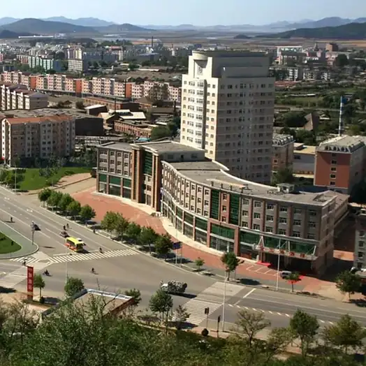
Photo adjustments
EXIF orientation normalized; resized without changing aspect ratio; converted to WebP. No subject edits.
- Administrative area
- District · 市辖区
- Part of
- Dalian
- Chinese name
- 普兰店区
- Local areas
- District guide
Area & population
- Area in the source
- 2,769.90 km²
- Population · 2010
- 741,230
- Administrative seat
- No. 12 Fuqian Road (府前路12号)
Source: cited geographic source, as of the dates shown.
Setting and landscape
The land falls from north to south and from west to east: low mountains in the north, hills across the north-east and centre, and coastal hills and plains in the south, with 187 kilometres of coast on both the Bohai and Yellow Seas. Laomao Mountain (老帽山), 848 metres, is the highest point; the district publicity department calls it the "little Everest of southern Liaoning". Its rivers include the Biliu (碧流河), which rises in Gaizhou. The climate is temperate monsoon, averaging 9.7°C a year.
History
Chinanews describes Pulandian as where Dalian's recorded urban history begins, with the Zhangdian Han city (张店古汉城) dating back more than 2,000 years. In 1899, under Russia's Kwantung administration, Piziwo (now Pikou subdistrict, 皮口街道) became one of the territory's four towns; Japan took over the lease in 1905. In September 1945 Xinjin County was formed, named after Jin County to its south, and its government opened at Piziwo on 25 September. The seat moved to Pulandian town in November 1958; the county became Pulandian City in 1991 and a district of Dalian in 2015.
What to see
Ancient lotus seeds found in the early 20th century on the eastern edge of Pulandian were dated to about a thousand years and still sprouted and flowered; in 1962 Guo Moruo (郭沫若), then president of the Chinese Academy of Sciences, wrote a poem about them. The Thousand-Year Ancient Lotus Garden (千年古莲园), in the west of the town, grows lotuses bred from those seeds and hosted Dalian's first Ancient Lotus Culture Festival in July 2023.
Other named sights are the Weiba Mountain fortress (巍霸山城), Ping Island (平岛) off Pikou, the Anbo (安波) hot springs and ski area, and Mopan Minju (墨盘珉琚). Chengzitan (城子坦), a Liaoning historic and cultural town, keeps the century-old Chunman Street (春满街).
Food and local products
The district promotes Liaoning sea cucumber (辽参), with Pikou styled a sea-cucumber town and a sea-cucumber festival on Ping Island, along with sturgeon, award-winning Siping cherries (四平大樱桃) and Anbo Mitun persimmons (安波米屯铁柿子). Yangshufang (杨树房) is billed as a tailoring town.
Highlights
- Thousand-Year Ancient Lotus Garden 千年古莲园: Lotuses bred from thousand-year-old seeds found near Pulandian; site of Dalian's first Ancient Lotus Culture Festival in 2023.
- Laomao Mountain 老帽山: Highest point in the district at 848 metres.
- Chengzitan Chunman Street 城子坦春满街: Century-old street in a Liaoning historic and cultural town.
- Siping cherries 四平大樱桃: Award-winning cherries promoted by the district.
Sources for this guide
普兰店区 - 维基百科 · Wikipedia (Chinese) · CC BY-SA 4.0
大连首届古莲文化节暨普兰店区文旅产业发展大会开幕-中新网辽宁频道 · China News Service (Liaoning)
图说·普兰店 | 连有好去处 自在普兰店 - 国际在线 · China Radio International (text by the Pulandian District publicity department)
Original English written from the listed sources and checked sentence by sentence against quoted extracts by a separate reviewer. Updated 2026-09-26.
Explore Pulandian District
Core places to explore, with English and Chinese names.
Pulandian District 普兰店区
Plan your visit
Getting there
Pulandian District is about 65 km in a straight line from central Dalian. Search for 普兰店区 in a map app to find stations and your accommodation.
Where to stay →More in Dalian
Sources & geographic information
Administrative names and parent areas: Official geographic directory · Reference date 2026-09-06.
Some facts checked against 普兰店区 — Wikipedia contributors, CC BY-SA 4.0.
Map data © OpenStreetMap contributors. Pins mark approximate centres, not entrances or boundaries.