


Get to know Ningshan County
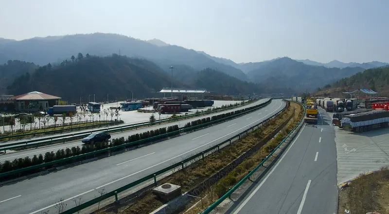
Photo adjustments
EXIF orientation normalized; resized without changing aspect ratio; converted to WebP. No subject edits.
- Administrative area
- County · 县
- Part of
- Ankang
- Chinese name
- 宁陕县
- Local areas
- County guide
Area & population
- Area in the source
- 3,678.00 km²
- Population · 2018
- 70,318
Source: cited geographic source, as of the dates shown.
Setting and landscape
The county stretches about 80 kilometres north to south and 84 kilometres east to west; it is high in the north and low in the south, with altitudes from 540 to 2,965 metres. A section of the main Qinling ridge runs along the north, from Huanghua Ridge (黄花岭) on the Zhashui (柞水) border west to Mount Tianhua (天华山) on the Foping (佛坪) border, and the Pinghe Liang (平河梁) range crosses the middle. About 59% of the land lies above 1,000 metres. Its rivers belong to three branches of the Han system: the Ziwu (子午河), the Xun (旬河) and the Chi (池河).
Neighbours are Zhashui and Zhen'an (镇安) to the east; Hanbin (汉滨区), Hanyin (汉阴) and Shiquan (石泉) to the south; Foping to the west; and Zhouzhi (周至), Huyi (鄠邑区) and Chang'an (长安区) of Xi'an to the north. The county government notes summer monthly averages of about 20°C, with July around 23°C and no severe heat.
History
The county began in 1783 as Wulang Subprefecture (五郎厅), carved from parts of five counties including Chang'an and Shiquan, with its seat at Laocheng (老城), "old town", from 1784. In 1800 the Jiaqing Emperor approved a walled town at the Wulang Pass (五郎关) and named it Ningshan, meaning to guard the pass and keep Shaanxi at peace; the subprefecture took the same name. A mutiny in 1806 destroyed the subprefecture's offices. Ningshan became a county in 1913.
The Red Army's 25th Army passed through twice between February and July 1935 and took Laocheng on 27 February. In August 1946 three officers of the Central Plains Military Region, Zhang Wenjin (张文津), Wu Zuyi (吴祖贻) and Mao Chuxiong (毛楚雄), were on their way to negotiate in Xi'an when Hu Zongnan's (胡宗南) troops secretly killed them at Jiangkou (江口镇).
What to see
An Ankang city government report of 2024 lists Tongchewan (筒车湾) as a national 4A scenic area and Qinling Canyon Park (秦岭峡谷乐园) as a 3A area, with Tongchewan and Shangbahe (上坝河) as the county's two provincial tourist resorts. A county government feature names Shangbahe and Mount Tianhua as national forest parks. The same feature records that a Northwest University geologist opened Qinling Canyon Rafting (秦岭峡谷漂流) in 2007 as the first high-mountain canyon water attraction in Shaanxi.
Highlights
- Tongchewan 筒车湾: National 4A scenic area and provincial tourist resort.
- Shangbahe 上坝河: National forest park and provincial tourist resort.
- Mount Tianhua 天华山: National forest park at the western end of the county's Qinling crest, on the Foping border.
- Laocheng 老城: Seat of Wulang Subprefecture from 1784; taken by the Red Army on 27 February 1935.
Sources for this guide
历史沿革-宁陕县人民政府 · Ningshan County People's Government
自然地理-宁陕县人民政府 · Ningshan County People's Government
宁陕县加速推进生态文明建设-安康市人民政府 · Ankang Municipal People's Government
全域视野下的宁陕旅游-宁陕县人民政府 · Ningshan County People's Government
Original English written from the listed sources and checked sentence by sentence against quoted extracts by a separate reviewer. Updated 2026-09-26.
Explore Ningshan County
Core places to explore, with English and Chinese names.
Places to explore around Ningshan County
 Tongchewan Scenic Area ·
 Plan your visit
Getting there
Ningshan County is about 105 km in a straight line from central Ankang. Search for 宁陕县 in a map app to find stations and your accommodation.
Where to stay →Build your route
Start with Tongchewan Scenic Area. The linked place guides have entrance and visit details.
Continue with Ankang →More in Ankang
Sources & geographic information
Administrative names and parent areas: Official geographic directory · Reference date 2026-09-06.
Photo: Tongchewan Scenic Area · Source photographer · License not provided. EXIF orientation normalized; resized without changing aspect ratio; converted to WebP. No subject edits.
Map data © OpenStreetMap contributors. Pins mark approximate centres, not entrances or boundaries.