


Get to know Langao County
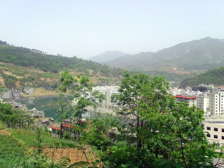
Photo adjustments
Full frame retained; proportionally resized and converted to WebP. No retouching or changes to the photographed subject. Card displays may crop the view.
- Administrative area
- County · 县
- Part of
- Ankang
- Chinese name
- 岚皋县
- Local areas
- County guide
Area & population
- Area in the source
- 1,957.26 km²
- Population · 2018
- 156,455
Source: cited geographic source, as of the dates shown.
Setting and landscape
The county borders Pingli (平利), Ziyang (紫阳) and Hanbin (汉滨区) within Ankang, and Chengkou (城口) in Chongqing. The land rises from 331 metres to 2,641 metres, and forest covers 81.5% of it. According to the county government, a soil survey by the Shaanxi Institute of Geological Survey found medium- or high-selenium soil across 94.39% of the county, and the government lists the county as a title-holder of "China's home of konjac" (中国魔芋之乡).
History
Langao was first called Zhuanping (砖坪), "brick flat", because soldiers building a post here early in the Shunzhi reign of the Qing dug up Han-dynasty bricks. Until the Yongzheng reign it was wild forest in the Daba Mountains with no administration. An assistant magistrate of Ankang County was stationed here in 1783, and in 1822, because the area lay on the border of three provinces, Zhuanping became a subprefecture of its own. It became a county in 1913 and was renamed Langao in 1917: lan is mountain mist and gao is high ground beside water.
What to see
Mount Nangong lies in the east of the county, 28 kilometres from the county town, with its main peak, Jinding (金顶), at 2,267.4 metres. Its rocks come from volcanic eruptions 420 million years ago, and its old volcanic stone forest is its signature. The mountain was first called Bijia Shan (笔架山) for a peak shaped like a writing-brush rest; the name Nangong, "southern palace", comes from a detached palace built there in 1126–1127. It became a national forest park in 2000 and a national geopark in 2009.
In the south-west at Hengxi (横溪镇), the Qianceng River (千层河) area links four streams in a chain of pools and waterfalls between 1,230 and 2,520 metres. The Bashan Grassland (巴山大草原) spreads over 32 meadows at 2,300 to 2,540 metres on the northern slope of the main Daba ridge, on the Chengkou border. Quanshengzhai (全胜寨) at Minzhu (民主镇) is a mountain stronghold begun in the Chongzhen reign (1628–1644), with stone walls running for several kilometres; it took its name, "complete victory stronghold", in 1943 after local forces beat off four bandit attacks, and became a provincial protected site in 2018.
Food and local products
The Langao hanging-pot casserole (岚皋吊罐砂锅) simmers beef, vegetables and rice noodles in a stock of pork bones, beef bones and local chicken seasoned with tsaoko, cassia bark, bay leaves and angelica. The stock is cooked in a cast-iron hanging pot with a close-fitting lid, and regulars first add a spoonful of the shop's own chilli sauce.
Highlights
- Mount Nangong 南宫山: Volcanic stone forest; national forest park 2000, national geopark 2009; main peak 2,267.4 m.
- Qianceng River 千层河: Four streams forming tiers of pools and waterfalls at Hengxi.
- Bashan Grassland 巴山大草原: Thirty-two meadows at 2,300–2,540 m on the main Daba ridge.
- Quanshengzhai 全胜寨: Late-Ming mountain stronghold at Minzhu; provincial protected site since 2018.
- Langao hanging-pot casserole 岚皋吊罐砂锅: Beef, vegetables and rice noodles in a bone-and-chicken stock cooked in a cast-iron hanging pot.
Sources for this guide
岚皋概况-岚皋县人民政府 · Langao County People's Government
历史沿革-岚皋县人民政府 · Langao County People's Government
岚皋旅游景点简介-岚皋县人民政府 · Langao County Bureau of Culture, Tourism, Radio and Television
【岚皋味道】 岚皋吊罐砂锅:穿越千年为君一品-岚皋县人民政府 · Langao County Media Centre, on the Langao County People's Government website
Original English written from the listed sources and checked sentence by sentence against quoted extracts by a separate reviewer. Updated 2026-09-26.
Explore Langao County
Core places to explore, with English and Chinese names.
Places to explore around Langao County
 Nangong Mountain ·
 Plan your visit
Getting there
Langao County is about 55 km in a straight line from central Ankang. Search for 岚皋县 in a map app to find stations and your accommodation.
Where to stay →Build your route
Start with Nangong Mountain. The linked place guides have entrance and visit details.
Continue with Ankang →More in Ankang
Sources & geographic information
Administrative names and parent areas: Official geographic directory · Reference date 2026-09-06.
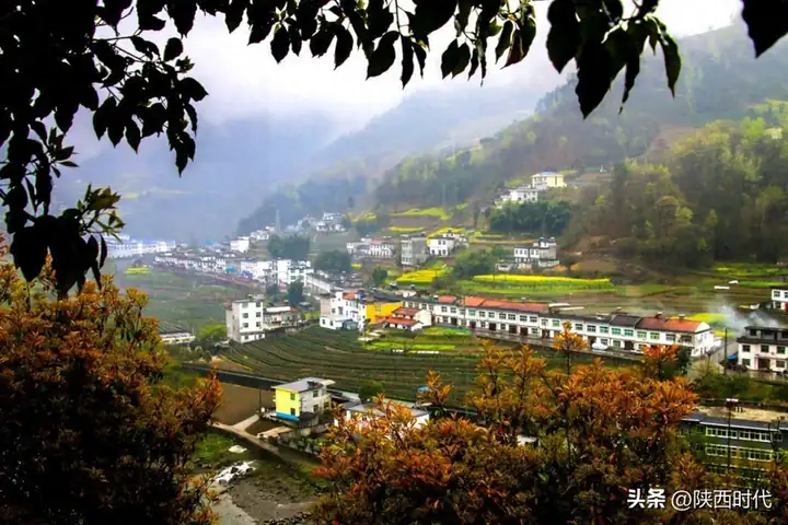
Photo: Nangong Mountain · Source photographer · License not provided. EXIF orientation normalized; resized without changing aspect ratio; converted to WebP. No subject edits.
Map data © OpenStreetMap contributors. Pins mark approximate centres, not entrances or boundaries.