


Get to know Baishui County
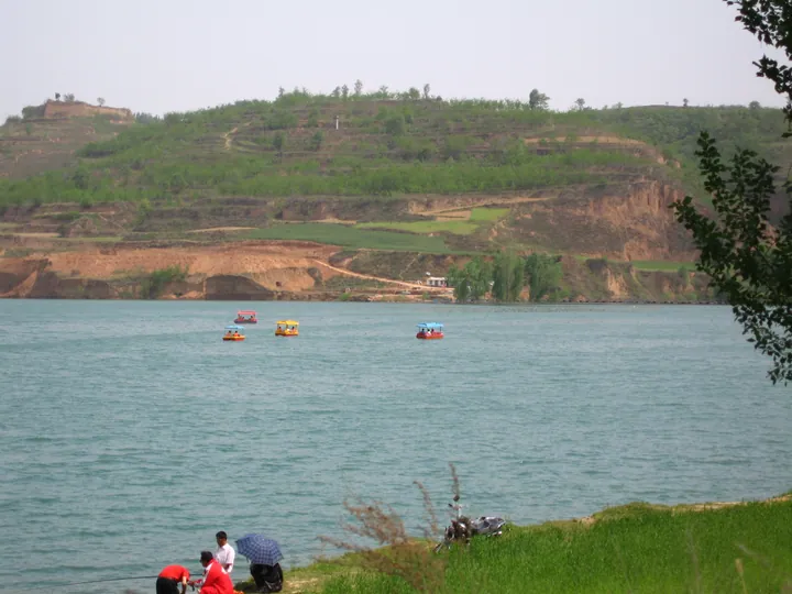
Photo adjustments
Full frame retained; proportionally resized and converted to WebP. No retouching or changes to the photographed subject. Card displays may crop the view.
- Administrative area
- County · 县
- Part of
- Weinan
- Chinese name
- 白水县
- Local areas
- County guide
Area & population
- Area in the source
- 986.60 km²
- Population · 2018
- 278,590
Source: cited geographic source, as of the dates shown.
Writing and brewing traditions
Cangjie Temple (仓颉庙) commemorates the figure traditionally credited with creating Chinese writing. Its setting brings together a temple, tomb, inscriptions and ancient cypresses. East of the temple, the Writing Park (文字公园) presents bird-script characters. Dukang, associated with brewing traditions, has a temple, tomb and spring in Dukang Valley (杜康沟). In 1972, local brewing workshops were consolidated into the Baishui Dukang Distillery (白水杜康酒厂).
The apple landscape
Apples are a defining crop of Baishui. Orchard renewal includes soil improvement, adjusting branches to improve light, and grafting new varieties onto established rootstock. The county’s apple sector extends through growing, processing and trade. Lingao Lake (林皋湖) and Fangshan (方山) add lake and mountain destinations to the county’s cultural sites and orchards.
Sources for this guide
白水访三圣(行天下) · People’s Daily Overseas Edition
全力推进县域经济高质量发展典型案例之七十六:渭南白水县-陕西省发改委 · Shaanxi Development and Reform Commission
Original English written from the listed sources and checked sentence by sentence against quoted extracts by a separate reviewer. Updated 2026-09-27.
Explore Baishui County
Core places to explore, with English and Chinese names.
Places to explore around Baishui County
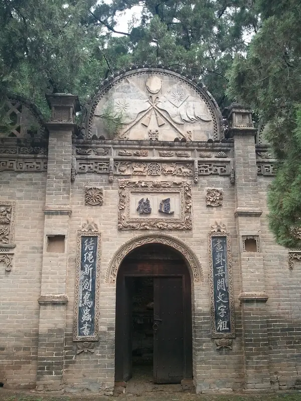 Cangjie Temple (
Plan your visit
Getting there
Baishui County is about 75 km in a straight line from central Weinan. Search for 白水县 in a map app to find stations and your accommodation.
Where to stay →Build your route
Start with Cangjie Temple. The linked place guides have entrance and visit details.
Continue with Weinan →More in Weinan
Sources & geographic information
Administrative names and parent areas: Official geographic directory · Reference date 2026-09-06.
Photo: Cangjie Temple · WaitinZ · CC BY-SA 3.0. Full frame retained; EXIF orientation normalized, proportionally resized to at most 800 pixels and converted to WebP. No generated pixels or subject changes. Cards may crop the display.

Map data © OpenStreetMap contributors. Pins mark approximate centres, not entrances or boundaries.