


Get to know Qixia
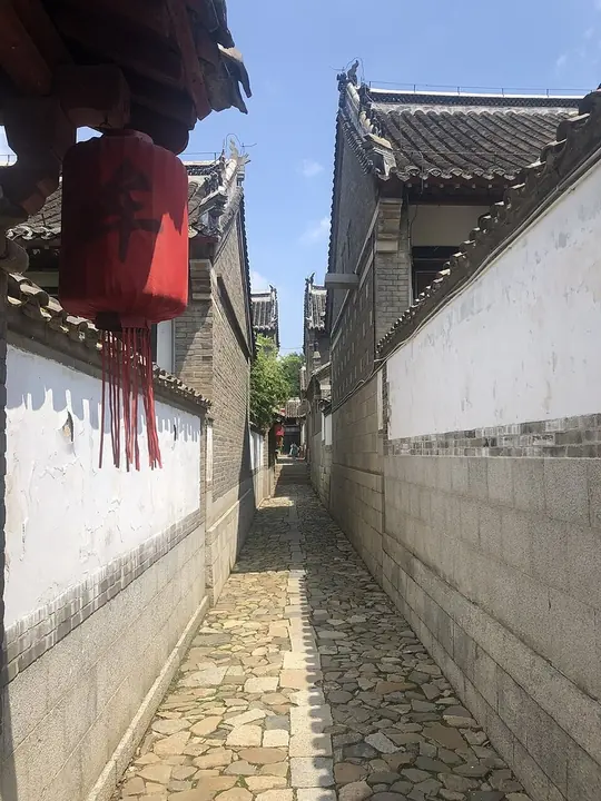
Photo adjustments
Full frame retained; proportionally resized and converted to WebP. No retouching or changes to the photographed subject. Card displays may crop the view.
- Administrative area
- County-level city · 县级市
- Part of
- Yantai
- Chinese name
- 栖霞市
- Local areas
- County-level city guide
Area & population
- Area in the source
- 1,793.00 km²
- Population · 2017
- 622,000
Source: cited geographic source, as of the dates shown.
Setting and landscape
Almost the whole city is upland: mountains cover 72.1 percent of it, hills 21.8 percent and plains only 6.1 percent. Five ranges run across it from east to west, Yashan (牙山), Tangshan (唐山), Fangshan (方山), Aishan (艾山) and Canshan (蚕山), and Mount Ai is the highest point at 814 metres.
All 114 of Qixia's rivers rise inside the city. The largest, the Baiyang (白洋河), flows east into Fushan District (福山区) and on to the Yellow Sea. Menlou Reservoir (门楼水库) in Fushan, downstream on the Baiyang and the Qingyang (清阳河), is Yantai's largest reservoir and main water source, and a local saying claims that eight and a half liang of every jin (ten liang) of water drunk in Yantai comes from Qixia.
History
The name refers to an old description of red clouds at daybreak lighting up the town walls. People have lived here for about 6,000 years. Qixia County was created in 1131 from Yangtuan town (阳疃镇) of Penglai and part of Laiyang, and became a county-level city on 30 November 1995.
What to see
The Mou Family Manor (牟氏庄园) stands in Guzhendu village (古镇都村) north of the town. Building began in 1723 and was largely finished by 1935; the manor is described as the largest and best-preserved landlord estate in northern China. The Mou family, originally from Gong'an (公安) in Hubei, descends from Mou Jingzu (牟敬祖), who became the county registrar in 1370. Its courtyard houses in the Jiaodong style form three groups and six compounds, each four to six courtyards deep, with names such as Rixin Hall (日新堂) and Baoshan Hall (宝善堂).
Provincial heritage sites include the Yangjiaquan site (杨家圈遗址), the Li family manor (李氏庄园), the former First Branch of the Anti-Japanese Military and Political University (抗日军政大学第一分校) and the Jiaodong Revolutionary Martyrs Cemetery (胶东革命烈士陵园).
Food, crafts and traditions
Qixia is the core growing area for Yantai apples, with more than a million mu (about 67,000 hectares) of orchards. Its national intangible heritage items are the Bagua drum dance (八卦鼓舞) and mantis boxing (螳螂拳); provincial items include bobbin lace (棒槌花边), Jiaodong drum singing (胶东大鼓) and the custom of decorated steamed buns (胶东花饽饽).
Highlights
- Mou Family Manor 牟氏庄园: National protected site; landlord estate built 1723–1935 in three groups of courtyard houses.
- Mount Ai 艾山: Highest peak in Qixia at 814 metres.
- Mantis boxing 螳螂拳: National intangible heritage item listed for Qixia.
Sources for this guide
栖霞市 - 维基百科,自由的百科全书 · Wikipedia (Chinese) · CC BY-SA 4.0
牟氏庄园 - 维基百科,自由的百科全书 · Wikipedia (Chinese) · CC BY-SA 4.0
Original English written from the listed sources and checked sentence by sentence against quoted extracts by a separate reviewer. Updated 2026-09-23.
Explore Qixia
Core places to explore, with English and Chinese names.
Places to explore around Qixia
Plan your visit
Getting there
Qixia is about 55 km in a straight line from central Yantai. Search for 栖霞市 in a map app to find stations and your accommodation.
Where to stay →Build your route
Start with Mou Family Manor. The linked place guides have entrance and visit details.
Continue with Yantai →More in Yantai
Sources & geographic information
Administrative names and parent areas: Official geographic directory · Reference date 2026-09-06.
Some facts checked against 栖霞市 — Wikipedia contributors, CC BY-SA 4.0.
Some facts checked against 牟氏庄园 — Wikipedia contributors, CC BY-SA 4.0.
Photo: Mou Family Manor · Vitsuha · Vitsuha — 牟氏莊園之一.jpg — CC BY-SA 4.0 · CC BY-SA 4.0. Full frame retained; proportionally resized and converted to WebP. No retouching or changes to the photographed subject. Card displays may crop the view.

Map data © OpenStreetMap contributors. Pins mark approximate centres, not entrances or boundaries.