


Get to know Pinglu District
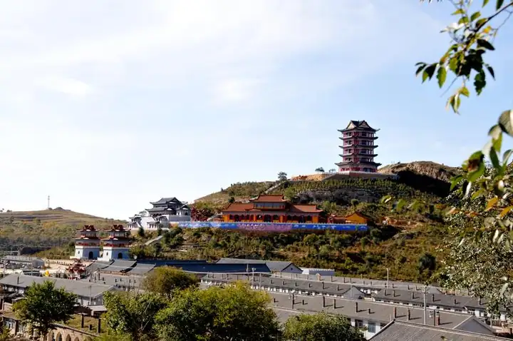
Photo adjustments
EXIF orientation normalized; resized without changing aspect ratio; converted to WebP. No subject edits.
- Administrative area
- District · 市辖区
- Part of
- Shuozhou
- Chinese name
- 平鲁区
- Local areas
- District guide
Area & population
- Area in the source
- 2,317.00 km²
- Population · 2020
- 148,212
Source: cited geographic source, as of the dates shown.
Fenghuang’s military origins
Fenghuang Ancient Town (凤凰古城) occupies the north-central part of the district. The Pinglu Guard (平虏卫) was established here in 1481. Brick and stone facing was added to the eastern and western walls in 1498, developing the town as a military stronghold. The historical layout included four main streets, eight lanes, barracks, grain stores and a fodder yard.
Walls and the old administrative seat
Fenghuang’s historic resources include ancient walls, a commanders’ platform, a military drill ground and Mount Beigu (北固山). Its eastern, western and southern gates once had gate towers and outer defensive enclosures. In the third year of the Qing Yongzheng reign, the guard was abolished and a county established. The county seat moved to Jingping (井坪) in 1953.
Sources for this guide
平鲁概况-平鲁区人民政府门户网站 · Pinglu District Culture and Tourism Bureau
凤凰古城-平鲁区人民政府门户网站 · Pinglu District Government
Original English written from the listed sources and checked sentence by sentence against quoted extracts by a separate reviewer. Updated 2026-09-26.
Explore Pinglu District
Core places to explore, with English and Chinese names.
Pinglu District 平鲁区
Plan your visit
Getting there
Pinglu District is about 25 km in a straight line from central Shuozhou. Search for 平鲁区 in a map app to find stations and your accommodation.
Where to stay →More in Shuozhou
Sources & geographic information
Administrative names and parent areas: Official geographic directory · Reference date 2026-09-06.
Map data © OpenStreetMap contributors. Pins mark approximate centres, not entrances or boundaries.