


Get to know Jingyan County
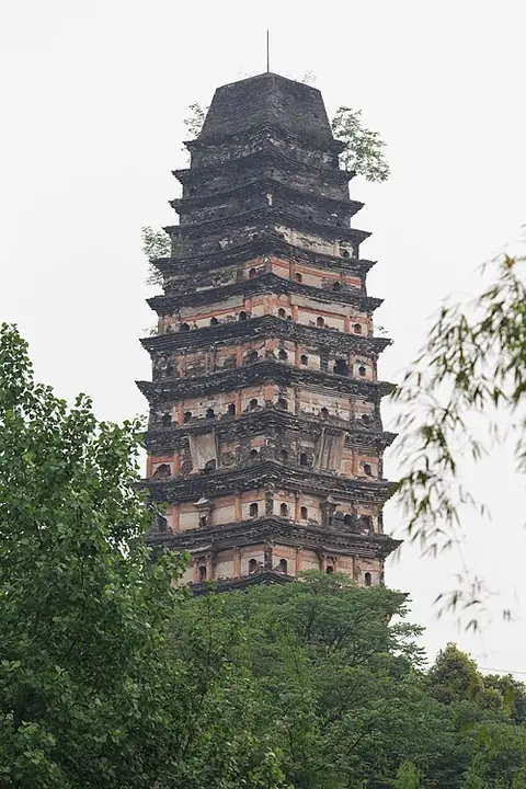
Photo adjustments
Full-frame source proportionally resized and converted to WebP for display. No subject alteration. Source-supplied marks and edits remain; cards may crop the view.
- Administrative area
- County · 县
- Part of
- Leshan
- Chinese name
- 井研县
- Local areas
- County guide
Area & population
- Area in the source
- 841.00 km²
- Population · 2020 census
- 280,641
Source: cited geographic source, as of the dates shown.
Buildings and waterscapes
The former residence of Lei Chang (雷畅故居), the Sanjiang White Pagoda (三江白塔), and Liao Ping's Academy of Classical Studies (廖平经学堂) are among Jingyan's historical sights. Qianfo Old Town (千佛古镇) also features on the county's cultural touring route. Dafo Lake (大佛湖) and Yanxi Wetland (研溪湿地) are separate landscape stops on its nature-focused itinerary.
Orchards and local dishes
Citrus cultivation is concentrated in northern Jingyan, while grain and oil crops shape the south. Local fruit varieties include blood oranges (血橙), Shuijing mandarins (水晶柑) and Baba mandarins (耙耙柑). Sichuan Online's account of Jingyan's tourism routes also names mutton soup (羊肉汤), wine-flavoured chicken (酒醉鸡) and Doujigu mushrooms (斗鸡菇) among its foods.
Sources for this guide
井研县人民政府 · Jingyan County Government
吃橘购橘看演出 井研丰收节暨全省文旅发展大会井研分会场活动启动_四川在线 · Sichuan Online
Original English written from the listed sources and checked sentence by sentence against quoted extracts by a separate reviewer. Updated 2026-09-26.
Explore Jingyan County
Core places to explore, with English and Chinese names.
Places to explore around Jingyan County
 AI illustration · AI
 Plan your visit
Getting there
Jingyan County is about 30 km in a straight line from central Leshan. Search for 井研县 in a map app to find stations and your accommodation.
Where to stay →Build your route
Start with Dafo Lake. The linked place guides have entrance and visit details.
Continue with Leshan →More in Leshan
Sources & geographic information
Administrative names and parent areas: Official geographic directory · Reference date 2026-09-06.
Map data © OpenStreetMap contributors. Pins mark approximate centres, not entrances or boundaries.