


Get to know Dechang County
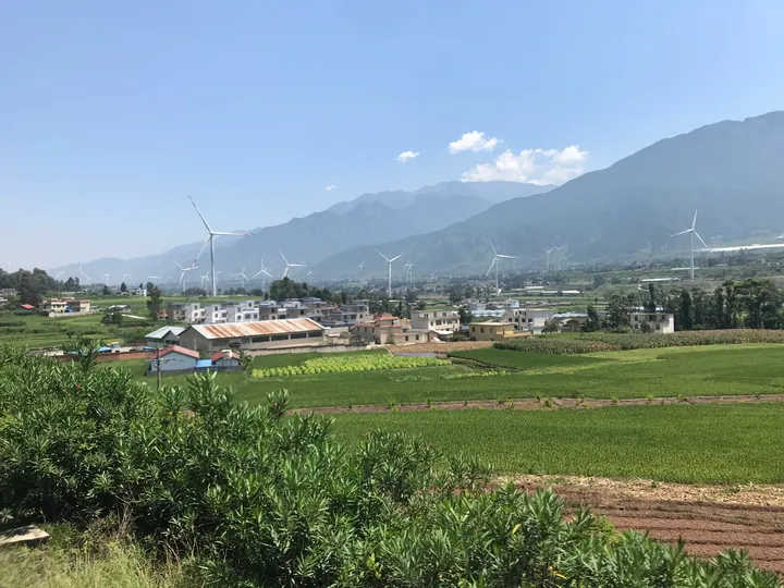
Photo adjustments
Full frame retained; proportionally resized and converted to WebP. No retouching or changes to the photographed subject. Card displays may crop the view.
- Administrative area
- County · 县
- Part of
- Liangshan Yi Autonomous Prefecture
- Chinese name
- 德昌县
- Local areas
- County guide
Area & population
- Area in the source
- 2,284.00 km²
- Population · 2020
- 216,533
- Administrative seat
- Dezhou Subdistrict
Source: cited geographic source, as of the dates shown.
What to see
Fenghuang Pavilion (凤凰阁) stands beside the Anning River (安宁河), north of the town. This building in traditional architectural style rises through eleven storeys to 64.3 metres. Its displays cover changes in county administration, local landscapes and urban development, alongside phoenix traditions, revolutionary history and Lisu culture. The second floor contains the Lisu exhibition; the third presents phoenix culture. An outdoor viewing terrace occupies the seventh floor.
Food and local products
Loquats and winter strawberries are characteristic agricultural products. Dechang has developed rural tourism around these fruits and its Lisu communities. The phoenix theme also appears in names such as Fengming Street (凤鸣街), Fenghuang Bridge (凤凰桥) and Fenghuang Park (凤凰公园).
Sources for this guide
四川德昌县凤凰阁免费对外开放 · People’s Daily Online
安逸四川 氧生德昌 这个冬天来德昌晒太阳 - 中国日报网 · China Daily, republishing Jiangxi Network Radio and Television
Original English written from the listed sources and checked sentence by sentence against quoted extracts by a separate reviewer. Updated 2026-09-27.
Explore Dechang County
Core places to explore, with English and Chinese names.
Dechang County 德昌县
Plan your visit
Getting there
Dechang County is about 55 km in a straight line from central Liangshan Yi Autonomous Prefecture. Search for 德昌县 in a map app to find stations and your accommodation.
Where to stay →More in Liangshan Yi Autonomous Prefecture
Sources & geographic information
Administrative names and parent areas: Official geographic directory · Reference date 2026-09-06.
Map data © OpenStreetMap contributors. Pins mark approximate centres, not entrances or boundaries.